Schneller Fahrradservice in Wien, Guntramsdorf und Umgebung – auch nachts
Ein kaputtes Fahrrad kommt immer im falschen Moment: kurz vor dem Urlaub, am Abend vor einem wichtigen Rennen oder genau dann, wenn alle Werkstätten bereits geschlossen haben. Genau hier kommt unser Notfall-Veloservice in Wien und Guntramsdorf ins Spiel.
Wir bieten Ihnen einen professionellen Fahrradservice außerhalb der Öffnungszeiten – schnell, flexibel und zuverlässig. Unser mobiler Service ist für Sie da, wenn andere Werkstätten nicht mehr erreichbar sind.
🚴♂️ Notfall Fahrradservice – wenn jede Minute zählt
Stellen Sie sich vor: Sie planen eine mehrtägige Radtour, einen Wettkampf oder einen spontanen Ausflug – und plötzlich funktioniert Ihr Fahrrad nicht mehr.
Schaltung springt nicht richtig
Bremse greift schlecht oder gar nicht
Reifen verliert Luft
E-Bike zeigt Fehler an
Warten bis zum nächsten Tag? Oft keine Option.
👉 Unser Express Fahrradservice in Wien und Umgebung hilft genau in solchen Situationen – auch spät abends oder nachts.
🕒 Fahrradreparatur außerhalb der Öffnungszeiten (20:00 – 03:00)
Unser Notfallservice ist täglich verfügbar:
⏰ 20:00 – 03:00 Uhr
Wir bieten Ihnen einen schnellen und professionellen Fahrradservice, wenn alle anderen geschlossen haben.
💰 Preis: 120 € pro Stunde ✔ transparente Abrechnung ✔ keine versteckten Kosten ✔ schnelle Problemlösung vor Ort oder in der Werkstatt
🔧 Alle Arten von Fahrradreparaturen und Service
Unser Veloservice deckt alle Arten von Arbeiten ab – von kleinen Reparaturen bis hin zu komplexen Problemen:
✔ Wartung & Inspektion
Komplettcheck vor Touren oder Rennen
Einstellung von Bremsen und Schaltung
Sicherheitsprüfung
✔ Reparaturen
Schaltung einstellen oder reparieren
Bremsenservice (Scheiben- & Felgenbremsen)
Austausch von Verschleißteilen
✔ Reifen & Pannenhilfe
Schlauchwechsel
Tubeless Reparatur
Notfall-Reifenservice
✔ E-Bike Service
Diagnose von Elektronikproblemen
Motor- und Systemcheck
Fehleranalyse
✔ Spezialarbeiten
Laufradzentrierung
Lager-Service
individuelle Lösungen für jedes Problem
👉 Egal ob Rennrad, Gravelbike, MTB, Trekkingrad oder E-Bike – wir bringen Ihr Fahrrad wieder in Top-Zustand.
📍 Einsatzgebiet – Wien & Umgebung
Unser mobiler Fahrradservice ist in folgenden Regionen für Sie im Einsatz:
Guntramsdorf
Mödling
Baden
Wiener Neudorf
Perchtoldsdorf
Brunn am Gebirge
Vösendorf
und ganz Wien
👉 Wir kommen direkt zu Ihnen – nach Hause, ins Hotel oder zum Startpunkt Ihrer Tour.
⚠️ Wann benötigen Sie einen Notfall-Veloservice?
Es gibt viele Situationen, in denen ein Abend- oder Nachtservice für Fahrräder notwendig wird:
🚨 Typische Notfälle:
Sie fahren morgen in den Urlaub und Ihr Fahrrad ist nicht fahrbereit
Ein wichtiges Rennen oder Event steht bevor
Plötzlicher Defekt am Abend
Alle Werkstätten sind bereits geschlossen
Bremsprobleme kurz vor einer Tour
Schaltung funktioniert nicht mehr richtig
Platter Reifen kurz vor Abfahrt
E-Bike zeigt Fehlermeldung
Sie haben tagsüber keine Zeit für eine Werkstatt
Sie möchten keine Tage oder Wochen auf einen Termin warten
👉 In all diesen Fällen ist ein schneller Fahrradservice außerhalb der Öffnungszeiten die beste Lösung.
💡 Warum unser Veloservice?
Wir wissen, wie wichtig ein funktionierendes Fahrrad ist – besonders wenn es schnell gehen muss.
Ihre Vorteile:
✔ Schnelle Hilfe auch nachts ✔ Keine langen Wartezeiten ✔ Mobiler Service vor Ort ✔ Professionelle Werkzeuge & Erfahrung ✔ Flexible Terminvereinbarung ✔ Service für alle Fahrradtypen
🚀 Ihr Fahrrad sofort wieder einsatzbereit
Mit unserem Notfall Fahrradservice in Wien und Guntramsdorf müssen Sie keine Kompromisse eingehen.
Egal ob:
Vorbereitung für einen Wettkampf
letzte Checks vor dem Urlaub
spontane Reparatur am Abend
👉 Wir sorgen dafür, dass Sie so schnell wie möglich wieder fahren können.
📞 Jetzt Termin sichern – auch nachts
Wenn Ihr Fahrrad Probleme macht und Sie nicht bis morgen warten können, kontaktieren Sie uns:
📩 per Nachricht
📧 per E-Mail – au***************@***il.com
📱 per WhatsApp Nachricht – +4368864899667
👉 Wir sind für Sie da – auch wenn andere schlafen.
Premium Bike Rental in Europe: Everything You Need to Know Before You Book
Rent High-End Road, Gravel & MTB Bikes with Confidence
Planning to rent a high-performance road bike, gravel bike, or mountain bike in Europe? Whether you’re riding in the Alps, exploring Austria, or cycling through Tuscany, choosing the right rental service makes all the difference.
This guide will help you:
Avoid costly mistakes
Understand rental contracts and insurance
Protect yourself from hidden risks
Rent with confidence from a professional provider
Why Choose a Professional Bike Rental Service?
When you rent from a premium bike rental company, you get:
✔ High-end carbon bikes (road, gravel, MTB) ✔ Perfect sizing and bike fitting ✔ Expert maintenance and safety checks ✔ Flexible rental options ✔ Support in case of issues
👉 Book with confidence: Our bikes are maintained to professional standards and ready for real performance.
What to Check Before Renting a Bike
1. Inspect the Bike Carefully
Before you start riding:
Check frame, wheels, brakes, drivetrain
Take photos or a short video
Report any scratches or damage immediately
👉 Pro tip: This protects you from being charged for pre-existing damage.
2. Make Sure the Bike Fits You
A proper fit is essential:
Correct frame size
Saddle height adjusted
Right pedals (SPD, Look, flat, etc.)
👉 Riding the wrong size can lead to injury or accidents.
3. Know What’s Included
Ask what comes with your rental:
Helmet
Lock (very important)
Repair kit
GPS mount
👉 Missing items may be charged if not returned.
Understanding Bike Rental Contracts (Very Important)
Before booking, always review the rental agreement.
Key Elements You Should See:
Rental period (strict timing)
Bike model and value
Deposit amount
Liability terms
Insurance conditions
⚠️ Critical Rule: You Are Responsible for the Bike
In most European rentals:
You are fully responsible for the bike during your rental.
This includes:
Damage
Theft
Loss
👉 Even with a deposit, you may still be charged the full replacement value.
Bike Rental Insurance Explained (What Most People Miss)
What Is Usually Covered
Accidental damage (with deductible)
Mechanical issues (sometimes)
What Is Often NOT Covered
Theft
Negligence
Riding under alcohol
Improper use (e.g. off-road with road bike)
👉 Important: Insurance does NOT mean full protection.
The Truth About Theft Protection
Even if theft is covered:
You must use a proper lock
The bike must be secured to a fixed object
A police report is required
👉 Otherwise, you pay 100% of the bike cost.
Hidden Pitfalls You Should Avoid
❌ Assuming insurance covers everything
❌ Not checking the bike condition
❌ Ignoring contract details
❌ Leaving the bike unlocked
❌ Returning the bike late
👉 These mistakes can cost hundreds or even thousands of euros.
How Professional Rentals Protect Their Bikes
Top rental companies use:
Financial Protection
High deposits
Credit card guarantees
Legal Protection
Detailed contracts
Strict liability rules
Technical Protection
GPS tracking (premium bikes)
Frame identification
Anti-Theft Measures
Mandatory locks
Security guidelines
What You Should Do to Stay Safe
✔ Take photos before riding ✔ Always lock your bike ✔ Follow usage rules ✔ Understand your insurance ✔ Ride responsibly
👉 Treat the bike like your own €5,000+ investment.
What to Do If Something Goes Wrong
Mechanical Issue
Contact the rental immediately
Do not repair without approval
Accident
Take photos
Collect details
Inform the rental company
Theft
Go to the police immediately
Report to rental
Provide documentation
Damage
Be honest and report it
Document everything
Why Rent Premium Bike Rental in Europe From Us?
We make premium bike rental simple, safe, and transparent:
✔ Top-tier road, gravel & MTB bikes ✔ Clear contracts — no hidden surprises ✔ Fair insurance options ✔ Local support and quick assistance ✔ Perfect bikes for Austria and beyond
👉 Ready to ride? Book your bike now and explore Europe the right way.
Final Thoughts about Premium Bike Rental in Europe
SpeedBox, Bikespeed, Legalität, Technik und Risiken im Detail
E-Bike Chip-Tuning gehört zu den meistgesuchten Themen im Bereich Elektrofahrräder. Immer mehr Fahrer möchten die gesetzliche 25-km/h-Begrenzung von Pedelecs entfernen, um schneller fahren zu können oder sportlichere Leistungen zu erreichen.
Dieser professionelle Leitfaden erklärt vollständig:
Wie E-Bike Tuningchips funktionieren
Welche Hersteller führend sind
Wie schwierig der Einbau ist
Welche Schäden entstehen können
Welche Gesetze in Europa gelten
Ob Werkstätten Chips einbauen dürfen
Welche Risiken wirklich bestehen
Diese Analyse basiert auf technischen Daten, Herstellerangaben und Werkstattpraxis.
Was ist E-Bike Chip-Tuning?
Ein E-Bike Tuningchip ist ein elektronisches Modul, das die Motorsteuerung manipuliert und die Geschwindigkeitsbegrenzung von 25 km/h aufhebt oder verschiebt.
Standard-Pedelecs in Europa:
Parameter
Wert
Motorleistung
250 W
Unterstützung
bis 25 km/h
Kategorie
Fahrrad
Nach Chip-Tuning:
Parameter
Wert
Unterstützung
bis 40–60 km/h
Kategorie
Kraftfahrzeug
Zulassung nötig
Ja
Damit verliert das Fahrrad seinen rechtlichen Status als Fahrrad.
Warum wollen Fahrer ihre E-Bikes tunen?
Typische Gründe:
1 – Pendeln
Viele Fahrer nutzen E-Bikes zum Pendeln.
Bei 25 km/h dauert eine Strecke:
20 km = fast 50 Minuten.
Mit Tuning:
20 km = ca. 30 Minuten.
Zeitersparnis ist ein Hauptmotiv.
2 – Sportliches Fahren
Mountainbike-Fahrer wollen:
höhere Geschwindigkeit
mehr Flow
bessere Beschleunigung
3 – Flache Strecken
Auf flachen Strecken ist die Begrenzung besonders störend.
Viele Fahrer können problemlos:
30–35 km/h treten.
Ohne Motorunterstützung wird das jedoch anstrengend.
4 – Technisches Interesse
Viele Nutzer interessieren sich einfach für Technik.
E-Bike Tuning ist für manche ein Hobby.
Wie funktioniert ein E-Bike Tuningchip technisch?
Grundprinzip der Motorsteuerung
Ein E-Bike-Motor arbeitet mit mehreren Sensoren:
Geschwindigkeitssensor
Trittfrequenzsensor
Drehmomentsensor
Controller
Der wichtigste Parameter für die Begrenzung ist:
Geschwindigkeitssignal
Signalmanipulation
Der Chip manipuliert das Signal des Geschwindigkeitssensors.
Beispiel:
Realität
Gemeldet
30 km/h
15 km/h
40 km/h
20 km/h
Der Motor glaubt:
Geschwindigkeit < 25 km/h
→ Unterstützung bleibt aktiv.
Technisches Funktionsschema
Originalsystem

Speed Sensor → Motor Controller → Motor
                    |
                Limit 25 km/h


Mit Tuningchip

Speed Sensor → Tuning Chip → Controller → Motor
                   |
          Manipuliertes Signal
Best Cycling Accommodation in Vienna and Lower Austria
Austria is one of the most bicycle-friendly countries in Europe, and routes like EuroVelo 9 and EuroVelo 16 (Danube Cycle Path) attract thousands of cycling tourists every year. The section through Vienna and Lower Austria (Niederösterreich) is especially popular thanks to safe bike infrastructure, cultural highlights, and excellent accommodation options.
The Austrian section of EuroVelo 9 passes through the Weinviertel region and Vienna toward the Alps, offering scenic vineyards and historic towns along the way.
For multi-day bike tours, choosing bike-friendly hotels makes a huge difference. Specialized cycling accommodation provides services that make bicycle travel easier, safer, and more comfortable.
Many cycling accommodations also offer packed lunches, luggage transport, and overnight stays without minimum nights.
Certified bike-friendly accommodations typically provide:
Lockable bike garages
Repair kits
Cycling maps
Energy-rich breakfasts
Why Choose Bike-Friendly Accommodation?
1. Secure Bicycle Storage
For touring cyclists with expensive bikes, safe storage is essential.
Bike-friendly hotels usually offer:
Indoor locked storage
Video-monitored bike rooms
Charging stations for E-bikes
This is especially important in cities like Vienna.
2. Better Recovery After Long Rides
Cycling hotels often provide:
Early breakfast
High-energy meals
Laundry or drying rooms
Showers available after checkout
These small details make long-distance touring much easier.
3. Local Cycling Knowledge
Many cycling hotels are run by cycling enthusiasts who can recommend:
Scenic routes
Gravel alternatives
Repair shops
Weather advice
Bike-Friendly Accommodation on EuroVelo 9
EuroVelo 9 runs through Lower Austria and Vienna, offering vineyard landscapes and historic villages.
The Vienna Alps region includes several certified cycling hotels located directly along EuroVelo 9.
Examples include:
Grandhotel Niederösterreichischer Hof
Gasthof Pichler
Vitalzeit Hotel Weber
These hotels offer bike tools, maps, and cyclist-oriented services.
Bike-Friendly Hotels in Austria on EuroVelo 16 (Danube Cycle Path)
EuroVelo 16 (Danube Cycle Path) is one of Europe’s most famous cycling routes, running from Passau to Vienna and beyond.
The Vienna–Lower Austria section is ideal for:
Beginner cyclists
Families
E-bike travelers
Cyclists can easily find bike-friendly hotels along the Danube.
Top 10 Bike-Friendly Hotels for EuroVelo Cyclists
Vienna & Lower Austria
Hotel
Region
Route
Bike Services
Why Stay Here
Hotel Le Parc (Wiener Neustadt)
Lower Austria
EV9
Bike garage, e-bike charging
Directly on EuroVelo 9
Grandhotel Niederösterreichischer Hof
Lanzenkirchen
EV9
Bett+Bike certified
Classic cycling hotel
Gasthof Pichler
Petersbaumgarten
EV9
Cyclist services
Located on EV9
Vitalzeit Hotel Weber
Bad Schönau
EV9
E-bike friendly
Quiet countryside
Krumbacherhof
Bucklige Welt
EV9
Cycling host
Local cycling expertise
Hotel Post
Bucklige Welt
EV9
Charging stations
Bike-focused hospitality
Hotel Stefanie
Vienna
EV9/EV16
Bike storage
Central Vienna
Motel One Wien-Staatsoper
Vienna
EV9/EV16
Bike storage possible
Budget-friendly
Donau Lodge Ybbs
Lower Austria
EV16
Riverfront cycling hotel
Danube views
Wachau Hotel Melk
Lower Austria
EV16
Bike-friendly region
Near Danube route
How to Choose the Right Bike Hotel
Location Matters
Look for hotels:
Within 1–2 km of the route
Near grocery stores
Near bike shops
Must-Have Services
Essential features:
✔ Secure bike storage ✔ Pump and repair tools ✔ Charging station (for e-bikes) ✔ Early breakfast ✔ One-night stays
Useful Extras
Recommended features:
✔ Laundry service ✔ Bike washing station ✔ Packed lunches ✔ Route advice
Tips for EuroVelo Cyclists in Austria
Book in Advance
Especially between:
May – September
Cycling hotels fill quickly.
Ask About Bike Storage
Always confirm:
Indoor storage availability
Charging options
Access hours
Consider Distance Between Hotels
Ideal daily distance:
50–90 km touring
70–120 km road cycling
Budget Expectations
Typical prices:
Type
Price per Night
Guesthouse
€60–90
Bike Hotel
€80–140
City Hotel Vienna
€100–180
Conclusion
Vienna and Lower Austria offer some of the best cycling accommodation in Europe. Whether riding EuroVelo 9 through vineyards or EuroVelo 16 along the Danube, Bike-Friendly Hotels in Austria make cycling tours safer and more comfortable.
Choosing a certified cycling hotel ensures:
Safe bike storage
Reliable services
Better recovery
Stress-free travel
For serious bicycle travelers, bike-friendly accommodation is not a luxury — it’s an essential part of a successful cycling tour.
Wild Camping in Austria: Rules, Risks & Practical Tips for Bicycle Tourists
Wild camping in Austria is a dream for many bicycle tourists and bikepackers. Waking up in the mountains, near alpine lakes or in quiet forests feels like true freedom. However, wild camping in Austria is highly regulated and often illegal, and cyclists who ignore the rules can face fines, safety risks, and uncomfortable situations.
This guide explains where wild camping is allowed in Austria, where it is forbidden, what problems cyclists may face when sleeping in a tent, and what legal alternatives exist.
Is Wild Camping Legal in Austria?
In most parts of Austria, wild camping (camping outside official campsites) is not allowed. The rules depend on the federal state (Bundesland) and local municipalities, but the general principle is:
❌ Camping with a tent in forests, mountains, nature reserves and outside designated campsites is usually illegal. ❌ Sleeping overnight in protected areas and national parks is strictly forbidden.
Some regions are more restrictive than others, especially popular alpine and tourist areas.
Where Is Wild Camping Forbidden in Austria?
Cyclists should avoid setting up tents in the following places:
🌲 Forests (often explicitly forbidden by forestry laws)
🏔️ Mountains and alpine meadows
🌿 Nature reserves & national parks
🏞️ Protected landscapes
🚫 Private land without owner permission
🚧 Near roads, ski resorts, tourist infrastructure
Even discreet “stealth camping” can result in fines if discovered by landowners, forestry officials, or police.
Where Is Wild Camping Sometimes Tolerated?
There is no nationwide legal right to wild camp in Austria, but in some remote areas:
🏕️ A bivouac without a tent (sleeping bag only, no fire, no impact)
🚴 One-night emergency stays
🤝 Camping with explicit permission from the landowner
…may be tolerated, depending on local rules. However, this is never guaranteed and should not be relied upon.
Common Problems for Bicycle Tourists Sleeping in Tents
1. Legal Problems & Fines
Wild camping fines vary by region and can range from small penalties to several hundred euros. Being woken up by authorities at night is stressful and unpleasant.
Solution: ✔ Use official campsites ✔ Ask locals or farmers for permission ✔ Use legal alternatives like “micro camps” or bike-friendly hostels
2. Private Property Conflicts
Much of Austria’s countryside is privately owned. Landowners may ask you to leave immediately or call authorities.
Solution: ✔ Always ask before setting up a tent ✔ Use platforms that connect travelers with private landowners ✔ Be respectful and polite – Austrians value privacy
3. Wildlife Encounters
Wild animals such as deer, boar, foxes, and even cows can wander near tents at night. Food smells may attract animals.
Solution: ✔ Store food sealed and away from your sleeping area ✔ Avoid camping near animal trails or water sources ✔ Keep your bike and gear organized and quiet
4. Weather Risks
Austria’s alpine weather can change suddenly:
⛈️ Heavy rain
❄️ Cold nights, even in summer
🌬️ Strong mountain winds
Solution: ✔ Use a high-quality waterproof tent ✔ Check local weather forecasts ✔ Avoid valleys prone to flooding ✔ Carry warm layers even in summer
5. No Access to Water, Toilets or Charging
Wild camping means:
🚱 No drinking water
🚽 No toilets
🔋 No phone charging
Solution: ✔ Plan water stops in villages ✔ Use power banks or dynamo hubs ✔ Choose campsites occasionally to recharge both yourself and your equipment
6. Safety & Theft Risks
Camping in isolated places increases the risk of:
Theft of bike or gear
Unwanted encounters
Feeling unsafe at night
Solution: ✔ Use a bike lock even at night ✔ Camp away from roads and public paths ✔ Choose visible but quiet locations when permitted
Legal Alternatives to Wild Camping for Cyclists
🚴 Bike-friendly campsites Austria has excellent cycling infrastructure and many campsites welcome cyclists with low-cost tent spots.
🏡 Farm stays & guesthouses Small family-run accommodations are widespread and affordable.
⛺ Micro-camping & private camping platforms Some platforms connect travelers with landowners offering legal overnight spots.
🚴 Cyclist shelters & alpine huts (seasonal) In some regions, shelters or mountain huts offer simple overnight stays.
Responsible Camping: Do No Harm
If you ever camp legally or with permission:
Leave no trace
Do not light fires
Take all rubbish with you
Respect nature, wildlife, and private property
Be quiet and respectful toward locals
Conclusion: Is Wild Camping in Austria Worth the Risk?
While wild camping in Austria sounds romantic, the legal risks, fines, and safety concerns often outweigh the benefits, especially for bicycle tourists who rely on rest, safety, and predictable logistics.
With Austria’s excellent network of campsites, bike-friendly accommodations, and hospitality, legal options are easy to find – often for just a few euros more than wild camping, but with far greater comfort and peace of mind.
👉 For a stress-free cycling adventure in Austria, choose legal camping options and enjoy the journey without worrying about fines, weather, or midnight wake-up calls.
Beschädigtes Gewinde am Fahrradkurbelarm – Ursachen, Folgen und professionelle Reparatur
Ein beschädigtes Pedalgewinde am Kurbelarm ist ein häufiges, aber oft unterschätztes Problem. Viele Radfahrer merken es erst, wenn sich das Pedal während der Fahrt löst oder sich gar nicht mehr richtig einschrauben lässt. In diesem Artikel erklären wir, warum das passiert, welche Reparaturmöglichkeiten es gibt und warum eine professionelle Reparatur langfristig die günstigere Lösung ist.
Häufige Ursachen für beschädigte Gewinde an Kurbeln
1. Falsch eingeschraubte Pedale Eine der häufigsten Ursachen ist das „Verkannten“ der Pedale beim Einschrauben. Pedale haben unterschiedliche Gewinde (rechts und links), und wenn sie schief oder mit Gewalt angesetzt werden, wird das feine Aluminiumgewinde der Kurbel schnell zerstört.
2. Fahren mit nicht richtig festgezogenen Pedalen Wenn Pedale nicht mit dem korrekten Drehmoment montiert sind, beginnen sie sich während der Fahrt minimal zu bewegen. Diese Mikrobewegungen wirken wie eine Feile auf das Gewinde und führen mit der Zeit zu starkem Verschleiß oder vollständigem Ausreißen der Gewindegänge.
3. Mehrmaliges Montieren und Demontieren ohne Schmierung Häufiges Ein- und Ausschrauben der Pedale ohne Fett oder Montagepaste erhöht die Reibung und kann das Gewinde beschädigen. Besonders bei Aluminiumkurbeln ist das Risiko hoch.
4. Korrosion und Schmutz Feuchtigkeit, Schmutz und Korrosion können das Gewinde schwächen. Beim späteren Lösen oder Festziehen reißt das Material dann leichter aus.
5. Verwendung von minderwertigen oder beschädigten Pedalen Abgenutzte oder beschädigte Pedalgewinde können auch das Kurbelgewinde zerstören – selbst wenn man alles „richtig“ macht.
Mögliche Reparaturlösungen
1. Gewindereparatur mit Reparatureinsatz (z. B. Helicoil / Gewindeeinsatz) Dabei wird das beschädigte Gewinde professionell nachgeschnitten und ein neuer, hochfester Gewindeeinsatz eingesetzt. ➡️ Das ist die gängigste und zuverlässigste Lösung.
2. Verwendung von Oversize-Gewinden In manchen Fällen kann ein größeres Reparaturgewinde geschnitten werden. Das ist technisch möglich, aber nicht bei allen Kurbeln sinnvoll.
3. Austausch des Kurbelarms Wenn das Gewinde komplett zerstört oder die Kurbel strukturell geschädigt ist, bleibt oft nur der Austausch. ➡️ Das ist meist die teuerste Variante, besonders bei hochwertigen Kurbeln.
Warum „Do it yourself“ oft teurer wird
Im Internet gibt es zahlreiche Anleitungen und günstige Reparatursets. Was auf den ersten Blick nach einer günstigen Lösung aussieht, endet in der Praxis oft mit:
schief geschnittenem Gewinde
nicht zentriertem Reparatureinsatz
weiter beschädigter Kurbel
im schlimmsten Fall: Totalschaden der Kurbel
Ohne das richtige Werkzeug, Erfahrung und präzise Ausrichtung ist die Gefahr groß, dass die Reparatur misslingt. Am Ende muss die Kurbel ersetzt werden – und das wird deutlich teurer als eine fachgerechte Reparatur von Anfang an.
Professionelle Reparatur mit Unior Crank Saver
Wir reparieren beschädigte Pedalgewinde fachgerecht mit professionellem Spezialwerkzeug, unter anderem mit dem Unior Crank Saver. Dieses System ermöglicht eine präzise, haltbare und sichere Gewindereparatur direkt am Kurbelarm – ohne Kompromisse bei Stabilität und Sicherheit.
✔ Präzise Ausrichtung ✔ Dauerhafte Reparaturlösung ✔ Geeignet für Aluminiumkurbeln ✔ Sicher für Alltag, Touren und sportliche Nutzung
Kosten der Reparatur
Die Kosten für eine professionelle Reparatur des Kurbelgewindes beginnen bei ab 50 Euro. Der genaue Preis hängt vom Schaden, vom Kurbeltyp und vom Arbeitsaufwand ab.
Im Vergleich dazu kostet ein neuer Kurbelarm oder eine komplette Kurbelgarnitur oft ein Vielfaches – ganz zu schweigen vom Zeitverlust und möglichen Folgeschäden durch unsachgemäße Eigenreparaturen.
Für eine professionelle Reparatur von Fahrradkurbelgewinden kontaktieren Sie uns bitte.
Fazit
Ein beschädigtes Gewinde am Kurbelarm ist kein Grund, das Fahrrad sofort aufzugeben oder teure Teile zu ersetzen. Mit der richtigen Technik und professionellem Werkzeug lässt sich das Problem dauerhaft beheben. Wer hier am falschen Ende spart und selbst experimentiert, zahlt am Ende oft doppelt.
👉 Sparen Sie Zeit, Geld und Nerven – lassen Sie die Reparatur gleich professionell durchführen.
Fahrrad online gekauft: Selbst montieren oder lieber in die Werkstatt bringen?
Der Online-Kauf von Fahrrädern wird immer beliebter: große Auswahl, attraktive Preise und Lieferung direkt nach Hause. Doch nach dem Öffnen des Kartons stehen viele Kund:innen vor der gleichen Frage: Soll ich das Fahrrad selbst montieren oder es von einer professionellen Fahrradwerkstatt in der Region Wien aufbauen lassen? Was auf den ersten Blick einfach wirkt, entpuppt sich in der Praxis oft als zeitaufwendig, technisch anspruchsvoll und mit Risiken verbunden.
Welche Probleme treten bei der Selbstmontage eines Fahrrads aus dem Karton auf?
Ein Fahrrad wird vom Hersteller oder Händler in der Regel nur vormontiert geliefert. Das bedeutet: wichtige sicherheitsrelevante Komponenten müssen korrekt montiert, eingestellt und überprüft werden. Typische Problemfelder sind:
1. Falsche Montage von Lenker, Vorbau und Steuersatz
Der Lenker muss exakt ausgerichtet und mit dem richtigen Drehmoment angezogen werden. Zu fest angezogen → Beschädigung von Lenker oder Vorbau (besonders bei Alu oder Carbon). Zu locker → Spiel im Steuersatz, instabiles Fahrverhalten, Unfallgefahr.
2. Unsachgemäße Montage der Pedale
Pedale haben unterschiedliche Gewinde (rechts/links). Häufige Fehler:
falsche Seite eingeschraubt
Gewinde beschädigt
nicht gefettet → spätere Demontage kaum möglich
3. Bremsen nicht korrekt eingestellt
Scheibenbremsen müssen exakt zentriert werden. Typische Probleme:
schleifende Bremsscheiben
ungleichmäßige Bremskraft
schlecht eingestellte Bremshebel Im schlimmsten Fall: deutlich verlängerte Bremswege und Sicherheitsrisiken.
4. Schaltung schlecht eingestellt
Die Schaltung ist bei Versand oft nur grob voreingestellt. Ohne Erfahrung entstehen:
Kettenabsprünge
Geräusche beim Schalten
schlechter Gangwechsel unter Last Dies führt zu schnellerem Verschleiß von Kette und Kassette.
5. Laufräder nicht korrekt montiert
Schnellspanner oder Steckachsen müssen mit dem richtigen Druck befestigt werden. Zu locker → Rad kann sich während der Fahrt lösen. Zu fest → Beschädigung von Achse oder Ausfallenden.
6. Fehlende Endkontrolle
Viele wichtige Punkte werden von Laien übersehen:
Drehmomente an sicherheitsrelevanten Schrauben
Kontrolle aller Schraubverbindungen
Reifendruck
Sitzposition und Ergonomie
Auch „vormontierte“ Fahrräder aus großen Fachhändlern oder Online-Shops wie Statera oder Fahrrad XXL sind in der Regel nicht vollständig fahrfertig im technischen Sinne. Die Vormontage dient vor allem dem sicheren Transport und der schnellen Übergabe, ersetzt jedoch keine professionelle Endkontrolle. In der Praxis bedeutet das: Schaltung und Bremsen sind oft nur grob eingestellt, der Steuersatz kann Spiel haben, Schraubverbindungen sind nicht immer mit dem korrekten Drehmoment angezogen, und Laufräder können leicht dezentriert sein. Besonders bei neuen Fahrrädern setzen sich Züge, Speichen und Lager in den ersten Kilometern, was ohne Nachjustierung zu schlechter Schaltperformance, schleifenden Bremsen oder vorzeitigem Verschleiß führen kann. Eine fachgerechte Durchsicht und Feinjustierung in der Werkstatt sorgt dafür, dass auch ein vormontiertes Fahrrad wirklich sicher, leise und langlebig fährt – genau so, wie es vom Hersteller gedacht ist.
Welche Werkzeuge werden für eine korrekte Selbstmontage benötigt?
Um ein Fahrrad fachgerecht zu montieren und einzustellen, reichen einfache Inbusschlüssel meist nicht aus. In der Praxis benötigt man:
Diese Werkzeuge kosten schnell 100–250 € oder mehr, wenn man sie in vernünftiger Qualität kauft – für viele Kund:innen eine unnötige Investition für eine einmalige Montage.
Wie viel Zeit kostet die Selbstmontage wirklich?
Viele rechnen mit „30 Minuten“. Realistisch sieht es so aus:
Auspacken & Sortieren: 15–30 Minuten
Montage der Komponenten: 45–90 Minuten
Einstellen von Schaltung & Bremsen: 60–120 Minuten
Probefahrt & Nachjustieren: 30–60 Minuten
➡️ Gesamtzeit: 2 bis 4 Stunden – ohne Garantie, dass danach alles perfekt funktioniert. Für unerfahrene Personen kann es deutlich länger dauern, inklusive Frust und Unsicherheit.
Warum die professionelle Fahrradmontage Werkstatt Wien die bessere Lösung ist
Eine professionelle Fahrradwerkstatt in der Region Wien bietet:
✔ Fachgerechte Endmontage nach Herstellervorgaben ✔ Einstellung von Schaltung und Bremsen auf Prüfstand ✔ Kontrolle aller sicherheitsrelevanten Schrauben mit Drehmoment ✔ Funktionsprüfung und Probefahrt ✔ Individuelle Anpassung von Sattel, Lenker und Sitzposition ✔ Sofort einsatzbereites, sicheres Fahrrad
Der Kunde erhält ein fertig montiertes, geprüftes und fahrbereites Fahrrad, ohne Stress, Zeitverlust oder Risiko.
Fazit: Sicherheit, Zeitersparnis und langfristige Kostenersparnis
Was zunächst nach einer einfachen Aufgabe aussieht, ist in Wirklichkeit ein komplexer technischer Prozess. Fehler bei der Selbstmontage können zu Sicherheitsrisiken, schnellerem Verschleiß oder sogar teuren Folgereparaturen führen.
👉 Wer sein Fahrrad direkt nach dem Online-Kauf in eine professionelle Fahrradmontage Werkstatt Wien bringt, spart Zeit, Nerven und sorgt für maximale Sicherheit. Statt stundenlangem Schrauben erhält man ein perfekt eingestelltes Bike – bereit für die erste Fahrt.
Unser Service: Wir übernehmen die komplette Endmontage deines online gekauften Fahrrads – schnell, professionell und nach höchsten Sicherheitsstandards. So kannst du dein neues Bike von Anfang an sorgenfrei genießen. 🚴♂️
EuroVelo 14, also known as “Waters of Central Europe”, is one of the most picturesque and culturally rich long-distance cycling routes in Europe. Stretching across Austria and extending into Hungary, this iconic EuroVelo route connects alpine landscapes, river valleys, historic towns, UNESCO World Heritage cities, vineyards, thermal spa regions, and charming rural villages.
The route is designed for cycle tourists who want to experience the authentic heart of Central Europe at a slow, immersive pace. Unlike high-alpine adventure trails, EuroVelo 14 follows rivers and gentle valleys, making it accessible to a wide range of cyclists, from beginners to experienced touring riders. The combination of natural beauty, cultural depth, well-developed cycling infrastructure, and excellent hospitality makes EuroVelo 14 one of the most underrated long-distance cycling routes in the European cycle tourism network.
SEO keywords: EuroVelo 14, Waters of Central Europe, cycling route Austria Hungary, EuroVelo bike tour, EuroVelo 14 guide, long-distance cycling Europe, best bikes for EuroVelo 14, EuroVelo attractions, cycling holidays Austria
What Is EuroVelo 14? – Overview of the Route
EuroVelo 14 is part of the official EuroVelo network developed by the European Cyclists’ Federation. The route focuses on the theme of water, following rivers, floodplains, lakes and cultural landscapes shaped by waterways. The Austrian section alone covers approximately 430 kilometers, connecting several well-known cycle paths into one continuous long-distance cycling experience.
EuroVelo 14 integrates multiple famous cycling routes:
Tauern Cycle Path (Tauernradweg)
Enns Cycle Path (Ennsradweg)
Mur Cycle Path (Murradweg)
Raab Valley Cycle Path (Raabtalradweg)
The route is mostly flat to gently rolling, with some moderate climbs in alpine foothills. Surfaces are predominantly asphalt with occasional compact gravel sections along rivers and rural areas. The signage in Austria is generally excellent, making navigation easy even without digital tools.
Route Highlights and Main Stages
Zell am See – The Alpine Gateway
The traditional starting point of EuroVelo 14 is Zell am See, a famous alpine resort town surrounded by mountain peaks and a crystal-clear lake. The region is known for its dramatic scenery, glacier views, and outdoor sports culture. Cycling out of Zell am See, riders follow the Tauern Cycle Path along river valleys with postcard-perfect mountain panoramas.
This section is ideal for cyclists who want to combine lake views, mountain air, and smooth cycle paths. The infrastructure is excellent, with bike-friendly hotels, cafés, and frequent rest points along the route.
Along the Enns Valley – Traditional Alpine Towns
Following the Enns Cycle Path, the route passes through historic alpine towns such as St. Johann im Pongau, Radstadt, and Schladming. These towns combine medieval architecture, alpine traditions, and modern tourism infrastructure. Riders can explore local markets, traditional Austrian cuisine, and small museums dedicated to regional history.
The Enns Valley section is one of the most relaxing parts of EuroVelo 14, with wide riverbanks, green meadows, and quiet cycling paths separated from car traffic. This makes it particularly suitable for families and less experienced cyclists.
Graz – UNESCO World Heritage City
One of the cultural highlights of EuroVelo 14 is Graz, the capital of Styria and Austria’s second-largest city. Graz Old Town is a UNESCO World Heritage Site, famous for its preserved medieval streets, Renaissance courtyards, and the iconic Schlossberg hill overlooking the city.
Cyclists can park their bikes and explore:
Schlossberg and the Clock Tower
Kunsthaus Graz (modern art museum)
Murinsel (floating island on the Mur River)
Traditional Styrian restaurants and wine taverns
Graz is an excellent place for a rest day, offering bike shops, repair services, and a wide choice of accommodations.
Eastern Styria – Vineyards, Thermal Baths and Rural Landscapes
After Graz, the route continues through Eastern Styria, a region known for rolling hills, vineyards, apple orchards, pumpkin seed oil production, and thermal spa resorts. This part of EuroVelo 14 offers a completely different atmosphere compared to the alpine sections: warmer climate, Mediterranean-influenced landscapes, and gentle countryside scenery.
Cyclists can combine riding with wellness tourism by visiting thermal spas, tasting local wines, and enjoying farm-to-table cuisine. This region is ideal for slower travel, culinary experiences, and relaxed cycling holidays.
Crossing into Hungary – New Cultural Horizons
Near the Austrian-Hungarian border, EuroVelo 14 continues into Hungary, opening up opportunities to extend the journey towards Lake Balaton or Budapest. The landscape becomes flatter, with open fields, wetlands, and small villages. The Hungarian section offers a more rural and traditional atmosphere, perfect for cyclists seeking less touristy environments.
This cross-border dimension makes EuroVelo 14 particularly attractive for international cycling tours and multi-country bikepacking adventures.
Interesting Facts About EuroVelo 14
EuroVelo 14 is themed around water, following major rivers that historically shaped trade routes, settlements, and cultural development in Central Europe. Many towns along the route developed around river crossings and trading posts, which today form the historic centers visited by cyclists.
The route is part of a broader European strategy to promote sustainable tourism, eco-friendly travel, and cross-border cultural exchange. It connects natural landscapes with urban heritage, creating a unique blend of nature and culture rarely found on a single cycling route.
Practical Information for Cyclists
Best Time to Cycle EuroVelo 14
The best period to cycle EuroVelo 14 is from late April to early October. Spring offers blooming landscapes and mild temperatures, while summer provides long daylight hours and vibrant outdoor culture. Autumn is ideal for wine lovers, as vineyards are active during harvest season.
Although the route is well signposted in Austria, it is recommended to use GPX tracks with navigation apps such as Komoot, Ride with GPS, or Garmin devices. This ensures accurate routing, especially in rural areas and cross-border sections.
What Bikes Are Best for EuroVelo 14? – Detailed Analysis
Choosing the right bicycle is crucial for comfort and efficiency on EuroVelo 14. The route combines asphalt cycle paths, rural roads, and occasional gravel sections. Below is a detailed analysis of suitable bike types:
Touring Bikes – Best Overall Choice
Touring bikes are the most versatile option for EuroVelo 14. They are designed for long-distance travel with luggage, offering stable geometry, strong frames, wide gear ranges for climbs, and compatibility with racks and panniers. Touring bikes perform well on both asphalt and light gravel, making them ideal for multi-day journeys.
Gravel Bikes – Modern and Flexible
Gravel bikes offer a sporty yet comfortable riding position and wider tires compared to road bikes. They are suitable for riders who want speed on paved sections and confidence on gravel paths. Gravel bikes are an excellent choice for lightweight bikepacking setups on EuroVelo 14.
E-Bikes – Comfort and Accessibility
E-bikes are becoming increasingly popular on long-distance cycle routes. They make longer daily distances accessible to a broader audience and reduce fatigue on moderate climbs. For EuroVelo 14, e-bikes with long-range batteries are recommended, especially for riders planning 80–100 km per day.
Road Bikes – Limited Suitability
Road bikes can be used on EuroVelo 14, but they are less practical due to narrow tires and limited comfort on gravel sections. They are best suited for riders who travel light and stick strictly to paved parts of the route.
Top Attractions and Experiences Along EuroVelo 14
EuroVelo 14 offers a rare combination of:
Alpine mountain scenery
River landscapes and floodplains
UNESCO-listed historic cities
Wine regions and culinary tourism
Thermal spa towns
Rural villages and traditional culture
This diversity makes the route suitable not only for cycling enthusiasts but also for couples, families, senior travelers, and cultural tourists.
Conclusion – Why EuroVelo 14 Is One of Europe’s Best Cycling Routes
EuroVelo 14 is an exceptional long-distance cycling route that combines nature, culture, wellness, and gastronomy into a single coherent journey. From alpine lakes to vineyards and historic cities, the route showcases the diversity of Central Europe in a way that is only possible by bicycle. Whether you are planning a multi-week cycling holiday or a shorter section tour, EuroVelo 14 offers a rewarding, well-organized, and unforgettable cycling experience.
Bicycle Chain Wax vs Oil: What’s Better? A Complete 2026 Analysis
Bicycle Chain Wax vs Oil: Why Chain Lubrication Matters More Than You Think
The bicycle chain is the heart of your drivetrain. Every watt you produce, every climb, every acceleration depends on how efficiently your chain transfers power. Proper chain lubrication directly affects:
Drivetrain efficiency (watts lost to friction)
Chain, cassette, and chainring lifespan
Noise levels and ride feel
Maintenance time and long-term costs
In recent years, cyclists have increasingly questioned traditional oil-based chain lubricants. Paraffin-based wax chain lubes — once reserved for pro teams — are now mainstream. But which system is truly better?
This in-depth, SEO-optimized analysis compares traditional oil lubrication vs modern wax lubrication, with a special focus on Smoove Chain Lube and Dynamic Wax products.
How Bicycle Chain Lubrication Works
A bicycle chain consists of pins, rollers, and plates under constant load. Lubrication must penetrate inside the rollers, where most friction occurs, while also protecting the chain from contaminants.
The key difference is what happens after application.
Oil remains wet, attracting dirt and grit
Wax dries into a solid, friction-reducing layer that repels contaminants
Traditional Oil Chain Lubes: Strengths and Weaknesses
Oil-based lubes have been the standard for decades — and for good reason.
Advantages of Oil Lubes
Excellent water resistance
Immediate usability after application
Easy to find and inexpensive
Works well in wet and muddy environments
Disadvantages of Oil Lubes
Attract dirt and dust
Form abrasive paste inside the chain
Increase drivetrain wear over time
Require frequent deep cleaning
In real-world riding, oil-lubed chains often appear lubricated but internally suffer accelerated wear due to contamination.
Wax Chain Lubrication: The Modern Alternative
Wax lubrication uses paraffin wax to coat chain components. Once cured, wax creates a dry boundary layer that:
Reduces friction
Repels dirt and dust
Minimizes metal-to-metal contact
Independent laboratory testing consistently shows lower drivetrain friction with wax compared to oil, especially in dry and dusty conditions.
Types of Wax Lubes
Hot-melt wax (chain immersion)
Drip-on wax emulsions (no melting required)
Modern drip-on waxes deliver most of the performance benefits of hot waxing with far less effort.
In-Depth Analysis: Smoove Chain Lube
What Is Smoove Chain Lube?
Smoove Chain Lube is a high-performance wax-based emulsion lubricant. It uses microscopic paraffin wax particles suspended in a liquid carrier that evaporates after application.
Once cured, Smoove leaves a dry, durable wax coating inside and outside the chain.
Technical Characteristics
Lubrication type: Paraffin wax emulsion
Application: Drip-on
Final state: Dry wax film
Dirt attraction: Very low
Noise reduction: Excellent
Performance & Efficiency
Independent testing and long-term rider data show that Smoove:
Produces lower friction than most oil-based lubes
Approaches hot-wax efficiency in dry conditions
Keeps drivetrains noticeably quieter
Reduces chain elongation over high mileage
Measured efficiency gains typically range from 1–3 watts compared to quality oil lubes — a meaningful difference for endurance and performance riders.
Chain Wear & Longevity Bicycle Chain Wax vs Oil
Because Smoove does not attract abrasive contaminants, chains lubricated with it often last 30–50% longer than oil-lubed chains under similar conditions.
This significantly reduces:
Chain replacement frequency
Cassette and chainring wear
Long-term maintenance costs
Wet-Weather Performance
Smoove performs well in dry conditions, dusty gravel, and light rain. In prolonged heavy rain, reapplication is required sooner than with wet oil lubes. However, unlike oil, Smoove does not turn into a grinding paste when wet dirt is present. If you dont want to waste your time ( professional chain waxing process is lasts approx, 1 hour – feel free to use our bike service for that )
Dynamic Wax Chain Lubes: Overview
Dynamic Wax products are classic paraffin-based drip wax lubricants designed for clean, efficient drivetrains.
Key Characteristics
Paraffin-based wax formula
Drip-on application
Clean, dry chain finish
Slightly firmer wax feel than Smoove
Dynamic Wax performs exceptionally well in dry conditions and is popular among road and gravel riders who prioritize cleanliness and simplicity.
Comparison Table: Smoove vs Dynamic Wax vs Oil
Feature
Smoove Chain Lube
Dynamic Wax
Traditional Oil Lube
Lubrication type
Wax emulsion
Paraffin wax
Oil-based
Friction efficiency
Very high
High
Medium
Dirt attraction
Very low
Very low
High
Chain cleanliness
Excellent
Excellent
Poor
Wet weather durability
Medium
Medium-low
High
Ease of application
Easy
Easy
Very easy
Maintenance frequency
Low
Low
High
Drivetrain lifespan
Long
Long
Shorter
Best use case
All-round performance
Dry / gravel riding
Wet commuting
Which Chain Lubrication Should You Choose?
Choose Wax (Smoove or Dynamic) If You:
Ride in dry or mixed conditions
Want a clean, quiet drivetrain
Care about efficiency and component longevity
Prefer less frequent deep cleaning
Choose Oil If You:
Ride daily in heavy rain or mud
Need immediate water resistance
Prefer minimal preparation
Final Verdict: Wax vs Oil
Wax lubrication is no longer a niche solution. Modern products like Smoove Chain Lube and Dynamic Wax deliver measurably lower friction, cleaner drivetrains, longer component life, and reduced maintenance over time.
Traditional oil lubes still make sense for wet commuting and extreme conditions, but for most road, gravel, MTB, and touring cyclists, wax-based lubrication is the superior long-term choice.
For riders seeking the best balance between performance, cleanliness, and ease of use, Smoove Chain Lube stands out as one of the most complete chain lubrication solutions available today.
What to Do in Vienna in 2026 – Top 10 Unusual Activities
Vienna is timeless — music, palaces, imperial cafés — but 2026 is the year to explore the city in unexpected ways. From bold architecture and quirky museums to thrill rides and immersive tours, this guide will take you well beyond the typical city break. Discover Vienna like a local, an adventurer, and a culture-vulture at the same time!
1. Explore the Newly Restored Villa Beer – Modernist Gem
4
Vienna’s architectural scene will get a boost in 2026 with the public opening of Villa Beer — a rare modernist house by Josef Frank. This previously private residence has been meticulously restored and will offer tours, cultural events, and even overnight stays. It’s a must-visit for design lovers and anyone who wants a deeper glimpse into 20th-century Austrian style.
✨ Best For: design lovers, architecture buffs
2. Vienna’s Roller Coaster Revolution – Ride Wiener Looping
4
Visit the Wurstelprater amusement park, but instead of just seeing the iconic Ferris wheel, ride the new Wiener Looping steel coaster — exhilarating inversions, steep drops, and views you won’t forget. Built by Mack Rides and operational since 2025, this attraction gives Vienna a theme-park thrill that few expect from the cultural capital.
🎢 Best For: thrill seekers, families
3. The Third Man Museum – A Cinematic Time Capsule
4
Dive into the surreal world of Vienna through The Third Man — the classic post-war noir film. The Third Man Museum is a treasure trove of memorabilia, original posters, and artifacts that whisk visitors into 1940s Vienna — as seen on screen. Film lovers will find its immersive displays oddly captivating.
🎬 Best For: film buffs, history fans
4. Vienna Transport Museum “Remise” – Wheels Through Time
4
Ever wondered how the city moved through time? At the Vienna Transport Museum Remise, you can wander through huge depots of historic trams, buses, and rail cars dating back to the 19th century — an unexpectedly fascinating look at Vienna’s urban evolution.
🚋 Best For: transport lovers, families, museum explorers
Vienna’s cultural calendar in 2026 is full of free open-air experiences. From Rathausplatz Film Festival outdoor cinema to Christmas markets set against palace backdrops, these events offer a rich dose of seasonal charm without spending a cent. Expect concerts, ballet screenings, and winter food stalls with a local flair.
🎟️ Best For: budget travelers, culture lovers
6. Quirky Museums You’d Never Guess
Go slightly “off-beat” with experiences like:
Globe Museum – the only museum in the world dedicated to globes.
Time Travel Vienna – a 5D storytelling adventure through Vienna’s past.
🧠 Best For: anyone who loves strange, wonderful places
7. Take a Nighttime Fiaker Ride Through Vienna
4
For a romantic or whimsical evening, take a horse-drawn carriage (Fiaker) ride through Vienna’s historic streets after dark. Glittering lights, cobblestones, and old-world charm make it a unique way to explore the city.
🐴 Best For: couples, romantics
8. Vintage Shopping & Hidden Art Markets
Looking for quirky souvenirs? Vienna’s vintage and flea market scene is booming, with underground markets, record shops, and boutique finds across neighborhoods like the 7th and 15th districts. You’ll discover items you simply won’t find in standard souvenir shops.
One of the most unique experiences in 2026 is a personalized mountain-biking adventure through the rolling landscapes around Vienna, Mödling, and Baden. The E-Bike All Inclusive Personalized MTB Tour by AustriaTrails takes you on an electrifying 4-hour journey tailored to your pace. Expect:
Personal bike guide & professional transfer
High-end mountain e-bike & safety gear
Epic climbs, thrilling descents & stunning views
Lunch, local beer, photos, and short videos included
Whether you’re an experienced rider or keen to try MTB for the first time, this adventure blends active exploration with Austrian flair — making it one of the most unforgettable activities in the region.
🚴 Best For: adventurers, cyclists, outdoor lovers
👉 Book before visiting to secure your slot — it’s popular and personalized!
Vienna’s coffee culture is as iconic as its music. In 2026, discover historic cafés and modern reinterpretations — from marble-top Classic Viennese houses to hip hybrid cafés pairing coffee with local music and art. Indulge in Viennese pastries that rival art masterpieces.
☕ Best For: foodies, culture seekers
Bonus Tips for 2026
Design & Art Tours: Vienna’s creative scene is evolving with pop-up galleries and contemporary exhibitions.
Seasonal Events: Oktoberfest-style Vienna WiesnFest returns with beer tents and Alpine cheer.
Nature Escapes: Ride e-bikes along the Danube Island or hike local vineyards.
Final Thoughts
Vienna in 2026 is so much more than palaces and orchestras. It’s a city of hidden gems, rugged adventures, quirky museums, and unforgettable local experiences. Whether you’re seeking romance, adrenaline, culture, or just a good cup of coffee in a storied café — Vienna delivers.
Plan ahead, explore widely, and make your trip truly exceptional!
3 Best Cycling Routes – From Beginners to Professionals
Cycling from Vienna to Salzburg is one of the most iconic multi-day bike adventures in Austria. It combines world-class scenery, charming old towns, alpine foothills, crystal-clear lakes, and perfectly maintained cycling infrastructure.
Whether you’re a first-time bike tourist, a confident recreational rider, or a hardcore gravel enthusiast, there is a route that fits your level, fitness, and sense of adventure.
In this guide, we present three carefully designed Vienna–Salzburg routes optimized for gravel bikes and e-bikes:
🟢 Beginner Route – the most popular and easiest classic
🟡 Intermediate Route – more variety, hills, and alpine lakes
🔴 Advanced Route – technical gravel, mountains, and epic climbs
Each route includes: ✔ daily stages ✔ distances ✔ elevation gain ✔ highlights ✔ difficulty profile ✔ who it’s perfect for
So you can confidently choose your tour – and the right bike rental – before you start.
Why this route? This is Austria’s most famous long-distance cycle route. It follows the Danube Cycle Path and later transitions into the rolling lake region of Salzkammergut. It is extremely well signposted, mostly flat, traffic-free, and full of cafés, hotels, and bike services.
Perfect for:
First-time bike tourers
Families
E-bike beginners
Riders who prefer comfort over challenge
Surface: 85% asphalt, 15% compact gravel Technical difficulty: Very low Navigation: Easy, fully signposted Total distance: ~330 km Total elevation: ~2,100 m Recommended duration: 5–6 days
Day 1: Vienna → Krems
Distance: 78 km Elevation: +250 m Highlights: Wachau Valley, vineyards, Danube river views
You leave Vienna on a dedicated riverside cycle path and enter the UNESCO-listed Wachau Valley. Castles, monasteries, and wine villages line the riverbanks.
Day 2: Krems → Linz
Distance: 95 km Elevation: +300 m Highlights: Schlögen Loop, baroque town of Linz
A relaxed riverside ride through Upper Austria. The famous Schlögen Loop is one of the most photogenic spots on the entire Danube.
Day 3: Linz → Gmunden
Distance: 75 km Elevation: +500 m Highlights: Traun River, Traunsee Lake
You leave the Danube and follow the Traun River into the Salzkammergut lake district. The turquoise waters of Traunsee feel like a reward after two flat days.
Day 4: Gmunden → St. Wolfgang
Distance: 42 km Elevation: +450 m Highlights: Wolfgangsee Lake, alpine scenery
Short and scenic. You ride along lakes, forests, and traditional villages.
Day 5: St. Wolfgang → Salzburg
Distance: 40 km Elevation: +600 m Highlights: Mondsee, Salzburg Old Town
A gentle alpine crossing followed by a smooth descent into Salzburg.
Who should choose Route 1?
If you want a stress-free cycling holiday with maximum sightseeing and minimal physical strain, this is your route. It’s also the best choice for e-bikes and casual riders.
🟡 ROUTE 2: Intermediate Level
Vienna Woods + Alpine Foothills + Lakes
Vienna → Mariazell → Bad Ischl → Salzburg
Why this route? This route leaves the flat Danube and heads into the Vienna Woods and Alpine foothills. It adds rolling climbs, forest gravel roads, and more solitude while still offering comfortable daily distances.
Perfect for:
Recreational cyclists
Gravel beginners
E-bike riders wanting more challenge
Riders seeking variety beyond the Danube
Surface: 60% asphalt, 40% gravel Technical difficulty: Low–medium Total distance: ~350 km Total elevation: ~5,400 m Recommended duration: 6–7 days
Day 1: Vienna → St. Pölten
Distance: 65 km Elevation: +600 m Highlights: Vienna Woods, forest climbs
You leave the city through the Wienerwald with gentle gravel climbs and panoramic views.
Day 2: St. Pölten → Mariazell
Distance: 75 km Elevation: +1,400 m Highlights: Alpine passes, Mariazell Basilica
A challenging but beautiful day. Mariazell is Austria’s most famous pilgrimage town.
Day 3: Mariazell → Göstling an der Ybbs
Distance: 55 km Elevation: +900 m Highlights: Alpine valleys, waterfalls
Forest roads and mountain scenery dominate this stage.
Day 4: Göstling → Bad Ischl
Distance: 70 km Elevation: +1,100 m Highlights: Salzkammergut lakes, spa town
Rolling terrain and postcard-worthy alpine views.
Day 5: Bad Ischl → St. Gilgen
Distance: 40 km Elevation: +700 m Highlights: Wolfgangsee Lake
Short but hilly, perfect for relaxed exploration.
Day 6: St. Gilgen → Salzburg
Distance: 45 km Elevation: +700 m Highlights: Alpine descent into Salzburg
A scenic finale with long downhill sections.
Who should choose Route 2?
If you want real mountain scenery without extreme difficulty, this route offers the perfect balance of challenge, comfort, and sightseeing.
🔴 ROUTE 3: Advanced Level
Alpine Gravel Epic
Vienna → Hochschwab → Dachstein → Salzburg
Why this route? This is a true gravel adventure through Austria’s wildest regions. Expect long climbs, technical gravel descents, remote valleys, and jaw-dropping mountain passes.
Perfect for:
Experienced gravel riders
Bikepackers
High-fitness e-bike users
Riders seeking a physical and technical challenge
Surface: 70% gravel, 30% asphalt Technical difficulty: Medium–high Total distance: ~420 km Total elevation: ~9,500 m Recommended duration: 7–9 days
Day 1: Vienna → Semmering
Distance: 85 km Elevation: +1,400 m Highlights: Semmering Pass, mountain railway views
A tough start with a legendary alpine crossing.
Day 2: Semmering → Wildalpen
Distance: 70 km Elevation: +1,600 m Highlights: Hochschwab Massif, wilderness gravel
Remote forest roads and alpine solitude.
Day 3: Wildalpen → Eisenerz
Distance: 60 km Elevation: +1,300 m Highlights: Erzberg mine, alpine gravel climbs
Technical gravel sections and steep gradients.
Day 4: Eisenerz → Hallstatt
Distance: 65 km Elevation: +1,500 m Highlights: Hallstatt UNESCO town, Dachstein Alps
One of the most scenic days in all of Austria.
Day 5: Hallstatt → Ramsau am Dachstein
Distance: 45 km Elevation: +1,100 m Highlights: Dachstein Glacier views
High-alpine plateau riding.
Day 6: Ramsau → Bad Gastein
Distance: 75 km Elevation: +1,700 m Highlights: Alpine passes, thermal spa town
Long mountain stage with epic descents.
Day 7: Bad Gastein → Salzburg
Distance: 55 km Elevation: +1,000 m Highlights: National park valleys, alpine finale
A dramatic final day into Salzburg.
Who should choose Route 3?
This route is for riders who want a once-in-a-lifetime alpine gravel expedition. It requires good fitness, confident bike handling, and proper equipment.
Hydraulische Scheibenbremsen gelten als High-End-Bremsen, die hervorragende Bremskraft, feinfühlige Modulation und Zuverlässigkeit selbst bei schlechten Bedingungen bieten. Doch wenn sie einmal Probleme machen – zum Beispiel Luft im System, verschlissene Beläge oder Ölwechsel – stellt sich vielen Radfahrer:innen die Frage: Soll ich das selbst machen oder zum Profi geben?
1. Warum hydraulische Bremsen besonders sind
Hydraulische Bremsen nutzen Flüssigkeit (Mineralöl oder DOT), um Kraft von den Hebeln zu den Bremskolben zu übertragen. Das System ist druckdicht, fein dosierbar und wartungsintensiv, wenn man Perfektion und Sicherheit will. Ein unsauber entlüftetes System kann zu toten, schwammigen oder gefährlichen Bremsen führen – was im Ernstfall ein Sicherheitsrisiko ist.
2. Kosten: Werkstatt vs. DIY – direkter Preisvergleich
Werkstattpreise (Wien, Mödling, Baden)
Viele Fahrradwerkstätten in und um Wien bieten konkrete Preise für hydraulische Bremsen an. Hier einige Beispiele:
➡️ Fazit: Für eine gründliche Entlüftung inkl. Öl, Reinigung und Kontrolle zahlt man in einer Werkstatt oft €30–€60 pro Bremse. Komplettes Brems-Service oder Kombi-Service kann mehr kosten, aber umfasst mehr.
DIY-Kosten (Werkzeug + Material)
Wer es selbst machen möchte, braucht mindestens:
Position
Einmalkosten
Anmerkung
Entlüftungskit (Bleed Kit)
€30–€90
Abhängig von Marke/Komplettset
Bremsflüssigkeit (Mineralöl/DOT)
€10–€30
Pro Bike/Bremse
Adapter/Schläuche/Einmalartikel
€5–€15
Kleinmaterial
Bremsbeläge (falls nötig)
€15–€40
Pro Bremse
Montageständer (optional)
€30–€60
Für komfortableres Arbeiten
➡️ Minimale DIY-Investition:ca. €60–€150+, wenn man alles neu kauft. ➡️ Realistische DIY-Investition:€150–€300+, wenn mehrere Werkzeuge oder höherwertige Kits erforderlich sind.
Zeitaufwand: Werkstatt vs. DIY
Aufgabe
Werkstatt
DIY
Bremsen entlüften
~30–60 min
~60–120+ min (Erstmalig)
Beläge wechseln + reinigen
~15–30 min
30–60 min
Werkzeug vorbereiten/sauber machen
–
15–30 min
Fehlerkorrektur/erneute Entlüftung
–
30–90 min
Fazit: Ein erfahrener Profi braucht oft deutlich weniger Zeit und macht es gleich beim ersten Mal sauber. Ohne Erfahrung verbringt man oft mehr Zeit mit Anleitung, Vorbereitung und Fehlerkorrekturen.
3. Risiken und versteckte Kosten beim DIY
Qualität der Arbeit
Ein unsauber entlüftetes System kann Luftblasen behalten, was zu:
verminderter Bremsleistung
unkontrollierbarem Bremsverhalten
Sicherheitsrisiken
führt. Die Werkstatt gewährleistet in der Regel professionelle Qualität, Prüfung und oft Garantie auf die Arbeit.
Werkzeugverschleiß und Wiederbeschaffung
Viele DIY-Leute unterschätzen:
Verschleiß an Werkzeugen
zweitmaligen Einkauf, wenn etwas falsch gekauft wurde
hohe Kosten, wenn spezielles Werkzeug fehlt
Wenn ein bestimmtes Spezialwerkzeug fehlt, kann man schnell €50–€100 extra ausgeben – und das nur für einen einzigen Service. Hydraulische Fahrradbremsen reparieren oder Werkstatt.
4. Vergleichstabelle: DIY vs. Werkstatt
Kriterium
Werkstatt
DIY zuhause
Direkte Kosten
€30–€60 pro Bremse
€60–€300+ (aller Aufwand)
Zeit
~30–90 min
60–240+ min
Werkzeug nötig
Keine eigenen Investitionen
Hoch (Bleed Kit, Ständer etc.)
Risiko Fehler
Sehr gering
Mittel–hoch
Sicherheit
Hoch
Abhängig von Erfahrung
Garantie
Oft inkludiert
Keine
5. Lokaler Kontext: Wien, Mödling, Baden
In Wien und Umgebung gibt es viele Fahrradwerkstätten – z. B. SG Velo in 1230 Wien, FaduBike, Velo Wien, Austriatrails.com oder mobile Fahrradservices, die oft günstige Fixpreise ohne große Vorabkalkulation anbieten.
Insbesondere in Mödling und Baden Umgebung bieten mobile Werkstätten oder lokale Shops ebenfalls vergleichbare Preise (z. B. €30–€50 für Hydraulik-Service). Viele Werkstätten bieten bei mehreren Arbeiten vergünstigte Paketpreise an.
6. Schlussfolgerung – lohnt sich DIY wirklich?
Auf den ersten Blick kann DIY günstiger erscheinen – vor allem, wenn man nur Teile und kein Personal bezahlt. Doch realistische Anfangsinvestitionen für Werkzeuge, Zeitaufwand, mögliche Fehler und Sicherheitsrisiken machen DIY oft teurer und riskanter. Besonders bei sicherheitskritischen Komponenten wie Bremsen lohnt es sich, Profi-Mechaniker zu beauftragen. Hier bekommt man:
✔ fundiertes Fachwissen ✔ professionelle Werkzeuge ✔ saubere Arbeiten ohne Lernkurven ✔ meist kurze Wartezeiten und Garantie
Kurz gesagt: Für hydraulische Bremsen ist der Gang zur Werkstatt in den meisten Fällen sinnvoller und am Ende günstiger, wenn man alle Kostenfaktoren berücksichtigt – besonders in einem Ballungsraum wie Wien, Mödling oder Baden.
Service für Federgabel & Dämpfer: Selbst machen oder in die Fahrradwerkstatt geben?
In Österreich – besonders in Regionen wie Wien, Mödling, Wienerwald und Baden – werden Mountainbikes und E-MTBs intensiv genutzt. Ob Wienerwald Trails, Anninger, Helenental oder Stadtfahrten: Federgabel und Dämpfer arbeiten ständig. Damit sie zuverlässig funktionieren, brauchen sie regelmäßigen Service.
Doch was ist sinnvoller? 👉 Service selbst durchführen oder 👉 zu einer professionellen Fahrradwerkstatt in Wien / Mödling / Baden bringen?
Diese Analyse erklärt:
warum Suspension-Service notwendig ist
welche Arbeiten ausgeführt werden
welche Kosten in Österreich realistisch sind
wie viel Zeit DIY vs. Werkstatt beansprucht
welche Risiken bestehen
warum für die meisten Fahrer in Österreich die Werkstatt die bessere Entscheidung ist
Warum ist regelmäßiger Service in Österreich besonders wichtig?
In Niederösterreich und Wien herrschen:
Staub im Sommer
Feuchtigkeit & Schlamm im Herbst
Salzreste im Winter
häufige Temperaturwechsel
Das beschleunigt Verschleiß an:
Dichtungen
Schmieröl
Luftkammern
Standrohren
Folgen ohne Service
schlechtere Leistung
weniger Komfort
höheres Unfallrisiko
teure Reparaturen
oft Totalschaden von Gabel oder Dämpfer
Empfohlene Serviceintervalle
Nutzung in Österreich
Intervall
Freizeit / Stadt Wien
1× pro Jahr
Wienerwald Trails / Mödling / Baden
alle 100 Stunden
E-MTB (z. B. Wienerwald / Helenental)
eher 50–80 Stunden
Bikepark
deutlich häufiger
Servicearten
1️⃣ Kleiner Service (Lower Leg / Air Can)
Ölwechsel Schmierbereiche
Reinigung
Dichtungen pflegen
2️⃣ Großer Service (200-Stunden-Service)
komplette Zerlegung
alle Dichtungen neu
neues Öl
volle Funktionsprüfung
Kostenvergleich – Österreich realistisch (Wien / Mödling / Baden)
Serviceart
Fahrradwerkstatt (AT Preise)
DIY Kosten
Kleiner Gabelservice
80 – 140 €
40 – 90 €
Großer Gabelservice
150 – 260 €
120 – 250 €
Dämpferservice
110 – 190 €
80 – 160 €
Fehler durch DIY
0 €
bis 700 €+ möglich
⏱️ Zeitaufwand – ganz wichtig für Vergleich
In Österreich arbeiten viele Menschen, viele haben Familie und nur wenig Freizeit – deshalb bedeutet Zeit hier auch echte Kosten
Zeitaufwand in Realität
Aufgabe
Selbst machen
Fahrradwerkstatt Wien/Mödling/Baden
Vorbereitung lernen (Videos/Manuals)
1–3 Stunden
0
Werkzeuge organisieren
1–2 Stunden
0
Service durchführen
2–5 Stunden
0
Aufräumen & Korrekturen
1–2 Stunden
0
Gesamtaufwand privat
4 – 10 Stunden
5–10 Minuten Abgabezeit
Was braucht man für DIY-Service?
Werkzeug
Drehmomentschlüssel
Spezialschlüssel
Hochwertiges Öl
Suspension Fett
Dichtungssätze
saubere Arbeitsfläche
Fachwissen
exakte Ölmenge
richtige Viskosität
korrekter Luftdruck
Montage- & Sicherheitswissen
❗ Risiken beim Selbermachen
Typische Fehler in Österreich häufig gesehen in Werkstätten:
falsches Öl
zu viel oder zu wenig Öl
beschädigte Dichtungen
Kratzer auf Standrohr → oft Totalschaden
fehlerhafte Montage
Garantieverlust
Viele Radwerkstätten rund um Wien, Baden und Mödling berichten, dass 30–40 % ihrer Reparaturen auf misslungene DIY-Versuche zurückgehen.
Warum Fahrradwerkstatt in Österreich die bessere Wahl ist
Vorteile professioneller Werkstatt in Wien / Mödling / Baden
✔ Spezialwerkzeug ✔ geschulte Techniker ✔ Originalteile ✔ Garantie auf Arbeit ✔ schnelle Durchführung ✔ keine Risiken ✔ Bike wird komplett überprüft
Viele Kunden sagen danach: 👉 „Fühlt sich wie ein neues Bike an!“
Leistungsunterschied nach Profi-Service
bessere Sensibilität
mehr Kontrolle
sichereres Fahrgefühl
längere Lebensdauer der Teile
Besonders relevant für:
Wienerwald Trails
Mödling Anninger
Helenental
MTB & E-MTB Fahrer
Vergleichstabelle – nüchtern & ehrlich
Kriterium
Selbst machen
Werkstatt Wien/Mödling/Baden
Kosten
kurzzeitig günstiger
fair & planbar
Risiko
hoch
sehr gering
Ergebnis
ungewiss
professionell
Zeitinvest
sehr hoch
minimal
Stress
hoch
keiner
Garantie
keine
oft vorhanden
Fazit
In Österreich – besonders im Raum Wien, Mödling und Baden – ist professioneller Suspension-Service in den meisten Fällen die deutlich bessere Entscheidung.
✔ mehr Sicherheit ✔ besseres Fahrgefühl ✔ weniger Stress ✔ langfristig günstiger
Wer sein Fahrrad liebt, sollte Federgabel & Dämpfer regelmäßig von Profis warten lassen. So bleibt das Bike zuverlässig, komfortabel und sicher – egal ob in Wien, am Anninger, im Wienerwald oder auf Touren durch Niederösterreich.
Battery Capacity of Electric Bicycles in Cold Weather: Deep Analysis, Real Behavior During Riding, and Practical Solutions
Cold weather significantly affects the performance and usable capacity of electric bicycle batteries. Riders living in regions with winter climates quickly notice reduced range, weaker acceleration, voltage drop, and longer charging times. However, these effects are often misunderstood. This article provides a science-oriented, deeply analytical explanation of how low temperatures—especially below 0°C—affect lithium-ion e-bike batteries during riding, not only while the bike is parked. We will examine real behavior under dynamic load conditions, present comparative data, analyze electrochemical processes, and provide expert recommendations for safe and efficient winter operation.
1. Why Cold Temperatures Affect E-Bike Batteries
Most electric bicycles use Lithium-ion (Li-ion) or Lithium-polymer (LiPo) batteries. Their behavior is governed by electrochemical reactions occurring inside the battery cells. Temperature directly influences:
Ion mobility inside electrolyte
Internal resistance
Voltage stability
Discharge efficiency
Chemical degradation speed
Key Scientific Principles
The colder the battery, the slower lithium ions move.
Internal resistance increases in cold temperatures.
Voltage dips occur faster under load.
Battery management systems (BMS) restrict power to protect the battery.
This means that even if the battery is fully charged, it cannot deliver its rated capacity efficiently in sub-zero conditions.
2. Actual Capacity Loss During Riding in Winter
Cold weather does not just reduce stored capacity—it reduces usable capacity while riding.
Typical Capacity Loss by Temperature
Ambient Temperature
Expected Capacity Loss
Behavior During Riding
+20°C (optimal)
0%
Stable output, max range
+10°C
5–10%
Slight efficiency loss
0°C
10–20%
Noticeable range drop
−5°C
20–35%
Power reduction, voltage sag
−10°C
30–50%
Major losses, faster drain
−20°C
50–70%
Severe instability, possible shutdown
3. What Happens to the Battery During Riding in the Cold
Riding an e-bike in winter introduces dynamic stress factors:
Power bursts during acceleration
Uphill load demands
Regenerative braking (if equipped)
Constant cycling stress
Internal Effects During Riding
Increased Internal Resistance Cold electrolyte thickens, slowing ion transfer. The battery has to “work harder,” causing:
Faster discharge perception
Lower available amperage
Heat buildup in some cells
Voltage Sag Under Load When a rider accelerates or climbs hills, the battery voltage temporarily drops more than in warm weather. In deep cold:
Controller limits output
Assist levels weaken
Motor feels “lazy” or delayed
BMS Protective Interventions Modern batteries have safety algorithms:
Reduce current flow
Prevent deep discharge
Shut down at critically low temperature
This can cause sudden power cutoffs even when battery still shows charge percentage.
4. Comparative Performance Analysis
Performance Comparison: Warm vs Cold Riding
Parameter
+20°C
0°C
−10°C
Peak Power Output
100%
90%
70–75%
Available Battery Capacity
100%
80–85%
55–65%
Voltage Stability
Excellent
Moderate sag
Strong sag
Assist Reliability
Very stable
Mostly stable
Occasional cutoffs
Battery Longevity Impact
Normal wear
Mild stress
High stress
5. Charging Behavior in Cold Weather
Charging Risks
Lithium-ion batteries must not be charged below 0°C. Charging in freezing temperatures leads to:
Lithium plating
Permanent capacity damage
Increased risk of internal short circuits
Safe Charging Recommendations
Temperature
Charging Recommendation
+10°C to +25°C
Ideal
0°C to +10°C
Acceptable, slower
Below 0°C
Not allowed
If you finish riding in −10°C, always bring the battery indoors and allow it to warm up before charging.
6. Long-Term Degradation Effects of Winter Riding
Even if short-term performance issues are acceptable, chronic winter exposure accelerates wear.
Effects include:
Permanent loss of capacity over seasons
Faster cycle degradation
Microstructural damage
BMS calibration drift
Estimated annual degradation increase:
Riding Condition
Expected Annual Battery Wear
Warm climate usage
5–8%
Mixed seasonal usage
8–12%
Frequent winter riding −10°C
12–20%
7. Practical Tips for Using an Electric Bicycle in Sub-Zero Conditions
Based on scientific analysis and real-world testing, here are practical solutions.
7.1 Before Riding
Store the battery indoors at room temperature.
Keep it charged between 60%–80% before winter use.
Pre-warm the battery by keeping it inside a jacket or insulated case.
7.2 During Riding
Start in eco mode, allow battery to warm internally gradually.
Avoid full-throttle acceleration initially.
Maintain steady speed to reduce voltage sag.
Avoid pushing battery below 20% in freezing weather.
Reduced braking assistance (for hub motors with regen)
Unpredictable battery readings
Never ignore:
Warning lights
Power drop symptoms
Battery overheating after cold ride
9. Conclusion
Cold weather has a profound effect on electric bicycle battery capacity, not only when parked but especially during active riding under load. Lithium-ion chemistry suffers reduced ion mobility, increased internal resistance, voltage instability, and protective shutdown behavior in sub-zero environments. Riders may lose 30–60% usable range in temperatures of −10°C, experience weaker performance, and accelerate long-term battery degradation.
However, with proper care—indoor storage, temperature management, insulated battery protection, controlled charging, and mindful riding behavior—electric bicycles remain usable, reliable, and safe in winter climates.
Summary
Electric bicycle batteries lose significant efficiency in cold weather due to electrochemical limitations and BMS protection behavior. Below zero degrees, range reductions of up to 50% are common, with weaker power output and voltage drop during acceleration. Proper winter preparation, thermal insulation, indoor charging, and conservative riding can drastically improve battery life and performance. Understanding battery behavior in winter ensures safer, longer, and more efficient e-bike operation in cold climates.
🔍 Additional Analytical Tables and Graph Visualizations
10. Temperature vs Real-World Riding Range (Empirical Estimation)
This table models real rider conditions including stops, acceleration, uphill riding, and dynamic load.
Interpretation: Efficiency declines progressively, but below −5°C the drop becomes sharply nonlinear, indicating severe electrochemical resistance increase.
12. Power Output Stability Under Load (During Riding)
Condition
+20°C
0°C
−10°C
Acceleration Stability
Excellent
Medium
Poor
Hill Climbing Power
Excellent
Reduced
Strongly reduced
Assist Delay Reaction
None
Noticeable
Significant
Sudden Cutoff Risk
Very low
Low
High
13. Graph: Voltage Sag During Riding at Different Temperatures
Voltage Stability Under Load

Stable ┤■■■■■■■■■■■■■■■■■■■■■■■■■■■■■ (+20°C)
Medium ┤■■■■■■■■■■■■■■■■■ (0°C)
Weak   ┤■■■■■■■■■ (-10°C)
Poor   ┤■■■ (-20°C)
Explanation: As temperature decreases, internal resistance increases, leading to more severe voltage drops during active cycling stress.
14. Battery Chemistry Reaction Speed vs Temperature
Temperature
Ion Mobility Level
Internal Resistance
Chemical Stress Level
+20°C
Optimal
Low
Minimal
+10°C
Normal
Slightly Elevated
Low
0°C
Restricted
Medium
Medium
−5°C
Slow
High
Increased
−10°C
Very Slow
Very High
High
−20°C
Critical
Extreme
Very High
15. Graph: Battery Heating Effect During Riding E-bike battery capacity
Even in cold weather, internal heat from cycling activity gradually warms the battery. However, this warming effect has limits.
Internal Battery Temperature Over Time (−10°C ambient)

40°C ┤
35°C ┤
30°C ┤
25°C ┤■■■■■■■■■■■■■■■■■
20°C ┤■■■■■■■■■■■
15°C ┤■■■■■■■
10°C ┤■■■■
 5°C ┤■
     0min 10min 20min 30min 45min
Meaning:
After 10–20 minutes, internal temperature rises enough to stabilize performance slightly.
But it does not fully compensate for extreme cold.
16. Battery Lifespan Impact Based on Winter Riding Frequency
Winter Usage Frequency
Estimated Lifespan Reduction
Rare winter rides
2–4% extra annual wear
Regular winter commuting
5–10% extra annual wear
Extreme cold frequent use
12–20%+ extra annual wear
17. Charging Speed vs Temperature Table
Temperature
Charging Time Increase
Risk Level
+20°C
Normal
Safe
+10°C
10–15% longer
Safe
0°C
20–30% longer
Acceptable with care
−5°C
Charging not recommended
High risk
−10°C
Dangerous
Very High
18. SEO Reinforcement Graph: Search Interest vs Winter Months
Useful for website SEO planners.
Search Interest for "E-Bike Battery Winter"

High ┤■■■■■■■■■■■■■■■■■■■■
Med  ┤■■■■■■■■
Low  ┤■
      Sep Oct Nov Dec Jan Feb Mar
Conclusion: Interest spikes sharply in winter months — meaning this topic brings strong seasonal organic traffic.
19. Summary Comparative Matrix
Factor
Warm Weather
Mild Cold
Deep Cold
Range
Full
Reduced
Severely Reduced
Power
Strong
Moderate
Weak
Voltage Stability
Excellent
Acceptable
Poor
Battery Safety
High
Manageable
Risky
Rider Experience
Optimal
Acceptable
Challenging
Support Vehicle for Multi-Day Cycling Tours in Europe – Safety, Comfort, and Full Assistance for Your Group
Planning a multi-day cycling tour in Europe is an unforgettable adventure. Beautiful landscapes, challenging climbs, scenic routes, and cultural discoveries make bicycle touring incredibly rewarding. However, long-distance cycling trips also require proper logistics, technical support, safety solutions, luggage transport, and medical backup. This is exactly where a Support Vehicle (Support Car) becomes essential.
We now offer a professional Support Car service for cycling tours, available in Austria and neighboring European countries. Price: from €300 per day ( CONTACT US for more information ) Perfect for multi-day cycling tours (3+ days), group adventures, organized events, training camps, and private cycling holidays.
🚐 What Is a Support Vehicle for Cycling Tours?
A Support Vehicle (also called Support Car, Escort Vehicle or Tour Support Vehicle) is a dedicated service car that follows and assists a cycling group during the entire tour. It provides safety, logistics, technical support, emergency help, and comfort, allowing cyclists to enjoy the journey without stress.
Unlike simple luggage transfer services, a true Support Vehicle travels with the group, monitors riders’ condition, provides real-time help, and stays ready for any unexpected situation.
✅ What Is Included in the Support Car Service?
Our Support Vehicle service is designed to cover all needs of a modern cycling tour:
🔧 Technical Support & Bicycle Repairs
Cycling long distances in different road and weather conditions increases the risk of mechanical issues. The support vehicle ensures that no rider is left alone with a problem.
Service may include:
On-route technical assistance
Basic repairs and adjustments
Fixing punctures and tire replacement
Chain, brake, and gear tuning
Minor spare parts availability
Emergency breakdown help
Transport of damaged bikes
A broken derailleur, flat tire, or mechanical failure will not ruin your trip. The tour continues safely and smoothly.
🩺 Safety & First Aid Support
Safety is the number one priority during multi-day cycling tours. Our Support Vehicle offers:
First-aid medical kit
Help in case of exhaustion, heat stroke, dehydration or injury
Pickup and transport of tired riders
Quick evacuation from dangerous situation
Assistance in case of accidents
Coordination with local medical services if necessary
Cyclists can ride with peace of mind knowing that professional help is always nearby.
🧳 Luggage Transport & Logistics
Cycling is much more enjoyable when you don’t need to carry heavy bags.
Our Support Car provides:
Transportation of luggage between hotels
Secure storage of personal belongings
Transport of extra clothing, spare shoes, rain jackets
Safe storage for electronics
Support for camera equipment and drone operators
Riders enjoy light cycling without weight stress.
🚴 Group Escort & Route Management
Managing a large cycling group is a serious logistical task. A support vehicle makes the tour organized, safe, and professional.
We help with:
Group coordination
Maintaining route discipline
Monitoring timing and schedule
Navigation support
Safety presence on roads
Support during border crossings
Communication support
Perfect for:
Cycling clubs
Corporate cycling tours
Tourist groups
Family cycling trips
Cycling holidays for tourists in Europe
🥤 Food, Water & Comfort Support
Long cycling days require energy and hydration. The Support Vehicle can carry:
Water supply
Energy drinks
Snacks & fruit
Lunch packages
Extra clothing
Rain protection
Sunscreen
Charging devices & power banks
This makes long rides much easier and enjoyable.
🚐 Transport & Backup for Riders
Not every rider feels great every day. Sometimes someone gets tired, sick, or simply needs a break.
Our support car offers:
Passenger seats for resting cyclists
Transport to finish point
Option to skip a stage
Comfortable ride without stress
Nobody is left behind. Everyone completes the tour happily.
🌍 Service Region – Austria & Neighboring European Countries
Our Support Vehicle service is available in:
Austria
Germany
Czech Republic
Slovakia
Slovenia
Hungary
Italy
Switzerland (depending on request)
Ideal for Alpine tours, Danube cycling routes, national parks, wine regions, and scenic mountain roads.
🕒 Ideal for Multi-Day Cycling Tours (3+ Days)
This service is specially created for:
Multi-day cycling holidays
EuroVelo touring
Alps cycling adventures
Training camps
Cross-country cycling routes
Long-distance tourism cycling
The longer the tour, the more valuable Support Car assistance becomes.
👥 Why Large Cycling Groups Need a Support Vehicle
For small private rides, cyclists can often manage on their own. But larger groups, especially tourists, face much more serious challenges:
Problems without Support Vehicle:
Difficult logistics and planning
No immediate help in case of breakdowns
Higher risk in unfamiliar locations
Luggage handling stress
Delays when someone has problems
Increased danger in traffic situations
Much lower comfort & safety level
With a Support Vehicle:
Full organization and structure
Higher safety for every rider
Professional problem solving
Better group control
Less stress for guides
Higher quality and premium tour experience
Happy cyclists and positive emotions
For tour organizers, it means: ✔ Professional image ✔ Fewer risks ✔ Better customer satisfaction
💶 Price
Support Vehicle Service – from €300 per day Price depends on:
Distance
Duration
Country
Size of group
Additional services required
Perfect for premium cycling tours and serious groups who value safety and comfort.
⭐ Who Is This Service Perfect For?
Cycling tourism companies
Private cycling tour organizers
Corporate cycling events
Cycling clubs
Travel agencies
VIP cycling holidays
Long-distance cycling adventurers
🏁 Final Conclusion – Why You Need a Support Vehicle
A Support Car transforms a cycling tour from “just a ride” into a professional, safe, well-organized, premium adventure. It protects riders, supports guides, solves problems, and ensures every participant finishes the tour happy.
If you are planning a cycling tour in Austria or neighboring European countries — a Support Vehicle is the smartest investment in safety, comfort, and quality.
For any additional information, support vehicle service calculation and anything else please CONTACT US
The Most Dangerous and Safest Countries for Bike Tourists: A Deep Analysis
Cycling tourism — whether exploring Europe’s famed long-distance routes or off-road trails around the globe — is one of the most exhilarating ways to travel. Yet, safety varies dramatically by region, country, and even riding style. In this analytical guide, we explore which countries are safest, which are most dangerous, and why, as well as the key factors that impact cyclist safety around the world.
🚴♂️ Global and European Cycling Safety: Big Picture Trends
📊 Worldwide Cyclist Safety
According to the World Health Organization, road traffic crashes claim around 1.2–1.3 million lives each year, and cyclists account for a significant portion of those fatalities as vulnerable road users. Road injuries are also the leading cause of death for people aged 5–29 globally — a stark reminder that cycling safety matters everywhere.
Cycling safety is influenced by infrastructure quality, driver behavior, traffic laws, modal share, and cultural attitudes towards cycling.
🇪🇺 Europe’s Safest Countries for Cyclists
Safety across Europe varies widely — and you often see the same countries consistently ranked at the top in cycling safety analyses.
🥇 Sweden: Europe’s Safest Cycling Nation
Sweden is often cited as the safest country for cycling in Europe, with low cyclist accident rates and strong public health and infrastructure policies.
It has a relatively low number of cyclist fatalities per population compared with many European nations.
Even though Sweden’s cycling route density isn’t as high as some cyclists may wish, its road safety culture and national cycling strategy help protect riders.
🥈 Luxembourg and the Netherlands
Luxembourg ranks near the top with both excellent route density and especially low annual cyclist deaths per million people, reflecting both infrastructure and safety policy strengths.
The Netherlands, meanwhile, is renowned for its comprehensive cycling infrastructure and exceptionally high modal share — about 27% of all trips are by bicycle, far higher than in most countries worldwide, which correlates strongly with safety.
Dutch cities like Amsterdam and Utrecht are known globally for cycle-centric planning, dedicated lanes, and seamless integration with everyday travel, increasing both safety and convenience.
🥉 Other European Leaders
Countries like Denmark, Germany, Belgium, Austria, Norway, and Spain also regularly appear in safety rankings due to wide route networks, public transport integration, and driver awareness programs.
🚧 Countries with Higher Risk for Bike Tourists
Safety isn’t uniform across Europe or the world. Some countries — particularly where cycling is less established or infrastructure is lacking — pose greater risks.
⚠ Eastern Europe — Romania & Bulgaria
According to the latest EU road safety statistics, countries like Romania and Bulgaria have some of the highest road fatality rates per million inhabitants, often due to less developed road safety enforcement and infrastructure challenges.
In places with higher overall road risks, bike tourists must be especially vigilant — and should plan routes that avoid fast motor traffic or poorly maintained roads.
⚠ Perception and Reality — Italy
While Italy remains a popular cycling destination, data and sentiment indicate growing cyclist fatalities and perceived danger, especially due to impatient drivers and limited dedicated cycling infrastructure outside major urban cycling zones. Recent reports showed a notable increase in cyclist deaths in Italy, underscoring the need for caution.
Other countries where cyclists frequently report feeling unsafe (based on surveys about cycling danger perception) include parts of France, Spain, and the UK — though these countries often have stronger infrastructure than the perception suggests.
🔍 What Makes a Country Safe or Dangerous for Bike Tourism?
Understanding why some countries are superior for bike touring safety requires looking beyond raw statistics.
🛣 Infrastructure Quality
Dedicated, separated bike lanes, protected intersections, and continuous routes significantly reduce conflict between cyclists and motor vehicles. Countries with developed bicycle infrastructure — like the Netherlands and Denmark — consistently show lower cyclist fatality rates and higher modal share.
🚗 Driver Behaviour and Laws
Strict enforcement of speed limits, required minimum passing distances, and public awareness campaigns greatly improve cyclist safety. Conversely, countries with lax enforcement or prevalent driver impatience often see more incidents.
🚴 Modal Share and Cycling Culture
High cycling participation correlates with improved safety through the “Safety in Numbers” effect — as cycling becomes more common, motorists become more accustomed to sharing the road, reducing conflict and fatalities. Evidence from Finland and London supports this phenomenon, showing dramatic decreases in accidents as bike use increases.
🧑⚕️ Demographics and Behaviour
Cyclist injury and fatality data show that certain groups — particularly male riders and riders in urban environments — tend to be over-represented in crash statistics, largely due to exposure and traffic interaction.
🚴♀️ Tourist-Specific Risks — What Bike Tourists Should Know
When bike touring rather than commuting, some unique hazards arise:
⛅ Seasonal Traffic & Weather
Summer months often see spikes in cyclist injuries due to higher volumes of both cyclists and tourists on the road. 🍂
🗺 Route Type
Tourists often ride rural roads with limited shoulder space, where fast traffic increases risk — especially in countries without dedicated touring infrastructure.
🚨 Urban vs Rural
Urban areas may have denser cycling infrastructure but also more intersections and mixed traffic. Rural roads might be scenic but lack safe shoulders or lighting.
🚚 Heavy Traffic and High Speeds
Routes alongside fast highways, roads without cycling safety design, or areas without bike lanes drastically increase danger — particularly in countries without strong cycling policy enforcement.
🧠 Practical Tips for Bike Tourists
Even in countries deemed “safe,” risks remain. Here’s how to mitigate them:
✔ Plan Routes on Protected Paths
Always prefer national or regional cycling routes, especially those with segregated lanes or low vehicle traffic.
✔ Be Visible
Use reflective gear, lights, and signalling devices — this matters in countries where drivers may not expect cyclists.
✔ Know Local Laws
Helmet requirements, required lights/reflectors, and traffic rules vary widely — having correct equipment and knowledge helps prevent fines and enhances safety.
✔ Adapt to Local Driving Culture
In some regions, drivers give generous passing space; in others, riders must anticipate close overtaking and adjust accordingly.
🏁 Final Takeaways
🛡 Safest Countries for Bike Tourism (Europe)
Sweden — low cyclist fatalities and strong safety policies.
Luxembourg & Netherlands — exceptional infrastructure and modal share.
Denmark, Germany, Austria — high cycling participation and supportive infrastructure.
⚠ Higher-Risk Contexts
Romania & Bulgaria — higher road fatality rates.
Parts of Italy — increasing cyclist fatalities reported.
Countries with low cycling prevalence — often fewer dedicated routes and less driver awareness. euronews.com
📈 Conclusion
There is no perfectly safe place to ride — but context, infrastructure, culture, and laws matter enormously. For bike tourists, Europe offers some of the safest long-distance touring options in the world, especially in countries with mature cycling networks. Still, understanding risks, planning carefully, and respecting local conditions are essential for a fulfilling and safe touring experience.
Which European Country Is Best for Bike Touring? Routes, Prices, and Key Facts
Europe is arguably the world’s most attractive continent for bike touring — with diverse landscapes, well-developed infrastructure, affordable travel options, and thousands of kilometers of scenic routes. But which country is truly the best destination for cycling holidays? In this comprehensive guide, we compare several leading European countries for bike tourism based on infrastructure, route variety, accommodation and bike rental costs, scenic diversity, and overall touring experience.
🇳🇱 The Netherlands — The Gold Standard for Cycling Infrastructure
🚲 Infrastructure
The Netherlands is frequently cited as the ultimate cycling destination due to its flat terrain and ultra-dense network of separated bike paths and cycle highways. Dutch cities and countryside alike prioritize bicycles over cars, creating an extremely safe and enjoyable environment for touring. The total bike path network in the country extends to tens of thousands of kilometers, with many high-quality routes connecting towns and natural landscapes
🛣️ Routes & Experience
The Netherlands is ideal for:
Beginners and family travelers
Riders who prefer flat, easy routes
Urban and rural combinations
Iconic routes include regional networks through Friesland, the IJsselmeer loop, and coastal routes along the North Sea.
💶 Costs (Accommodation & Rentals)
Bike rental: ~€8–€25/day for a city bike; €25–€50/day for e-bikes in many cities.
Accommodation ranges from budget hostels (~€30–€50/night) to mid-range hotels (€80–€120+).
⭐ Who It’s Best For
The Netherlands excels for riders who want a stress-free cycling experience, excellent infrastructure everywhere, and an easy transition from city touring to countryside exploration — ideal for first-time bike tourists.
🇩🇰 Denmark — Scandinavian Cycling Excellence
🚲 Infrastructure
Denmark, especially Copenhagen, boasts one of Europe’s most extensive and well-designed cycling networks. Copenhagen alone has hundreds of kilometers of protected bike lanes and a culture deeply rooted in cycling as everyday transport. Travel & Vacation
🛣️ Routes & Experience
Urban bicycle routes comfortably connect with nature trails
Longer coastal routes and island-hopping cycles are highly popular
Cyclists benefit from well-marked signage and integrated public transportation
Routes like the Thor’s Trail in Jutland offer a mix of beaches, forests, and tiny towns perfect for touring.
💶 Costs (Accommodation & Rentals)
Bike rentals and accommodation costs are comparable to the Netherlands, often slightly higher in Copenhagen but balanced by excellent services.
⭐ Who It’s Best For
Denmark is perfect for those who value culture, design, and world-class infrastructure — especially city-to-countryside cycling experiences.
🇦🇹 Austria — Scenic Alpine Valleys and Cultural Touring
🚲 Infrastructure
Austria combines solid cycling infrastructure with some of Europe’s most spectacular scenery. While not as flat as the Netherlands, its long-distance routes — like sections of EuroVelo 6 (the Danube cycle path) — are exceptionally well maintained and offer memorable experiences. Wikipedia
Vienna and Lower Austria region boast networks of dedicated bike paths, bike-friendly public transport, and easy access to stunning landscapes.
🛣️ Routes & Experience
Austria’s main strengths:
Danube river routes (gentle and scenic)
Wine region loops (e.g., Wachau Valley)
Mountain valley riding (for intermediate cyclists)
These make Austria a very accessible country even for beginners who want more varied scenery than purely flat terrain.
💶 Costs (Accommodation & Rentals)
Bike rentals: similar to other Western EU countries (~€20–€40/day for a standard touring bike, €40–€60+ for e-bikes)
Accommodation: ranging from budget guesthouses (~€40–€70) to mid-range hotels (€90–€140)
Austria tends to be slightly more expensive than Eastern Europe but cheaper than Scandinavia & major Dutch tourist hubs.
⭐ Who It’s Best For
Austria is ideal for travelers who want diverse scenery, cultural stops (wineries, historic towns), and organized services without extreme mountain riding.
🇫🇷 France — Diverse Landscapes & Iconic Touring Routes
🚲 Infrastructure
France has many cycling cities and a strong culture of bike touring, especially in regions like Brittany, Loire Valley, Provence, and Bordeaux. Recent infrastructure investments have improved routes, especially for e-bike tourism. Xbenbike
🛣️ Routes & Experience
France offers:
Long river routes (Loire à Vélo)
Wine region tours
Beautiful countryside and mountain passes in the Alps and Pyrenees
Cities such as Strasbourg, Grenoble, and Rennes are now ranked among France’s most bike-friendly urban centers. Le Monde.fr
💶 Costs (Accommodation & Rentals)
France varies widely:
Rural hostels and campgrounds can be very affordable (€20–€50)
Cities and premium areas like Bordeaux and Provence tend to run higher
Bike rentals are similar to other countries (~€20–€40/day)
⭐ Who It’s Best For
France serves cyclists who want scenic diversity from beaches to high mountains and a mix of rural and urban touring.
🇪🇸 Spain — Sun, Culture & Mediterranean Routes
🚲 Infrastructure
Spanish cities like Barcelona and Valencia have been expanding their bike networks over recent years, with many dedicated city lanes and bike-share services. Xbenbike
🛣️ Routes & Experience
Cycling in Spain offers:
Mediterranean coastal rides
Vineyard and olive-tree landscape tours
Historic pilgrimage routes like Camino de Santiago
Urban cycling in cultural cities
Spain’s warm climate and scenic variety make it a favorite for destination cyclists.
💶 Costs (Accommodation & Rentals)
Spain is often cheaper than Northern and Central Europe for accommodation, food, and rentals — making it very attractive for budget travellers.
⭐ Who It’s Best For
Spain is great for those seeking beautiful weather, cultural richness, and varied terrain — from flat coastal paths to gentle hills.
📊 Summary Comparison
Country
Best For
Infrastructure
Cost Level
Recommended Route Types
🇳🇱 Netherlands
Infrastructure lovers
⭐⭐⭐⭐⭐
💶💶💶
Flat, easy, river & coast
🇩🇰 Denmark
Urban & scenic touring
⭐⭐⭐⭐
💶💶💶
Islands, coastal, countryside
🇦🇹 Austria
Scenic valleys & culture
⭐⭐⭐⭐
💶💶💶💶
Rivers, wine regions, moderate hills
🇫🇷 France
Diverse landscapes
⭐⭐⭐⭐
💶💶💶💶
Rivers, vineyards, mountains
🇪🇸 Spain
Sun & culture
⭐⭐⭐
💶💶
Coastal, historic routes
(Stars and cost levels are approximate estimates based on cycling tourism reviews and data)
💡 Key Takeaways for Bike Tourists
📍 Infrastructure vs Experience
Best infrastructure overall:The Netherlands & Denmark — safest and easiest for beginners. thewanders.eu
Best scenic variety:France and Spain — from coastlines to mountains.
Best balance of culture + scenery:Austria — ideal for mixed touring and cultural stops.
💰 Budget Considerations
Eastern routes and Spain tend to offer lower accommodation and food costs.
Western and Northern countries offer excellent services but at higher daily costs.
🚲 Bike Rental
Daily bike rentals typically range from €15–€50+ depending on bike type (standard vs e-bike).
🏁 Final Verdict: What’s Best?
There’s no one perfect country — it depends on what kind of experience you want:
Beginner & casual cycling: Netherlands or Denmark
Scenic touring with culture: Austria & France
Warm weather and cultural immersion: Spain
However, for many bike tourists seeking variety, quality infrastructure, and manageable costs, Austria sits near the top of the list, especially as a gateway country for multi-nation European tours. Its mix of gentle river paths, Alpine foothills, wine routes, and rich cultural stops make it an exceptionally compelling destination for cyclists of all levels.
Cycling across Europe is one of the most rewarding ways to travel. Well-developed bike infrastructure, breathtaking landscapes, cultural diversity, and cyclist-friendly services make Europe ideal for both beginners and experienced riders. If you are new to bike touring, starting in Austria — especially Vienna and Lower Austria (Niederösterreich) — is one of the smartest decisions you can make.
This comprehensive guide will walk you through everything you need to know about traveling Europe by bicycle, with practical tips, real-world advice, and a strong focus on Austria as a perfect gateway for your first cycling adventure.
Why Europe Is Perfect for Beginner Bike Travelers
Europe offers advantages that are hard to find elsewhere:
Thousands of kilometers of dedicated cycling paths
Clear signage and standardized route systems (EuroVelo)
Excellent public transport integration with bikes
High safety standards and cycling culture
Affordable accommodation options for cyclists
Countries like Austria, Germany, the Netherlands, and Slovenia consistently rank among the most bike-friendly in the world.
Why Start Your Cycling Journey in Austria
Austria is often overlooked by beginners, yet it is one of the best countries in Europe for first-time bike travelers.
Key Reasons:
Flat to gently rolling terrain in many regions
Famous long-distance routes like Danube Cycle Path (EuroVelo 6)
Excellent road quality and signage
Bike-friendly hotels (“Bett+Bike”)
Easy access to neighboring countries
Vienna & Lower Austria: Ideal Base
Vienna is not only a cultural capital but also a cycling hub. From here, you can reach:
Wachau Valley (UNESCO World Heritage)
Vienna Woods (Wienerwald)
Danube wetlands and vineyards
Cross-border routes to Slovakia, Hungary, and the Czech Republic
Lower Austria offers a perfect mix of nature, wine regions, historic towns, and quiet cycling paths, ideal for beginners who want variety without extreme difficulty.
Choosing the Right Bike for European Bike Travel
Selecting the right bicycle is crucial, especially for beginners.
Best Bike Types for Beginners:
🚴 Trekking Bike
Comfortable upright position
Suitable for paved and gravel paths
Ideal for Austria and Germany
🚴 Gravel Bike
Faster than trekking bikes
Great for mixed terrain
Popular for long-distance routes
🚴 E-Bike (Highly Recommended for Beginners)
Helps with hills and long distances
Perfect for alpine foothills and wine regions
Allows you to enjoy scenery without exhaustion
👉 Tip: Renting a bike locally in Austria is often cheaper and easier than transporting your own.
Planning Your Route: How Beginners Should Start
Use Established Routes
For your first trip, always choose official cycling routes:
EuroVelo network
National and regional cycling paths
River routes (Danube, Inn, Mur)
Beginner-Friendly Austrian Routes:
Danube Cycle Path (Passau – Vienna – Bratislava)
Wachau Cycle Path
Neusiedl Lake Loop
Vienna Woods leisure routes
These routes are flat, well-marked, and offer frequent services.
How Far Should You Ride Per Day?
A common beginner mistake is planning distances that are too long.
Recommended Daily Distances:
Beginners: 30–50 km per day
With E-bike: 50–80 km per day
In Austria, you’ll want time to:
Stop at wineries (Heuriger)
Visit historic towns
Swim in lakes or rivers
Enjoy cafés and viewpoints
Cycling is not a race — it’s a journey.
Accommodation: Where Cyclists Stay in Europe
Europe offers excellent accommodation options for cyclists:
Bike hotels (secure storage, repair tools)
Guesthouses and pensions
Farm stays (especially in Lower Austria)
Campsites along rivers
Austria-Specific Tip:
Look for “Radfreundlich” or “Bett+Bike” signs — they guarantee cyclist-friendly services.
Luggage: What to Pack for a Bike Tour
Essential Items:
Helmet
Padded cycling shorts
Lightweight rain jacket
Multi-tool & spare tube
Power bank & phone mount
Reusable water bottle
What NOT to Overpack:
Heavy clothes
Multiple shoes
Large backpacks (use panniers instead)
👉 Many Austrian rental services offer panniers, locks, helmets, and repair kits, so you don’t need to bring everything.
Safety Rules & Cycling Etiquette in Europe
European cycling rules are generally strict but logical:
Always use bike paths when available
Lights are mandatory at night
Helmets recommended (mandatory for kids in Austria)
Respect pedestrians and farm traffic
In Austria, cyclists are respected road users, especially on designated routes.
Navigation: How to Find Your Way
Best Tools:
Komoot
Google Maps (cycling mode)
Official regional cycling maps
Austria excels in physical signage — many routes are fully navigable without a phone.
Crossing Borders by Bike
One of Europe’s biggest advantages is borderless cycling.
From Austria, you can easily ride to:
Slovakia (Vienna–Bratislava in one day)
Hungary (Lake Neusiedl)
Czech Republic
Germany
Slovenia
No passport checks, no visa issues — just keep riding.
Best Time of Year for Cycling in Austria & Europe
Ideal Seasons:
April–June: Fresh nature, fewer tourists
September–October: Wine harvest, golden landscapes
Summer Tip:
Avoid midday heat — ride early mornings and evenings.
✔ Choose shorter stages ✔ Rent the right bike ✔ Plan flexible routes ✔ Enjoy local culture
Why Renting a Bike Locally in Austria Makes Sense
For beginners, renting a bike in Austria offers:
Professionally maintained bikes
Correct bike size fitting
No transport damage risk
Optional delivery & pickup
Local advice and route tips
This is especially convenient when starting in Vienna or Lower Austria.
Final Thoughts: Europe by Bike Starts in Austria
Traveling Europe by bicycle is not just about distance — it’s about freedom, discovery, and connection.
Austria, with its perfect infrastructure, scenic routes, and central location, is one of the best places in Europe to begin your cycling journey. Whether you plan a relaxed Danube ride or a multi-country adventure, starting here sets you up for success.
If you’re a beginner dreaming of your first European bike tour, Vienna and Lower Austria are where your journey should begin.
What’s the Best E-Bike to Rent for a Danube Bike Route Adventure?
A Guide to Choosing the Perfect Electric Bicycle for Your Danube Journey
Whether you’re planning a scenic week-long ride from Germany to Austria, a weekend escape along the Danube’s gentle valleys, or a relaxed family cycling trip, choosing the right e-bike can make the difference between a great experience and a tiring one. The Danube Bike Route (Donauradweg) is one of Europe’s most famous and cyclist-friendly trails — mostly flat, often paved, with beautiful towns, vineyards, castles, and stunning river views. To truly enjoy it, picking a comfortable, reliable electric bicycle is key.
This article explores why e-bikes are ideal for the Danube, compares popular models on the market, and highlights why the Hercules NOS SUV 2.3 — offered by Austria Trails Bike Adventures — is one of the best choices for riders of all levels.
⚡ Why Choose an E-Bike for the Danube Route?
Even though much of the Danube Bike Route is relatively flat, there are several reasons electric bikes are becoming the top choice for cyclists:
🪶 Less Strain, More Freedom
The motor helps with wind and long distances.
You arrive less tired, ready to explore towns and cafes.
⏱ Faster and More Flexible
E-bikes let you cover more ground in less time — perfect if you want to see more without rushing.
👨👩👧👦 Suitable for Everyone
Whether you’re a beginner, casual rider, or senior traveler, e-assistance levels the playing field.
🎒 Easier with Luggage
If you’re carrying panniers or touring gear, motor assistance makes climbing gentle bridges and inclines much easier.
Electric bikes extend comfort, enjoyment, and accessibility — making them a superior choice on long touring routes like the Danube.
🚲 Key Features to Look for in a Danube E-Bike
Before diving into models, here’s what matters for this route:
🔋 Battery & Range
A battery that reliably reaches 70–120+ km per charge is ideal — many daily stages are 40–70 km.
⚙️ Trekking Geometry
Comfortable upright position for hours in the saddle.
🛞 Strong Drivetrain & Gears
Shimano or Bosch systems are common and reliable for touring.
🚩 Good Brakes & Tire Clearance
Hydraulic disc brakes and tires that handle mixed surfaces are great for varied conditions.
⭐ Popular E-Bike Models for Touring the Danube
Below are several highly rated e-bikes chosen by tourers, rental companies, and everyday cyclists.
Excellent balance between comfort and performance.
Smooth motor and strong build quality.
Stylish and high-end components.
Perfect for riders who want a premium feel and high component quality.
🧭 Comparing These E-Bikes for the Danube Ride
Feature
Hercules NOS SUV 2.3
Gazelle Arroyo C8
Cube Touring Hybrid
Trek Allant+ 7
Comfort
⭐⭐⭐⭐
⭐⭐⭐⭐
⭐⭐⭐
⭐⭐⭐⭐
Battery Range
⭐⭐⭐⭐
⭐⭐⭐⭐
⭐⭐⭐⭐
⭐⭐⭐⭐
Motor Power
⭐⭐⭐
⭐⭐⭐⭐
⭐⭐⭐⭐
⭐⭐⭐⭐
Tourism Suitability
⭐⭐⭐⭐
⭐⭐⭐⭐
⭐⭐⭐⭐
⭐⭐⭐
Value for Money
⭐⭐⭐⭐
⭐⭐⭐
⭐⭐
⭐⭐⭐
🔹 Best value overall:Hercules NOS SUV 2.3 🔹 Best traditional touring e-bike:Gazelle Arroyo C8 🔹 Most powerful:Cube Touring Hybrid Pro 🔹 Premium feel:Trek Allant+ 7
📍 Why the Danube Route Works Perfectly with E-Bikes
The Danube Bike Trail is designed for cyclists — flat gradients, excellent signage, and supported communities. However, even small climbs, wind, or luggage can add difficulty. E-bikes smooth out these challenges, making the route pleasant for travelers of all ages.
Many e-bikers enjoy:
Day rides from Vienna to Bratislava or beyond
Exploring local vineyards
Visiting riverside cafes and historic towns
Riding multiple stages without fatigue
🧳 Practical Tips for Renting E-Bikes for the Danube
📅 Book Early
High season (spring–summer) means bikes go fast.
🔌 Ask About Spare Batteries
Extra batteries are great for longer or multi-day rides.
🛠 Maintenance Support
Check if your rental offers service support en route — invaluable if something goes wrong.
For those planning a Danube bike adventure, e-bikes are the smart choice — they enhance comfort, extend your range, and make the journey more enjoyable.
Among many great models, the Hercules NOS SUV 2.3 stands out as a top choice for its balance of comfort, reliability, touring performance, and excellent value — making it perfect for riders of all levels and ideal for rental fleets.
Ready to ride your Danube dream with confidence and joy? Choose the right e-bike, pack a light bag, and let the river guide you!
E-Bike Touring in Austria: The Ultimate Guide for Adventure-Seeking Travelers
Electric bikes (e-bikes) have revolutionized cycling tourism across Europe — and Austria is no exception. Whether you’re exploring Vienna’s scenic bike paths, cruising along the Danube, or discovering breathtaking alpine landscapes, touring e-bikes offer a perfect blend of comfort, power, and freedom. This guide will help you understand why e-bike touring is the ideal way to see Austria, how much it costs, what routes to consider, and practical tips to get the most from your cycling adventure.
Why Choose a Touring E-Bike in Austria?
E-bikes combine traditional pedal power with electric assistance, making them perfect for touring — especially for travelers who want to enjoy longer distances and varied terrain without excessive effort. Compared to regular bikes, e-bikes help you:
Cover longer distances with less fatigue
Tackle hills and alpine routes with ease
Enjoy sightseeing at your own pace
Carry luggage more comfortably with electric support
Modern touring e-bikes typically offer good battery range and are designed for comfort and stability, ideal for both city paths and scenic countryside routes. Xbenbike
Types of E-Bike Touring
When planning a cycling trip in Austria, you’ll find several types of e-bike experiences:
🚴♀️ Self-Guided E-Bike Rentals
Perfect for independent travelers who want flexibility. You choose your route, pace, and daily adventures. Most rental companies provide high-quality bikes with detailed maps, route suggestions, and basic safety gear. Xbenbike
🗺️ Organized E-Bike Tours
These include guided trips with planned itineraries, accommodation, luggage transfers, and local guides. These tours are great for first-time cycle tourists or travelers who want a hassle-free experience. Xbenbike
🧭 Hybrid Programs
A mix between self-guided and fully guided tours — routes are planned and accommodations arranged, but you ride independently each day. Xbenbike
Typical E-Bike Rental Prices in Austria
Prices can vary based on location, bike quality, and rental duration, but here’s what you can typically expect:
📍 Rental Rates
🔹 Daily Rental: about €20–€45 per day for quality touring e-bikes — perfect for short trips or city explorations around Vienna. Xbenbike 🔹 Weekly Rental: often €150–€280 per week with discounts for longer bookings. Xbenbike
In Austrian regions like Salzkammergut, weekly e-bike rentals can be around €170–€216 (for popular standard models). salzkammergut.co.at+1
💡 Tip: Rental prices typically include basic bike setup but check if accessories like a helmet or lock are included.
Best E-Bike Touring Routes in Austria
Austria’s cycling routes offer diversity from river valleys to lake circuits and gentle mountain trails. Here are some favorites:
🏞️ Vienna & Danube Bike Paths
Vienna’s urban and scenic cycling network makes it a great starting point for short e-bike tours — from city landmarks to countryside river paths. Explore historic sites, gardens, and paths along the Danube.
🚲 Danube Route (Passau to Vienna)
This world-famous cycling route is about 200–300 km long and perfect for e-bike touring. It combines flat terrain and mild hills, making it ideal for riders of all experience levels. Guided or self-guided options often include bike rental and luggage transfers. europe-bike-tours.eu
🌄 Salzkammergut Lakes Cycle Route
Explore the lakes and mountains of Salzkammergut by e-bike. Scenic paths between lakes like Mondsee, Attersee, and Traunsee provide unforgettable views and moderate terrain. Weekly e-bike rentals make this a superb choice for nature lovers. salzkammergut.co.at
📍 Tauern Cycle Trail
A longer and stunning option that stretches through Salzburg and beyond. With charging stations along the way and bike-friendly locations, this trail offers both convenience and beauty for touring e-bikers. SalzburgerLand.com
Planning Your E-Bike Adventure
Here are some practical tips to ensure a smooth journey:
🔋 Battery & Charging
Most touring e-bikes have battery ranges of 60–180 km depending on terrain and assist level. Plan your routes with charging stops every 80–100 km and look for accommodations with bike charging facilities. Xbenbike
🗺️ Route Planning
Austria has well-marked cycling networks with official signs. Use digital maps or guidebooks to choose daily distances that suit your energy levels and sightseeing plans.
🛡️ Travel Insurance
Consider insurance that covers theft, accidents, and liability — especially if you’re on a multi-day tour. Some organized tours include this, but check before booking.
🧰 Safety Equipment
Helmets are highly recommended and — for children — mandatory on many routes. Also consider gloves, reflective gear, and panniers for luggage.
Fun Facts About E-Bike Touring
🌍 Eco-Friendly Travel: E-bikes produce zero emissions, making them an environmentally friendly way to explore Austria’s natural beauty.
💪 Not Just for Fit Cyclists: E-bikes allow riders of different fitness levels to enjoy long distances and varied terrain without overheating.
📈 A Growing Trend: E-bike touring is increasingly popular among tourists from around the world, especially in bike-friendly destinations like Austria.
Why Tourists Love E-Bike Touring in Austria
Austria’s mixture of scenic landscapes, safe cycling infrastructure, and flexible touring options make it a top destination for e-bike travelers. Whether you’re cruising through Vienna’s cultural streets or exploring alpine lakes and valleys, a touring e-bike gives you the freedom, comfort, and power to explore at your pace. Ready to start your journey? Book your e-bike today and see Austria like never before!
Vom 08.01. bis 10.01. biete ich eine kostenlose Fahrradinspektion und Reparatur im Rahmen einer speziellen Promoaktion an. Diese Aktion ist dem Umzug meines kleinen Fahrradverleihs ( www.austriatrails.com ) und meiner Fahrradwerkstatt in neue Räumlichkeiten gewidmet.
📍 Neue Adresse: Steinfeldgasse 16, 2353 Guntramsdorf
🔧 Was ist enthalten?
Die Arbeitszeit für Reparaturen ist kostenlos
Ersatzteile sind separat zu bezahlen
Maximale kostenlose Servicezeit: bis zu 1 Stunde pro Kunde
Alles, was innerhalb dieser Zeit repariert werden kann, ist Teil der Aktion
💛 Freiwillige Spenden sind herzlich willkommen, aber nicht verpflichtend.
📅 Wichtige Information
Die Teilnahme ist nur mit vorheriger Online-Terminbuchung möglich. Bitte wählen Sie einen verfügbaren Termin über den Buchungslink:
📌 Die Aktion gilt ausschließlich vom 08.01. bis 10.01. Die Anzahl der Termine ist begrenzt.
📞 Kontakt & Fragen
Für weitere Fragen erreichen Sie mich gerne per WhatsApp: +43 688 648 996 67 (Es ist besser, über WhatsApp oder per E-Mail zu schreiben, da ein Mobiltelefon nicht immer verfügbar ist.) E-Mail:au***************@***il.com
Guide to Bike Workshops in Vienna & Lower Austria — Analysis, Ratings, Prices, and How to Choose the Best Service for Your Ride
If you live in Vienna or Lower Austria (Niederösterreich), or you’re visiting with a rented bike, knowing where to get fast, reliable, and fairly priced bike service can make or break your cycling plans. This long-form guide surveys the local workshop landscape, compares services and price ranges, explains what to expect from a reputable shop, ranks recommended shops by need (commuter, e-bike owner, gravel/MTB rider, family), and gives concrete tips to save money and keep your bike in excellent shape.
I researched local workshops, service menus, and published prices, and combined that with practical knowledge of bike maintenance to deliver an actionable resource that both locals and visiting cyclists can use. If you want the short version: you’ll find trusted shops with clear pricing (and loan bikes), mobile mechanics for quick fixes, and specialist e-bike service centers that follow manufacturer procedures. Read on for details, ratings, and an actionable plan.
Table of contents
Why this guide matters (and who it’s for)
How I selected and rated workshops (methodology)
What bike services usually cost in Vienna / Lower Austria — realistic price ranges and examples
Top recommended workshops by category (commuter, e-bike, performance, family-friendly, mobile services)
Final checklist & call to action (bookings, rentals, tours)
1. Why this guide matters (and who it’s for)
Cycling in and around Vienna is joyful — but you’ll want a reliable workshop when:
your commuter needs a yearly tune-up,
an e-bike needs professional software and battery checks,
a gravel/MTB needs suspension and tubeless setup,
you’re visiting and don’t want to transport your own bike (rentals and repair service matter).
This guide is for:
Residents of Vienna & Lower Austria who want to find a workshop they can trust.
Tourists and cyclists renting through AustriaTrails who need quick service, spare parts, or a pre-ride safety check.
Gravel/MTB and e-bike owners who want specialist treatment.
2. How I selected and rated workshops (methodology)
To create a practical, actionable ranking I used a simple, transparent method:
Data sources: company service pages and published price lists; local cycling directories and tourism service pages; field knowledge of typical industry pricing. (Where available I cite published service prices below.)
Categories evaluated:
Service breadth (basic tune-up → full service → e-bike diagnostics)
Price transparency (menu and example prices present)
Turnaround time & convenience (loan bike, pickup/dropoff, mobile service)
Customer experience (clear descriptions, support for tourists, English availability)
Rating scale: 5-star scale per category; aggregated to a final score.
Result: recommendations grouped by rider need (commuter, e-bike, performance, family).
Why this matters: a commuter needs fast, affordable service; an e-bike rider needs certified diagnostic tools; a gravel rider needs tubeless and wheel truing expertise. One shop won’t be perfect for all — this guide helps you pick the right one.
3. What bike services cost in Vienna & Lower Austria — realistic price ranges
Actual prices vary by workshop, bike type, and complexity. Below are typical market ranges with real examples pulled from local shops to give a realistic expectation.
Standard tune-up (adjust brakes & gears, true wheels): €45–€120
Full service (strip, clean, replace consumables — excluding parts): €80–€250
E-bike basic check: €60–€140 (many shops list dedicated e-bike packages)
E-bike full service / diagnostic with battery check: €120–€300 (special tools & software required)
Suspension service (fork/ shock basic service): €50–€200 (depending on OEM parts & overhaul)
Wheel build (new spokes, re-lace): €80–€250 per wheel depending on rim and labor.
Real-world examples (published prices)
Bike Vienna (Bike Workshop in Vienna) publishes an e-bike service starting at €139 (E-BIKE Service) and a Gold service around €199 (materials excluded). This is a typical specialist e-bike shop pricing structure. bikevienna.at
Many well-established shops (especially those servicing e-bikes and high-end road bikes) offer tiered packages (Basic / Gold / Premium) that separate labor from parts, which helps you estimate final cost. bikevienna.at
Some workshops participate in regional repair subsidy programs where customers can claim part of repair costs (e.g., repair bonus vouchers) up to a cap — worth checking if you qualify, as it reduces out-of-pocket expense. Fahrradverleih Copa Beach | Wien
Bottom line: expect to pay €45–€200 depending on service depth. E-bikes and high-end bike work cost more because of diagnostics, battery handling, and specialist tools.
4. Top recommended workshops by rider need (quick list)
Below is a quick recommendation map. Detailed profiles follow in section 5.
Best for E-bikes & thorough, certified service: Bike Vienna — strong e-bike service packages and clear pricing. bikevienna.at
Friendly family bike service in Guntramsdorf: Austriatrails.com – flexible working hours, professional small bike rental and bike workshop (20 min away from Vienna)
Best for commuter quick-turn and loan bikes: Fahrradverleih / bicycle workshop (rental + workshop) — offers loan bikes and participates in repair bonus programs. Fahrradverleih Copa Beach | Wien
Best for friendly local service & Mödling area: Bonanza Rad and 2rad Chladek — solid local workshops with year-round service & easy drop-offs. BONANZA RAD+1
Best for specialist shops & custom fitting: Wienerwaldbiker — brands, custom projects, and fitting services. wienerwaldbiker.at
Best for mobile service / pickup & drop: Bike Basement — advertises a pick-up/drop-off service and local workshop convenience. Bike Basement – Fahrradservice Wien
Best for Lower Austria towns (St. Pölten area): Radschneiderei and Radsport Strobl — accessible local service and regional presence. radschneiderei.at+1
5. Detailed shop profiles — services, strengths, pricing, and tips
Below are deeper profiles to help you decide where to go. Each profile includes: what they do best, example prices (where published), and practical tips.
A. Bike Vienna (Vienna) — e-bike specialists, transparent service tiers
Why choose them: Bike Vienna lists specific e-bike service packages (e.g., E-BIKE service €139; Gold €199), which shows they have an established workflow and diagnostic capabilities. If you own an e-bike (Bosch, Yamaha, Shimano, Brose), a shop with e-bike packages and torque-check procedures is essential. bikevienna.at
Services:
E-bike check & software diagnostics
Standard tune-ups and full-service packages
Torque-checking for bolts, wheel and brake checks
Parts replacement (batteries handled per OEM rules)
Best for: e-bike owners who need certified checks, commuters with e-bikes, riders who want predictable packages.
Tip: Book in advance in high season; e-bike batteries sometimes require LG/Bosch-level diagnostics that take longer to schedule.
B. Fahrradverleih & Workshop (rental + repair) — loaner bikes and repair bonus friendly
Why choose them: A rental workshop model is ideal if you visit Vienna and need both a rental and quick repairs. Some workshops also participate in local repair bonus programs, reducing repair costs (up to program caps). They often provide loan bikes during longer repairs. Fahrradverleih Copa Beach | Wien
Services:
Short-term rentals and long-term hire
Workshop repairs with loan bike option
Participation in regional repair bonus schemes (up to 50% reimbursement, check eligibility)
Special perks:
Free loaner bicycle during repairs (when required)
Participation in repair bonus programs; can cover up to €200 in subsidies for eligible repairs. Fahrradverleih Copa Beach | Wien
Best for: tourists, visitors, or locals who need a loan bike while repairs are performed.
Tip: Always ask for a loan bike in writing and confirm insurance responsibility for the loaner.
C. Bonanza Rad (Mödling) — regional favorite, full-service options
Why choose them: Bonanza Rad is a well-known workshop in Mödling that offers year-round services for commuters, e-bikes, MTBs and touring bikes. For riders based in southern suburbs (Mödling, Mödling district), this is a convenient and reliable local option. BONANZA RAD
Services:
General repairs, e-bike maintenance, upgrades
Parts, accessories, and consultation for conversions
Local knowledge for routes and rental options
Best for: locals in Mödling and nearby towns; families and commuter bikes.
D. 2Rad Chladek (wide stock + workshop) — big inventory, open drop-off
Why choose them: 2rad Chladek advertises a large stock and a workshop that accepts bikes without advance appointments. This is valuable if you need same-day drop-ins or want to try test bikes. 2rad-chladek.at
Services:
Repair & e-bike servicing
Large selection of test/bikes in stock
Drop-off without appointment (convenient)
Best for: riders who want to combine shopping (test/choose) and service in one visit.
E. Wienerwaldbiker — Bike Workshop in Vienna, custom fitting & performance service
Why choose them: If you need custom fitting, performance tuning, or brand-level warranty work, a brand-focused shop like Wienerwaldbiker can handle specific frames, high-end setups, and custom projects. wienerwaldbiker.at
Services:
In-store fitting services
Performance-oriented maintenance and upgrades
Test bikes, brand warranties, and custom projects
Best for: riders with high-end bikes, those seeking custom fitting and performance-oriented service.
F. Bike Basement — Bike Workshop in Vienna + pickup/drop service, convenient for busy commuters
Why choose them: Bike Basement advertises a hol-&-bring (pick-up & delivery) service, which is ideal for busy commuters who can’t drop off bikes during business hours. Pickup/drop often adds a small surcharge but saves time. Bike Basement – Fahrradservice Wien
Services:
Pick-up & delivery for repairs
Standard and full service packages
Evening/weekend appointment options upon request
Best for: time-poor commuters, office workers, and anyone who needs contactless service.
G. Radschneiderei & Radsport Strobl (Lower Austria towns) — solid regional service
Why choose them: For cyclists in St. Pölten and surrounding Lower Austria towns, Radschneiderei and Radsport Strobl provide local service, good advice, and easier access than traveling into central Vienna. Useful for touring cyclists passing through the region. radschneiderei.at+1
Services:
General bike service and sales
Local route knowledge, rental options in some cases
Family-friendly support (child seats, easy bikes)
Best for: Lower Austria residents and touring cyclists on regional routes.
6. Practical advice: how to pick the right workshop & what to expect
A. Decide by need
Commuter / quick fix: choose a shop with “fast service” or a mobile mechanic. Expect €20–€60 for a quick tune.
E-bike: always pick a shop that lists e-bike service packages (diagnostics + battery checks) and has manufacturer tools. Expect €100+ for thorough checks. bikevienna.at
High-end road / suspension work: choose a shop that lists suspension services and wheel building.
B. Ask before you hand over your bike
Get a written estimate (labour + parts).
Ask if labour includes torque checks on stem, handlebars, cranks — these are safety-critical.
Ask whether they use OEM parts (recommended for e-bike batteries & motors), and whether they offer a loaner.
C. Turnaround & communication
Busy season: spring & early summer — book ahead.
E-bike diagnostics may take longer due to battery checks and software updates.
If you need urgent help, check for mobile mechanics or shops advertising same-day drop-ins.
D. Mobile mechanics: convenience vs complexity
Mobile services are perfect for punctures, minor tune-ups, and on-route help. For complex e-bike battery work or full strip services, bring the bike to the workshop.
7. Preventive maintenance plans: save money and avoid breakdowns
Why preventive maintenance?
Regular servicing extends parts life (chains, cassettes, cables), improves safety, and reduces emergency breakdowns that are costlier and more inconvenient.
Simple preventive schedule:
After every ride / weekly commuter: wipe chain, check tyre pressures, visual brake check.
Every 500–800 km: basic check (brakes, gears, bolts).
Every 2,000–4,000 km or seasonally: standard tune-up (true wheels, adjust shifting, full cleaning).
Annually for e-bikes: battery health check + full diagnostic.
Package idea (cost-saving)
Many shops offer subscription-style or package pricing for urban commuters: e.g., three tune-ups per year for a single flat fee — economical compared to one-off emergency repairs.
8. FAQs — quick answers for immediate questions
Q: Do workshops offer loan bikes? A: Yes — rental workshops and some repair shops explicitly offer loaner bikes for the repair duration; always confirm at drop-off. Fahrradverleih Copa Beach | Wien
Q: How long does a full service take? A: Typical turnaround is 2–7 days depending on workload, parts availability, and whether the bike is an e-bike needing diagnostics.
Q: Who services e-bike batteries? A: Only certified shops with the right safety equipment and OEM diagnostic tools should handle battery diagnostics and electric motor software.
Q: Can I get a same-day repair? A: Some shops accept walk-ins for quick fixes; others operate on appointment basis. If timing is critical, call first.
9. Final checklist & call to action (bookings, rentals, tours)
Quick checklist when choosing a workshop:
Does the shop list e-bike service? (If you own an e-bike.) bikevienna.at
Is pricing transparent? (Tiered packages are a good sign.)
Finding the right workshop in Vienna or Lower Austria comes down to matching the shop’s strengths with your needs: quick commuter fixes, certified e-bike diagnostics, suspension and wheel specialists for off-road riders, or a loaner bike while you travel. Use the guide above to pick the right provider — and if you want, I can convert this into a printable PDF, create a comparison table you can embed on your site, or prepare a ready-made email template for workshop enquiries (price quote + loan bike request).
Family & Kid-Friendly Cycling Routes Near Vienna — What to Know & Rent
Cycling around Vienna and Lower Austria is not just for hardcore bikers — it’s a fantastic activity for families with children. Quiet lanes, scenic landscapes, gentle riverside paths, and accessible services make for perfect family bike outings. In this article, we’ll explore some of the most family-friendly cycling routes near Vienna, what you need to know before you ride, and how renting bikes (for adults and kids) from a trustworthy rental like AustriaTrails can make your trip easy and stress-free.
🌳 Why Vienna & Its Surroundings Are Great for Family Cycling
Flat or gently rolling terrain: Many paths around Vienna, Lower Austria, and along the Danube are very gentle — ideal even for small kids or beginners.
Safe cycling infrastructure: Dedicated bike paths, especially along rivers and through vineyards or forest edges, reduce traffic risks.
Nature + culture + convenience: Routes often pass rivers, meadows, historic towns, wine villages — so you can mix cycling + picnic + sightseeing.
Easy access: Starting points are reachable from Vienna by public transport or car, so you don’t need an expedition — just a fun day or weekend.
And when you rent bikes for the whole family (kids, adults, maybe even a trailer or child seat), you get maximum flexibility: no need to worry about transporting your own bikes, maintenance or specific equipment.
✅ What to Know Before Going: Family Cycling — Key Considerations
Before you load the family onto bikes and hit the road, here are a few things to plan for:
Choose easy / short routes. Small legs, no steep climbs, minimal traffic.
Check surface type — paved or good gravel is better for kids’ bikes and smoother rides.
Plan for stops — water, snacks, bathroom breaks, rest. Kids get tired quickly.
Have the right equipment — kid-size bikes, helmets, maybe trailer, child seat, small backpack.
Safety first — helmets for all, lights if riding near dusk, reflective gear, some first aid basics.
Flexibility — be ready to shorten the ride or switch to a more relaxing plan if kids get tired.
With a good rental service, you don’t need to own special gear — you just book what you need and go.
📍 Family-Friendly Cycling Routes Near Vienna (Day Trips & Short Tours)
Here are some of the best cycling routes near Vienna (family bike tour Vienna) that are especially suitable for families with children or beginners.
Danube Riverside Path (Vienna → Klosterneuburg) — Easy River Ride
Why it works for families: Flat, paved, mostly away from heavy traffic. Riverside views, water-side benches, and shady sections.
Distance options: You can ride a short loop (10–15 km) or go to Klosterneuburg and back — depending on kids’ stamina.
Highlights: River views, small beaches, maybe a café stop in Klosterneuburg.
Good to know: You can easily start from Vienna city center. Ideal for a half-day or full-day ride.
Vienna Woods Scenic Route — Gentle Hills & Forest Air
Why it works: Gentle inclines, forest shade, calm roads — nature feels, but still manageable.
What kids love: Trees, small creeks, hunger for snacks and picnic in green spaces.
Route ideas: Short loops around forest borders — 10–20 km so you can adapt distance based on kids’ energy.
Neusiedl Lake Loop (for families) — Lake, Water & Easy Pedaling
Why it works: Mostly flat paths around a scenic lake. Water views, maybe a splash, and lakeside cafés.
Good for kids: Easy terrain, possibility to rest/swim, easy access to services.
Tip: For younger kids — shorten the loop. For older ones — full ride with lunch or picnic by lake.
Thermenregion Vineyards & Villages Route — Wine Country with Gentle Paths
Why it’s good: Calm country roads for family bike tour Vienna, vineyards, small villages, less traffic, and a cozy countryside vibe.
Nice mix: Parents enjoy wine-region views and maybe wine tasting; kids enjoy open spaces, small roads, easy ride.
Distance: Short loops of 10–25 km — depending on kids’ age and mood.
To make family cycling easy and comfortable, here’s how rental from AustriaTrails works in your favor:
✔️ Small size bikes — S and XS
✔️ Child seats, trailers, baby trailers — if you want to ride with a little kid but not rely on their own pedal strength.
✔️ Helmets for all ages — guaranteed, properly sized, secure. (kids helmets upon request)
✔️ Comfort equipment — sturdy bikes, smooth tires or hybrid tires for mixed surfaces, luggage racks for picnics or shopping.
✔️ Flexibility — rent for a day, weekend or more; change sizes if needed; easy pickup and drop-off.
✔️ Route advice — we help you pick the best route for your family (short, easy, safe), and supply maps or GPX if you want.
👉 If you’re in Vienna or nearby — booking with AustriaTrails saves you trouble: no need to transport bikes, no maintenance worries, and you can enjoy the ride immediately.
🎒 Family Cycling — Tips for Parents & Kids for family bike tour Vienna
💡 A few tips to make the trip comfortable and fun:
Start early — kids are freshest in the morning.
Take frequent breaks — shorter legs, snacks, maybe small games by the lake or in the woods.
Pack light — but smart: water, snacks, rain jacket, change of clothes, small first-aid kit.
Make it playful: small “quests” or nature hunts (spot a bird, collect leaves), or plan a picnic.
Stay flexible: if kids get tired — cut short, return by public transport (if possible), or rent a trailer for the little ones.
Check weather & time — avoid midday heat in summer, or early sunset in winter.
✅ Why Family Cycling Is Great — And Why Renting Helps
No need for expensive personal bikes — kids grow fast; buying new bikes often annoying. Rental gives flexibility.
Less hassle with logistics — no transport of bikes to Vienna, no maintenance, no storage.
Comfort & safety — good bikes, helmets, quality gear.
Local knowledge — we know the best family-friendly routes: safe, scenic, child-friendly.
Peace of mind — if something goes wrong: service, help, support from rental company.
What to Pack for a Bike Tour in Austria: The Complete Checklist for All Seasons
Planning a bike adventure in Austria? Whether you’re exploring wine regions near Vienna, cycling along the Danube River, or riding mountain trails in the Alps — packing the right gear makes your trip safer, more comfortable, and more fun.
This ultimate cycling checklist includes everything you need for summer and winter bike tours in Austria. Save it, share it, and check it before each ride! 🚴♂️🇦🇹
🚲 Essential Gear for Every Bike Tour in Austria
No matter the season, these items are must-haves (bike tour check list):
✔️ Helmet
✔️ Padded cycling shorts
✔️ Cycling jersey (quick-drying fabric)
✔️ Gloves for grip and comfort
✔️ Water bottle (or hydration pack)
✔️ Sunglasses (UV + wind protection)
✔️ Small handlebar or saddle bag
✔️ Bike lock
✔️ Fully charged phone + power bank
Tip: If you rent a bike with Austria Trails, helmets and basic accessories are available — so you can travel lighter! 😉
🧰 Repair & Safety Essentials
Even the best bike paths can surprise you:
Mini pump or CO₂ inflator
Spare inner tube or patch kit
Tire levers
Multitool with chain link
First-aid kit
Lights (front & rear)
GPS device or offline maps (phone signal can drop in mountains)
💡 Austrian law requires bike lights when visibility is low.
🔥 Food & Hydration Strategy
The key to an enjoyable bike ride:
Water or electrolyte drink
Pocket snacks: energy bars, dried fruit, nuts
Cash/card for café stops
Austria has amazing bakeries and cycling-friendly restaurants — take advantage! 🍰
🌞 Summer Bike Tour Packing List
Warm weather means lightweight preparation — but don’t underestimate the sun.
Recommended summer items:
UV-protection sunscreen (SPF 30+)
Breathable, windproof vest
Lightweight arm/leg warmers for morning chill
Insect repellent (especially near rivers)
Swimsuit + small towel — you’ll want to jump into the lakes!
Quick Summer Checklist
Essential
Optional
Shorts, jersey, gloves
Action camera
Sunglasses
Picnic blanket
Hydration
Compact lock
❄️ Winter Bike Tour Packing List
Winter cycling in Austria can be magical and quiet — but requires solid preparation.
Rule: If you stop sweating → you’re not warm enough.
📦 Multi-Day Bike Tour Checklist
Perfect for Danube Cycle Path or Lake Neusiedl tours:
Extra clothing stored in dry bags
Travel-size toiletries
Slippers for accommodation
Laundry soap for daily washing
Spare chargers + power bank
Printed confirmations (some areas have weak signal)
🌄 Seasonal Route Tips for Austria
Season
Best Regions
Things to Watch For
Spring
Wachau wine route
Rain + cool winds
Summer
Danube Cycle Path, Lake Neusiedl
Heat & dehydration
Autumn
Vienna Woods, Styria vineyards
Wet leaves/slippery
Winter
Maintained city cycle paths
Icy mountain routes
Austria Trails can help you select the safest and most enjoyable trail for each season.
🚴 Rent a Bike & Book Tours with Austria Trails
We offer:
✔️ Premium MTBs, E-bikes, Gravel & Touring bikes ✔️ Winter-ready bikes with lighting and tires ✔️ Full accessories: helmets, bags, locks ✔️ Route planning with GPX navigation ✔️ Guided cycling tours near Vienna
👉 Book now: AustriaTrails.com
Final Tip
There is no bad weather — only bad preparation or bad bike tour check list. With the right gear, bike touring in Austria is unforgettable in every season!
Hidden Gems: Lesser-Known Cycling Routes in Austria
Austria is celebrated for its iconic bike routes — the Danube Cycle Path, the Alpe-Adria Trail, or the Großglockner High Alpine Road. Yet, beyond these popular classics lies a network of underrated, secret, and off‑the-beaten-path cycling trails. These routes deliver an authentic Austrian experience: quiet hills, hidden valleys, forest roads, vineyards, alpine ridgelines, and remote cultural spots. Here’s a guide to some of the most interesting lesser-known bike routes in Austria.
1. Southern Styria Hidden Tours (ÖBBike)
Situated in southern Styria, this collection of routes (promoted via ÖBBike) offers an idyllic blend of vineyards, lavender fields, sleepy wine taverns, and rural charm — an area often called the “Styrian Tuscany.” komoot.com
What Makes It Special:
Routes are curated to be off the beaten track, avoiding the most touristy cycling corridors. komoot.com
Gentle hills, rolling vineyards, warm southern climate. komoot.com
Ideal for gravel and touring cyclists who want a relaxing, scenic pedal with cultural stops, local wine, and rural hospitality.
Suggested Sections:
Several individual loops/routes, each ranging in length — the total ÖBBike Hidden Tours collection is about 384 km with ~3,880 m of elevation gain. komoot.com
You can combine wine villages with forest roads, small farms, and hilltop viewpoints.
2. Gravel Austria Route — Through Eight Provinces
One of Austria’s most challenging and scenic gravel routes is the Gravel Austria route, which traverses all eight Austrian provinces on a mix of gravel and tarmac. austria.info
Why It’s a Hidden Gem:
Combines remote gravel tracks with paved roads — not purely mainstream cycling infrastructure. austria.info
Takes cyclists through mountains, forests, lakes, and rural villages — diverse landscapes rarely seen on standard tourist routes. austria.info
Very good for gravel bikers who want to explore beyond tourist-heavy lanes and enjoy Austria’s natural variety. austria.info
Bike‑friendly accommodations specifically cater to cycling-savvy guests, making this route ideal for multiday tours. austria.info
Also offers gastronomic delights — wineries, regional food — so the route is as much about culture as about cycling. austria.info
3. Vienna Alps Road Circuit
Just because it’s near Austria’s capital doesn’t mean it’s overrun by tourists. The road cycling loop through the Wiener Alpen (Vienna Alps) is a challenging but underappreciated route. lower-austria.info
Key Features:
Distance & Difficulty: ~141.7 km, with more than 2,500 m of elevation gain. lower-austria.info
Scenery: Rolling hills of the “Bucklige Welt” (Region of 1000 Hills), quiet forest lanes, and panoramic views from Semmering. lower-austria.info
Traffic: Relatively low traffic compared to major tourist arteries — you ride through peaceful countryside rather than busy thoroughfares. lower-austria.info
Experience: Ideal for road cycling enthusiasts who want steep climbs, challenging descents, and authentic Austrian hill-country.
4. Gravel & Wine in the Thermenregion (Lower Austria)
Close to Vienna, but rarely crowded with international bike tourists, is the Thermenregion gravel route (South of Vienna). According to AustriaTrails, this area is an excellent spot for mixed-surface gravel cycling. AustriaTrails
Highlights:
Rolling vineyards, thermal spa towns, and historic wine estates. AustriaTrails
Gravel roads weave between vineyards, forests, castle grounds, and small wine villages. AustriaTrails
Medium difficulty: ideal for gravel bikes, not just racing machines, but also for touring. AustriaTrails
A cultural ride: sample local wines, stop at boutique inns, and explore the quieter wine-producing landscapes of Lower Austria.
5. Kamptal Gravel Challenge
Also in Lower Austria, the Kamptal region offers a gravel challenge that is not as famous as national cycle routes, but is deeply rewarding. AustriaTrails recommends a route of about 90 km through rolling countryside, vineyard tracks, farm roads, and forest lanes. AustriaTrails
Why It’s Unique:
Mixed terrain: forested sections, vineyard tracks, country roads. AustriaTrails
Less tourist traffic, even in summer — you pedal through real countryside, not tourist corridors.
Cultural richness: old villages, rural chapels, local farms, and quiet wine taverns.
6. Danube Floodplains (Donau-Auen) Gravel Route
Another lower‑profile gem: cycling through the Danube‑Auen National Park on gravel paths. This is a peaceful, natural experience far from the busier Danube tourist paths. AustriaTrails
Mostly flat, gentle gravel tracks along the Danube’s floodplains. AustriaTrails
Rich in wildlife, flora, and natural beauty; perfect for nature-lovers who prefer quiet routes.
Great for a day trip or a relaxing weekend ride; very accessible from Vienna or Lower Austria.
7. Pinzgau Ridgeway (Pinzgauer Höhenweg)
If you’re into altitude and alpine ridge riding, the Pinzgau Ridgeway is a lesser-known but spectacular option. Wikipedia
What Makes It Stand Out:
High alpine terrain: stays at an elevation of ~1,800–2,000 m. Wikipedia
Ridgeway run: from the high Schmittenhöhe (near Zell am See) across mountain crests. Wikipedia
Stunning views, minimal traffic, and strong sense of remoteness.
Requires more experience: high mountain terrain, possibly some hike-a-bike or technical sections, depending on the exact alignment.
8. Salzkammergut Forestry and E‑MTB Tracks
The Dachstein-Salzkammergut region has less-known forestry roads and e‑MTB tracks that are officially accessible to cyclists. According to the regional Salzkammergut cycling map, there are dedicated forest roads and trails for e‑bikers. salzkammergut.at
Route Characteristics:
Multi-day potential: various forestry roads, mountain tracks, and quiet alpine lanes. salzkammergut.at
Suitable for mountain bikes, e-MTBs, or even touring bikes if you’re ready for unpaved terrain.
Less commercialized than the more famous Salzkammergut tourist circuits, giving a more authentic mountain feel.
9. Vorarlberg Western Loop (Klostertal + Bregenz Forest)
In Austria’s far west, Vorarlberg offers cycling routes that are entirely underrated. According to bike-touring reports, there are five marked cycling routes in the region, and by combining Klostertal and Bregenz Forest routes (plus a self-directed connection through Lech), you can form a substantial multi-day loop. Reddit
Why This Route Is a Hidden Gem:
Very low tourist cycling traffic compared to Austria’s more famous regions. Reddit
Stunning mountain valleys, forests, alpine villages, and scenic passes.
The connection via Lech (a public road) takes you through remote high-alpine terrain — very scenic, very quiet.
Great infrastructure for touring, though not heavily commercialized: you’ll find local inns, guesthouses, and small mountain accommodations.
10. Forest Roads Around Vienna — Gravel / MTB
Even near a major city like Vienna, you can escape into surprisingly quiet forest roads, especially in the Vienna Woods (Wienerwald). Some gravel cyclists report linking up forest tracks in Kahlenberg and nearby areas to create secluded loops. Reddit
Key Aspects:
Forest roads around Kahlenburg / Kahlenberg, often gravel, quiet, and green. Reddit
Less crowded than city bike lanes or classic tourist routes — people report riding there regularly. Reddit
Good connection to nature while still being accessible from Vienna, so suitable for both day trips and short escapes.
Some caution: legality and status of specific forest roads can vary; check local signage or maps (some roads are private or restricted). Reddit
11. Mondsee Lake Loop
One more under-the-radar gem: the Mondsee loop in the Salzkammergut region (Upper Austria / Salzburg area). According to a local Austrian cycling magazine, this route is about 26 km long and is “easy and beautiful.” nwm.at
Follows the lakeshore, offering postcard-perfect lake views, forested shores, and quiet cafés. nwm.at
Ideal for casual cyclists, families, and those who want to pair cycling with relaxation (you can stop, swim in the lake, or take a break at cafés). nwm.at
Because it’s not a “major long-distance” tourist route, it tends to be less congested, especially on weekdays or outside peak season.
Tips for Exploring These Hidden Bike Routes
To fully take advantage of these lesser-known Austrian cycling routes, here are some practical tips:
Use Detailed Maps & GPS
Use Komoot, Strava, or similar apps to plan your trip, especially for gravel and forest roads.
Download regional GPX files when available — for instance, the Vienna Alps route offers GPX on the Lower Austria site. lower-austria.info
Choose the Right Bike
Gravel or touring bikes work best for mixed terrain routes (like Gravel Austria or Kamptal).
Mountain bikes / e-MTBs are ideal for forest roads, alpine ridgelines, and forestry tracks (e.g., Salzkammergut).
Road bikes: perfect for the Vienna Alps circuit, though parts can be very steep.
Time of Year Matters
Spring to early autumn (May to September) is usually best for most routes: smoother weather, open passes, less snow.
For higher alpine routes (like Pinzgau Ridgeway), check snow conditions and whether trails are open.
Accommodation & Stops
Use bike‑friendly accommodations: in regions like Southern Styria or Salzkammergut, local inns, wine taverns, and guesthouses often welcome cyclists.
Plan food and water carefully: some remote areas don’t have frequent stores, so carry enough supplies, especially for multiday tours.
Respect Local Trails
Some forest roads may cross private land or restricted zones, so always check signage, local regulations, and use reputable cycling maps.
Be mindful of wildlife, especially in national park floodplain areas like Danube-Auen.
Transport Connectivity
Many of these regions are well-connected by train; you can bike to a trailhead, ride a route, and return by train.
ÖBB (Austrian Rail) is supportive of bicycles, making mixed transport + cycling trips more feasible.
Why These Routes Are Valuable for Cyclists
Authentic Experience: These hidden or lesser-known routes let you experience Austria like a local — away from the tourist crowds.
Diversity of Landscapes: You get a taste of vineyards, alpine ridges, forest canopies, lakes, and rural charm.
Challenge + Reward: Some routes offer serious climbs and technical terrain, but also tremendous rewards in terms of views and tranquility.
Sustainable Travel: By choosing less-touristed routes, you’re spreading your cycling impact more evenly and supporting smaller communities.
Unique Photo Opportunities: Hidden trails often give you vantage points and scenes that mass-tour routes don’t offer — quiet hills, secluded villages, and natural panoramas.
Cycling Shoe Rental in Mödling & Vienna – New service
When renting a bike in Mödling or Vienna, having proper cycling shoes can dramatically improve your riding performance, comfort, and safety. AustriaTrails — your trusted local provider of bike rental, bike tours, and full-service maintenance — now offers professional cycling shoe rental.
For road cyclists, MTB riders, gravel enthusiasts, and tourists who want maximum efficiency on their ride, our service provides high-quality cycling shoes without the need to carry your own. Whether you explore the Wienerwald trails, ride through Vienna, or join one of our guided tours, renting cycling shoes ensures perfect power transfer and a more enjoyable ride.
Why Rent Cycling Shoes at AustriaTrails?
✔ Perfect match for our rental bikes
All our shoes are compatible with the most common systems:
SPD
SPD-SL
LOOK KEO
Flat pedals (1 model)
✔ Hygienically prepared
Every pair is fully cleaned, disinfected, and maintained after each rental.
✔ Ideal for tourists & travelers
Avoid carrying bulky cycling shoes on your trip — rent them on-site.
✔ Try before you buy
Test real models from Shimano and Pearl Izumi on real Austrian routes.
Cycling Shoes Available for Rent
Below is the complete updated inventory of cycling shoes (running shoes removed), including cleat system compatibility.
The Lake Neusiedl Cycle Route (Neusiedler See Radweg, Route B10) is one of Austria’s most famous and scenic cycling routes. Circling the largest steppe lake in Central Europe, it stretches through the sunny Burgenland region in eastern Austria and touches Hungary near the southern edge.
Total distance: approx. 120–135 km (depending on ferry crossings and chosen detours)
Countries: Austria & Hungary
Difficulty: Easy to moderate — almost entirely flat terrain
Surface: 95% paved or fine gravel, well-marked with the “B10” symbol
Recommended duration: 1–3 days (depending on pace)
Best for: Leisure cyclists, families, e-bikes, and wine lovers
What makes this route truly special is its mix of nature, culture, and gastronomy. Expect shimmering reed beds, wide open skies, charming wine villages, bird sanctuaries, lakeside beaches, and the relaxed rhythm of Austria’s sunniest region.
🗺️ Route Overview
The classic loop can be ridden clockwise or counterclockwise. It connects lively resort towns such as Podersdorf, Rust, Mörbisch, Illmitz, and Neusiedl am See, with scenic detours through vineyards and national park landscapes.
A popular 1-day or 2-day version combines cycling with a ferry crossing between Illmitz (east shore) and Mörbisch (west shore). This ferry saves roughly 40 km and adds a unique experience gliding across the lake.
🔁 Typical route highlights (clockwise):
Neusiedl am See – starting point with train connections to Vienna (≈40 min).
Weiden / Gols – famous wine villages with tasting rooms and cozy heurigers.
Podersdorf am See – iconic lighthouse, beach promenade, and ferry port.
Illmitz – gateway to the Neusiedler See–Seewinkel National Park, ideal for birdwatching.
Ferry to Mörbisch (April–October) – scenic 20-minute crossing.
Mörbisch am See – historic village known for its Seefestspiele open-air lake stage.
Rust – the “Town of Storks,” with medieval houses, cobbled lanes, and local wine taverns.
Lake Neusiedl is a UNESCO World Heritage Site and one of Europe’s most unique ecosystems — a shallow steppe lake surrounded by reed beds, salt marshes, and meadows. It’s home to over 300 bird species, making it a paradise for birdwatchers and photographers.
The route skirts the Neusiedler See–Seewinkel National Park, Austria’s only steppe national park. Here you can spot herons, spoonbills, egrets, and flocks of wild geese. Wooden observation towers along the route invite short stops to enjoy the panoramic views.
🍷 Culture, Wine & Cuisine
The Burgenland region is known for its award-winning wines — especially fruity Zweigelt reds and crisp Welschriesling whites. Many villages along the route have heurigers (traditional wine taverns) where you can sample local vintages, homemade spreads, and cold plates.
Don’t miss:
Gols Wine Trail (Weinwanderweg) — over 30 wineries within cycling distance.
Rust — charming old town famous for its storks and sweet Ruster Ausbruch dessert wine.
Podersdorf — beach cafés and local fish specialties like Zander or Wels.
🏞️ Sights & Highlights
⭐ Neusiedler See Lighthouse (Podersdorf)
The postcard symbol of the region — perfect for sunrise or sunset photos.
⭐ Rust’s Old Town & Stork Nests
From spring to autumn, dozens of storks nest on chimneys throughout Rust’s rooftops — a magical sight.
⭐ Nationalparkzentrum Illmitz
Visitor center with exhibitions, maps, and guided birdwatching tours.
⭐ Mörbisch Lake Stage (Seefestspiele)
Every summer, the open-air festival presents classic operettas and musicals on a floating stage — a true cultural highlight.
⭐ Wine Villages of Oggau, Donnerskirchen & Gols
Small wine roads wind through vineyards, with tasting stops and panoramic terraces overlooking the lake.
🧭 Planning Your Ride
🕒 How many days do you need?
1 day: Ambitious cyclists can complete the 120-km loop in 6–8 hours (flat terrain).
2–3 days: Perfect for sightseeing, swimming, and relaxed wine breaks.
🚲 Bike types
The route is suitable for:
Touring bikes
City bikes
E-bikes (charging points are widely available)
Road bikes work well, but note a few gravel sections near Illmitz and Apetlon.
🧳 Bike rentals & repair
Bike rentals and e-bike services are available in Neusiedl am See, Podersdorf, Rust, and Mörbisch. Many accommodations offer bike storage and charging.
⛴️ Ferry connections (seasonal)
Mörbisch ↔ Illmitz: mid-April to late October, every 30–60 min.
Adult + bike ≈ €10–12
Cuts ~40 km of cycling and adds a scenic lake experience
From Vienna: frequent trains to Neusiedl am See (≈40–50 min, bike transport allowed).
From Bratislava or Budapest: regional train via Parndorf or Győr.
By car
Highway A4 from Vienna direction Hungary → Exit Neusiedl am See. Parking is easy near the lake or hotels.
🏡 Accommodation
The region offers an excellent mix of:
Family-run guesthouses and B&Bs
Winery stays (Weingut rooms with breakfast and tasting)
Camping sites (e.g., Podersdorf, Rust, Oggau)
Boutique hotels near the shore
Tip: In summer (June–August), book in advance, especially during festival weekends.
☀️ When to Go
Best season: April–June & September–October
High season: July–August (warmest, most crowded, 25–35 °C typical)
Winter: ferries stop, many services close, but cycling is possible on mild days.
Spring brings wildflowers and storks returning; autumn offers grape harvest and golden vineyard colors — both ideal times for touring.
💶 Costs & Budget
Category
Average Price (per person/day)
Accommodation (B&B)
€50–90
Meals & wine
€30–60
Bike rental
€25–40/day
Ferry ticket
€10–12
Total (comfortable touring)
€80–150/day
Camping or budget options reduce this easily to €40–60/day.
🛠️ Tips for an Ideal Experience
Start early to enjoy cool morning rides and fewer crowds.
Carry water and sun protection — Burgenland’s open plains can be hot and windy.
Bring binoculars if you love wildlife.
Check ferry times before starting the day.
Use offline maps (Komoot, Outdooractive) — the route is well-marked, but small detours can be tricky.
Visit local markets for fresh fruit, pastries, and cheese — ideal picnic fuel.
📸 Photo & Instagram Hotspots
Podersdorf Lighthouse (sunset)
Rust old town and storks
Ferry between Mörbisch & Illmitz
Vineyards near Oggau / Donnerskirchen
Wooden birdwatching towers in Seewinkel National Park
🧭 One-Day & Two-Day Sample Itineraries
1-Day Classic Loop (with ferry)
Start Neusiedl → Gols → Podersdorf → Illmitz → ferry → Mörbisch → Rust → Oggau → Neusiedl ≈120 km including ferry, mostly flat — full day ride with scenic stops.
2-Day Relaxed Itinerary
Day 1: Neusiedl → Podersdorf → Illmitz → ferry → overnight in Rust Day 2: Rust → Oggau → Breitenbrunn → Neusiedl Plenty of time for wine tasting, swimming, and birdwatching.
GPX track & maps: Available on Komoot / Outdooractive (“Neusiedler See Radweg B10”)
🌞 Final Thoughts
Cycling around Lake Neusiedl is the perfect blend of Austrian wine culture, nature, and slow adventure. Whether you come for a sporty day trip from Vienna or a long weekend of lakeside relaxation, the route offers a little bit of everything: shimmering water, peaceful reed paths, family-friendly beaches, and sunset wine on a terrace overlooking the lake.
It’s more than just a bike path — it’s a full experience of Austria’s sunny side.
Quick facts (headline numbers — perfect for SEO snippets)
Route name: EuroVelo 6 — Atlantic–Black Sea (The Rivers Route).
Approximate length: ~3,600–4,700 km depending on chosen segments and official vs. developed tracks. (en.eurovelo.com)
Countries crossed: 10+ (France → Switzerland → Germany → Austria → Slovakia → Hungary → Croatia/Serbia (sections vary) → Bulgaria → Romania) — multiple official variants exist. (Wikipedia)
Major rivers used: Loire, Saône, Doubs, Rhine, and the full stretch of the Danube (one of the longest continuous river-route cycling sections in Europe). (en.eurovelo.com)
Highlights & UNESCO sites: dozens of cultural highlights; official EuroVelo notes many UNESCO and protected sites along the route. (en.eurovelo.com)
Why EuroVelo 6 is special
EuroVelo 6 is affectionately called The Rivers Route because it links Europe’s great waterways — from the tidal Loire in western France, across central Europe via canals and the Rhine, then eastward along the mighty Danube to the Black Sea. That riverside logic makes EV6 unusually gentle, scenic, and accessible: long flat stretches, frequent towns and services, world-class heritage, and excellent camp / B&B infrastructure. It’s perfect for first-time long-distance cyclists, families, e-bike tours, and anyone who loves a mix of culture and gentle terrain. (en.eurovelo.com)
Full route overview — section by section
Note: EuroVelo maintains an official route that includes developed and developing parts. Local national partners publish the most accurate up-to-date maps and GPX files — always check the national pages before departure. (en.eurovelo.com)
Western France — Loire & Saône (Saint-Nazaire / Nantes → Nevers → Lyon / Mulhouse)
Character: Château-dotted Loire Valley, vineyard villages, dedicated Loire à Vélo signage and fully developed bikeways in many parts. Great for wine & cultural stops. (Touraine Val de Loire)
Eastern France → Switzerland → Germany — Canal du Centre, Doubs, Rhine
Character: Transition from the gentle Loire to canals, then the Rhine’s dramatic medieval towns and lakes (Basel → Lake Constance). The Rhine section mixes quiet riverside towpaths with high-quality paved cycleways. (en.eurovelo.com)
Germany / Austria (Donau / Danube Corridor: Donaueschingen → Passau → Linz → Vienna → Bratislava)
Character: The Danube Cycle Path (Donauradweg) is the route’s crown: perfectly signposted, mostly flat, with café culture, abbeys (e.g., Melk), vineyards of the Wachau, and major cities like Vienna. The Austrian EV6 section is especially developed and popular. (en.eurovelo.com)
Central/Eastern Europe (Vienna → Budapest → Belgrade → Danube Gorge)
Character: River towns, thermal spas, changing cuisine and architecture. Some sections are very well developed (Austria, Hungary); others are rural and less signed. (en.eurovelo.com)
Balkan & Danube Delta (Romania / Bulgaria → Constanța / Black Sea)
Character: Wild river landscapes, deltas, and eastern European towns. Parts are still being developed — expect mixed surfaces and more rustic experiences in southern/eastern sections. (pro.eurovelo.com)
Distances & how long to plan
Full route (end-to-end): plan 6–10 weeks at a relaxed pace (50–80 km/day average), or 3–5+ weeks for a focused section (e.g., Loire + Rhine, or Danube only). Estimated total kilometers reported vary (3,600–4,700 km) depending on exact lines and detours. (Wikipedia)
Popular shorter itineraries:
Loire Valley: 7–12 days (selectable stretches).
Rhine (Basel → Lake Constance → Germany): 7–10 days.
Danube Classic (Passau → Vienna): 5–7 days.
Danube Extended (Passau → Budapest): 10–14 days.
Danube East (Vienna → Constanța): 3–6 weeks depending on pace and routing.
Best time to ride
Ideal months: late April–June and September–early October — mild weather, fewer crowds, and open services in most regions. High summer (July–Aug) can be hot on open sections (Loire plains, Hungary, Romania) and busier in Austria/Germany. In shoulder seasons expect some closures of minor services, but cooler cycling. (Always check local weather & river flood warnings for the Danube region.)
Surface, difficulty & rider suitability
Terrain: Largely flat to gently rolling along riverbanks; occasional short climbs where routes leave valleys. Highway-style bike lanes exist near cities; parts of the Danube towpath and certain Balkan stretches may be unpaved gravel or compacted dirt.
Difficulty:Easy to moderate. Lower stress for touring cyclists, families (on the well-developed western and central sections), and e-bikes. More rugged sections (remote Balkans) require touring/gravel-capable bikes. (en.eurovelo.com)
Switzerland/Germany: Basel, Rhine medieval towns, Lake Constance. (en.eurovelo.com)
Austria (Danube): Passau (Germany border), Melk Abbey, Wachau Valley vineyards, Vienna. The Austrian Danube section (~380 km) is a highlight if you want a compact, scenic national route. (EuroVelo Österreich)
Slovakia/Hungary: Bratislava, the Danube Bend near Visegrád, Budapest. (en.eurovelo.com)
Balkans & Romania: Iron Gates (Djerdap Gorge), Danube Delta nature, Constanța / Black Sea coast — wild, remote, rewarding. (pro.eurovelo.com)
Combines Loire castles, Saône quiet roads, Rhine towns, and the Danube entry — a classic cross-section of EV6 character. Requires planning for cross-border logistics and GPX. (en.eurovelo.com)
Longer, variable surfaces; unfolds Eastern Europe’s varied cultures, cuisines, and landscapes. Useful for experienced self-supported riders. (pro.eurovelo.com)
Practical planning — maps, GPX & navigation
Official source: EuroVelo provides full-route GPX downloads and national pages with developed-track GPX. Always download the developed parts plus national GPX where available. (en.eurovelo.com)
Local resources: National cycling organisations (France, Austria, Hungary, Romania) often maintain superior local maps, signage updates, and accommodation networks. Use Komoot / Outdooractive / local bike tourism sites for last-mile routing and accommodation. (Touraine Val de Loire)
Accommodation & logistics
Options: hotels, guesthouses (pensions), cycle hostels, campsites, agritourism stays, and bike-specific B&Bs. Western & Central EV6 have dense options; eastern/delta sections can be sparse.
Luggage transfer & guided tours: Many operators offer luggage-forwarding or fully guided package tours (daily hotels + luggage move), especially on the Danube & Loire. Search for Danube bike tours or Loire à Vélo tours for package options. (ExperiencePlus! Bicycle Tours)
Bikes, gearing & gear list (practical SEO content)
Best bike types: touring bike, gravel/touring hybrid, or well-equipped e-bike (mid-drive, 500–750 Wh battery for long days). Road bikes are fine on paved sections but limit flexibility on gravel/unpaved stretches. Best gravel and road bike service probably will be here
Essential gear: multi-tool, spare tubes/patch kit, pump/CO₂ or mini-pump, chain quick-links, lights, lock, panniers (waterproof), helmet, rain jacket, layered clothing, first-aid, phone + power bank, GPS device or phone mount.
Packing tip: Pack light — services are frequent in western sections; carry extra spares and water for remote eastern stretches.
Borders, visas & transport
Most EV6 countries are in the Schengen zone (France, Germany, Austria, Switzerland — note Switzerland is in Schengen but not EU), but as you head east you will leave Schengen (e.g., Romania, Serbia depending on route). Check current visa and entry rules for each nationality before travel. Trains in central Europe are bike-friendly but rules differ — reserve bike spaces on international trains (especially high-speed and night trains). Always verify bike carriage rules and ticketing locally. (Check national rail websites or EuroVelo national pages.) (eurovelo.com)
Safety & seasonal hazards
Floods & river conditions: Rivers can flood or alter towpath usability; check local warnings in spring and after heavy rains.
Traffic: Mostly low-traffic bikeways; be cautious near urban sections and busy ferry/bridge approaches.
Health & services: Pharmacies and bike shops are common in towns — but sparse in remote eastern stretches; carry basic spares and a small medical kit.
Family, solo, and e-bike considerations
Families: Choose well-developed sections (Loire or Danube Passau→Vienna/Budapest). Short daily distances, frequent stops, and towns with family services make these ideal.
Solo riders: The route is safe but keep basic solo-travel precautions: share itinerary, keep charged comms, and have contingency plans.
E-bikes: A huge benefit for multi-day trips. Plan charging: many towns offer tourist charging points; aim for 120–160 km/day range planning depending on battery and terrain.
Budget estimate (per day, variable)
Low budget (camping, self-cater): €20–40 / day.
Mid-range (guesthouses & cafes): €50–100 / day.
Guided or hotel-based touring: €100–200+ / day (includes luggage transfers & some meals). Costs vary wildly by country (Western Europe is more expensive than Balkan/Romania).
Top planning checklist (copy-paste friendly)
Decide which section(s) of EV6 you want to ride.
Download official EuroVelo GPX + national GPX files for your segment. (en.eurovelo.com)
Book first & last night accommodation and a few key accommodation nights in peak season.
Reserve bike space on trains as needed.
Pack spares + suitable bike for surfaces (gravel-ready if heading east).
Inform someone of your rough daily plan and carry offline maps.
Useful official & authoritative resources (where to check / cite)
EuroVelo official pages — full route overview, downloadable GPX and national pages. (en.eurovelo.com)
National EV6 pages (e.g., Austria, France, Switzerland) for best local info & developed sections. (EuroVelo Österreich)
Detailed guides & blogs — many long-form trip reports and regional guides (Danube-specific guides are excellent for stage planning). (The Planet Edit)
Final tips & inspiration
If you can only ride one classic, do Passau → Vienna for an unbeatable mix of vibe, scenery, and infrastructure. (en.eurovelo.com)
Consider staging your trip: fly into Nantes / Paris for the Loire or Basel for the Rhine, finish in Budapest / Constanța depending on time.
Keep flexible — the route’s charm is found in small towns, riverside cafés, and unexpected detours.
Group or Private Bike Tour – Which Adventure Suits You Best?
Cycling in Austria is more than just a sport – it’s a lifestyle. Whether you prefer the buzzing energy of a group ride through the vineyards of Lower Austria or the solitude of a private e-bike tour through the Vienna Woods, one thing is clear: every cyclist finds their freedom on two wheels.
But when it comes to choosing between a group bike tour or a personalized private experience, which one fits you best? Let’s dive deep into the advantages, challenges, and hidden gems of both types – all through the lens of the beautiful cycling landscape of Vienna and Lower Austria.
🌄 The Austrian Cycling Playground
Vienna and its surrounding regions, like Mödling, Baden, Guntramsdorf, and the Wienerwald (Vienna Woods), offer some of the most diverse and scenic cycling routes in Europe.
From gravel trails cutting through vineyards in Gumpoldskirchen to E-bike-friendly routes along the Danube, and mountain bike tracks that climb into the Vienna Woods, this region is a paradise for riders of all styles and fitness levels.
Whether you’re a weekend warrior, a road racing enthusiast, or a traveler seeking a peaceful countryside escape — there’s a perfect trail waiting for you.
And that’s where the question arises: 👉 Should you ride with a group, or go solo with a personal guide?
🚴♀️ Group Bike Tours – Shared Adventure, Shared Energy
Group cycling tours are the beating heart of the cycling community. They attract people from around the world who share one simple passion — the love of riding.
⭐ Advantages of Group Bike Tours
1. Social Connection and Fun
You’re never alone on a group tour. You’ll meet fellow cyclists — travelers, locals, even pro riders — who share your enthusiasm. Many lifelong friendships (and even a few love stories!) start on group rides.
2. Motivation and Team Spirit
It’s easier to push through the final climb when others are cheering you on. The collective energy helps you go further and faster than you thought possible.
3. Professional Support at Every Turn in Group bike tour
Most group tours, including those offered by Austria Trails, include experienced guides, mechanical support, and a backup vehicle. So, if your chain breaks halfway up a hill near Baden, you won’t have to walk back to town.
4. Affordable and Accessible
Because costs are shared among participants, group tours are often more budget-friendly. It’s a great way to explore premium cycling routes and guides without breaking the bank.
⚠️ Disadvantages of Group Bike Tours
While group tours are packed with benefits, they aren’t perfect for everyone.
1. Limited Flexibility
Group tours run on a schedule — departure times, rest stops, and lunch breaks are fixed. If you like to stop often for photos or detour down an interesting trail, this might feel restrictive.
2. Pace Differences
Even if the group is matched by skill level, there will always be riders who are faster or slower. Maintaining the balance between keeping up and enjoying the view can be challenging.
3. Less Privacy and Customization
You can’t always choose the route, the pace, or where to have your post-ride coffee. For cyclists who value independence, this can feel limiting.
🚵 Private Bike Tours – Freedom, Focus & Flexibility
Private tours are all about you. Your route, your schedule, your rhythm. Whether it’s a quiet solo ride through the forest trails near Mödling or a romantic e-bike day for two along the Danube, a personalized cycling experience gives you full control.
🌟 Advantages of Private Bike Tours
1. Full Customization
Your guide tailors everything — from route difficulty and duration to the stops and local experiences. Want to visit a small family-run winery after a ride? Or stop for a swim in a hidden lake? With a private tour, anything is possible.
2. Perfect for Every Skill Level
Private tours are ideal for beginners, families, or pros. You can ride at your own pace without pressure or competition. Your guide can adjust the route on the fly, depending on weather, energy, or interest.
3. Premium Experience
You get personal attention from your guide, detailed route explanations, local insights, and the best photo stops. It’s not just a ride — it’s a personalized adventure.
4. Ideal for Special Occasions
Birthday surprise? Corporate retreat? Couple’s getaway? Private tours can be designed around a specific event, making the experience even more memorable.
⚠️ Disadvantages of Private Bike Tours
Even though private tours are premium experiences, they also have a few downsides:
1. Higher Cost
Because you’re booking the guide, support, and sometimes transport for yourself, private tours cost more than shared ones.
2. Less Social Interaction
If you love meeting new people or thrive on group energy, a solo ride might feel a bit too quiet.
3. More Responsibility
In private tours, you’re more involved in decisions — route choice, pace, timing. It’s empowering but requires a bit of planning and communication.
🚲 The Perfect Terrain: Vienna & Lower Austria
Both group and private tours in Vienna and Lower Austria have one major advantage — the region itself. Few places in Europe offer such a combination of:
well-maintained bike paths,
breathtaking scenery,
accessible public transport, and
cycling-friendly culture.
Here are just a few highlights for both types of tours:
🌿 Group Tour Hotspots
Thermenradweg (Vienna–Baden Route): 60 km of smooth cycling through vineyards and thermal towns.
Danube Riverside Trail (Donauradweg): Perfect for long group rides with scenic breaks along the river.
Wienerwald Loops: Great for MTB or gravel groups with varying levels of difficulty.
🏞️ Private Tour Highlights
Vienna Woods (Wienerwald): Hidden forest paths and panoramic viewpoints ideal for a quiet personal adventure.
Gumpoldskirchen Wine Trail: A romantic route for e-bikers and couples.
Hoher Lindkogel Loop: A challenging but rewarding mountain route, great for solo explorers.
🚐 Transfers & Support
At Austria Trails, we understand that comfort matters. That’s why both our group and private tours can include transfer services for you and your bike. We pick you up directly from Vienna, Mödling, Baden, or nearby towns — and bring you right to the trailhead. After your ride, we’ll handle transport back, so you can relax and enjoy the day.
🧭 Which Tour Type Should You Choose?
If you’re still unsure, here’s a simple rule of thumb:
Preference
Choose a Group Tour if…
Choose a Private Tour if…
Social Aspect
You enjoy meeting people and sharing experiences
You prefer quiet rides or time with close friends
Budget
You want an affordable adventure
You’re looking for a premium, customized experience
Flexibility
You’re fine with a set route and schedule
You want total control over your pace and stops
Skill Level
You like the challenge of keeping up
You want a guide fully focused on your comfort
Occasion
Perfect for solo travelers and groups of friends
Best for couples, families, or corporate events
💬 Real Stories from the Trails
“Our group tour through the Vienna Woods was pure joy — we laughed, raced, and ended the day with wine tasting in Gumpoldskirchen.” – Lukas, Vienna
“The private gravel tour with Austria Trails was unforgettable. We explored places no big group would ever find.” – Claire, UK
🏁 Final Thoughts
Whether you choose a group bike tour or a personalized private adventure, cycling in Vienna and Lower Austria will give you something special — freedom, beauty, and pure connection with nature.
At Austria Trails, we believe there’s a perfect ride for everyone. You bring the enthusiasm — we’ll bring the route, the bikes, and the adventure.
Schnell, flexibel und zuverlässig – Ihr Fahrradservice in Mödling, Wien, Baden und Guntramsdorf
In Österreich ist es längst zur Gewohnheit geworden: Wer sein Fahrrad reparieren oder warten lassen möchte, muss Wochen im Voraus einen Termin buchen. Doch was tun, wenn die Bremsen plötzlich schleifen, die Kette springt oder der Reifen platzt – und die nächste verfügbare Werkstattzeit erst in zwei Wochen ist?
Bei Austria Trails Bike Service sagen wir: 👉 „Schluss mit langen Wartezeiten – Fahrradservice ohne Termin ist möglich!“
Warum Fahrradreparaturen ohne Termin die Zukunft sind
🕒 Lange Wartezeiten – ein echtes Problem
In vielen Werkstätten in Wien, Baden oder Mödling beträgt die Wartezeit für eine einfache Inspektion zwischen 1 und 3 Wochen. Das bedeutet: Während der schönsten Radfahrzeit im Jahr bleibt Ihr Bike in der Garage stehen.
⚙️ Unnötiger Aufwand
Das ständige Vereinbaren, Verschieben und Absagen von Terminen kostet Zeit und Nerven – sowohl für Kunden als auch für Werkstätten. Moderne Kunden wünschen sich Flexibilität, nicht Bürokratie.
🚫 Verpasste Touren und verlorene Freizeit
Gerade am Wochenende oder im Urlaub will man spontan aufs Rad steigen. Doch wenn der Umwerfer blockiert oder der Akku spinnt, bleibt oft nur der Ärger – und das Rad steht still.
🚴 Austria Trails: Ihr flexibler Fahrradservice ohne Termin
Unser Konzept ist einfach: Bringen Sie Ihr Fahrrad vorbei – wann Sie möchten. Wir bieten sofortige Diagnose, schnelle Reparatur und Wochenend-Service – ohne Voranmeldung.
✅ Sofortservice für:
Reifen- und Schlauchwechsel
Bremsencheck und Entlüftung
Schaltungseinstellung und Kettenservice
E-Bike Akku- und Softwareprüfung
Laufrad-Zentrierung
Komplettservice und Sicherheitsprüfung
📍 Unser Einsatzgebiet
Wir sind regional verwurzelt und flexibel im Einsatz rund um: Mödling – Wien – Baden – Guntramsdorf – Perchtoldsdorf – Gumpoldskirchen.
Je nach Bedarf können wir Fahrräder auch abholen und zurückbringen – ideal für vielbeschäftigte Kunden oder Firmenflotten.
In Zeiten, in denen alles online und „on demand“ funktioniert, sollte auch der Fahrradservice flexibel und sofort sein. Mit Austria Trails bikeservice ohne termin bieten wir genau das: Einen modernen, verlässlichen und kundenfreundlichen Fahrradservice – ohne Termindruck, ohne Warten, einfach und direkt.
To provide the best experiences, we use technologies like cookies to store and/or access device information. Consenting to these technologies will allow us to process data such as browsing behavior or unique IDs on this site. Not consenting or withdrawing consent, may adversely affect certain features and functions.
Functional
Always active
The technical storage or access is strictly necessary for the legitimate purpose of enabling the use of a specific service explicitly requested by the subscriber or user, or for the sole purpose of carrying out the transmission of a communication over an electronic communications network.
Preferences
The technical storage or access is necessary for the legitimate purpose of storing preferences that are not requested by the subscriber or user.
Statistics
The technical storage or access that is used exclusively for statistical purposes.The technical storage or access that is used exclusively for anonymous statistical purposes. Without a subpoena, voluntary compliance on the part of your Internet Service Provider, or additional records from a third party, information stored or retrieved for this purpose alone cannot usually be used to identify you.
Marketing
The technical storage or access is required to create user profiles to send advertising, or to track the user on a website or across several websites for similar marketing purposes.


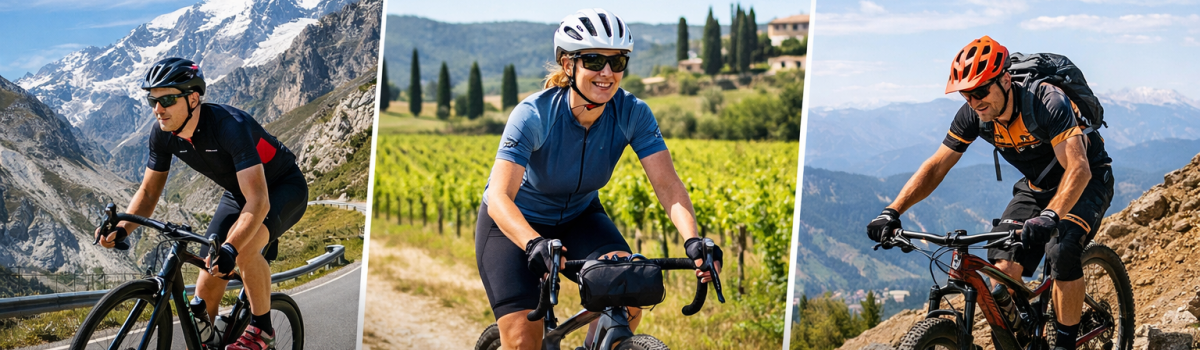

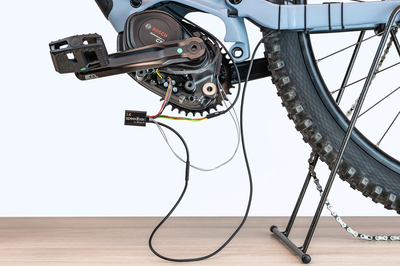
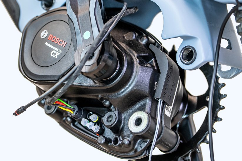
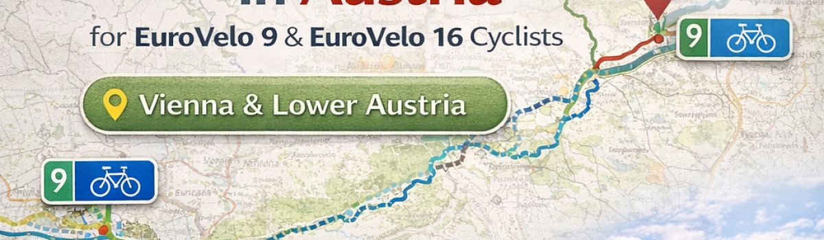

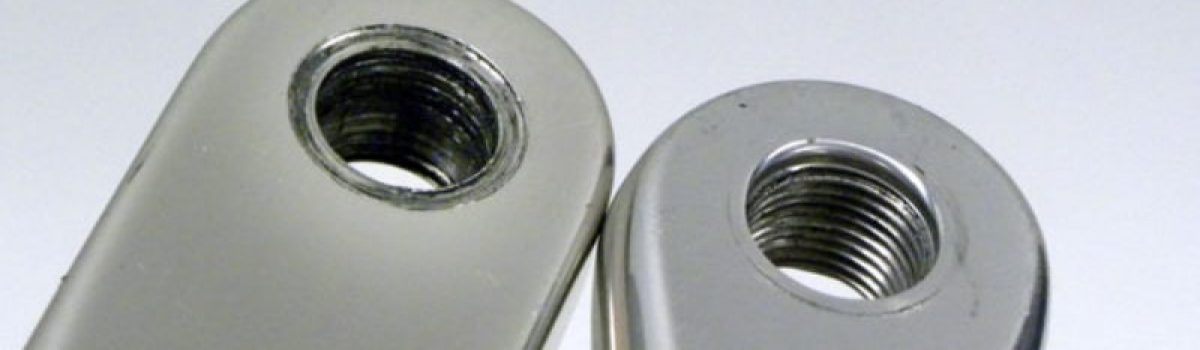
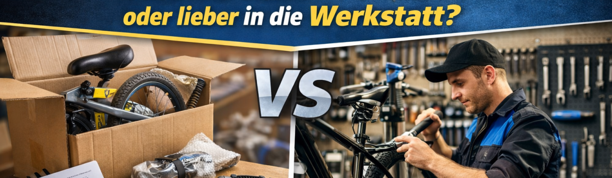
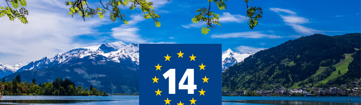
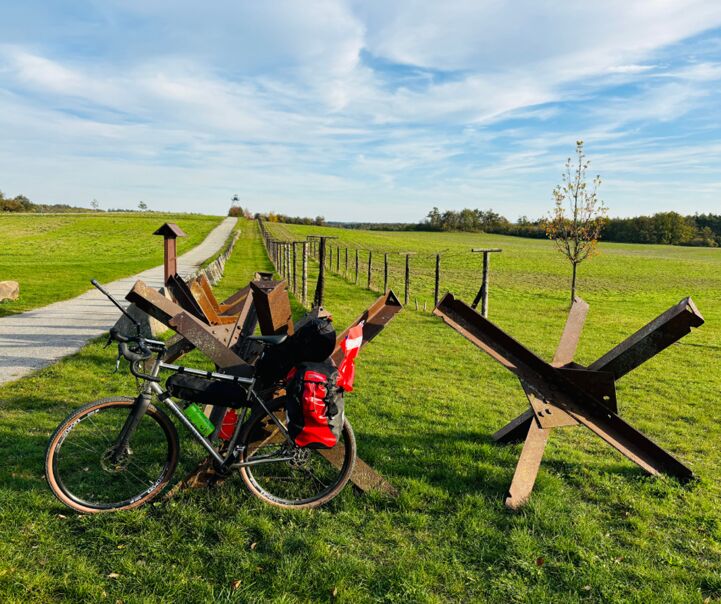
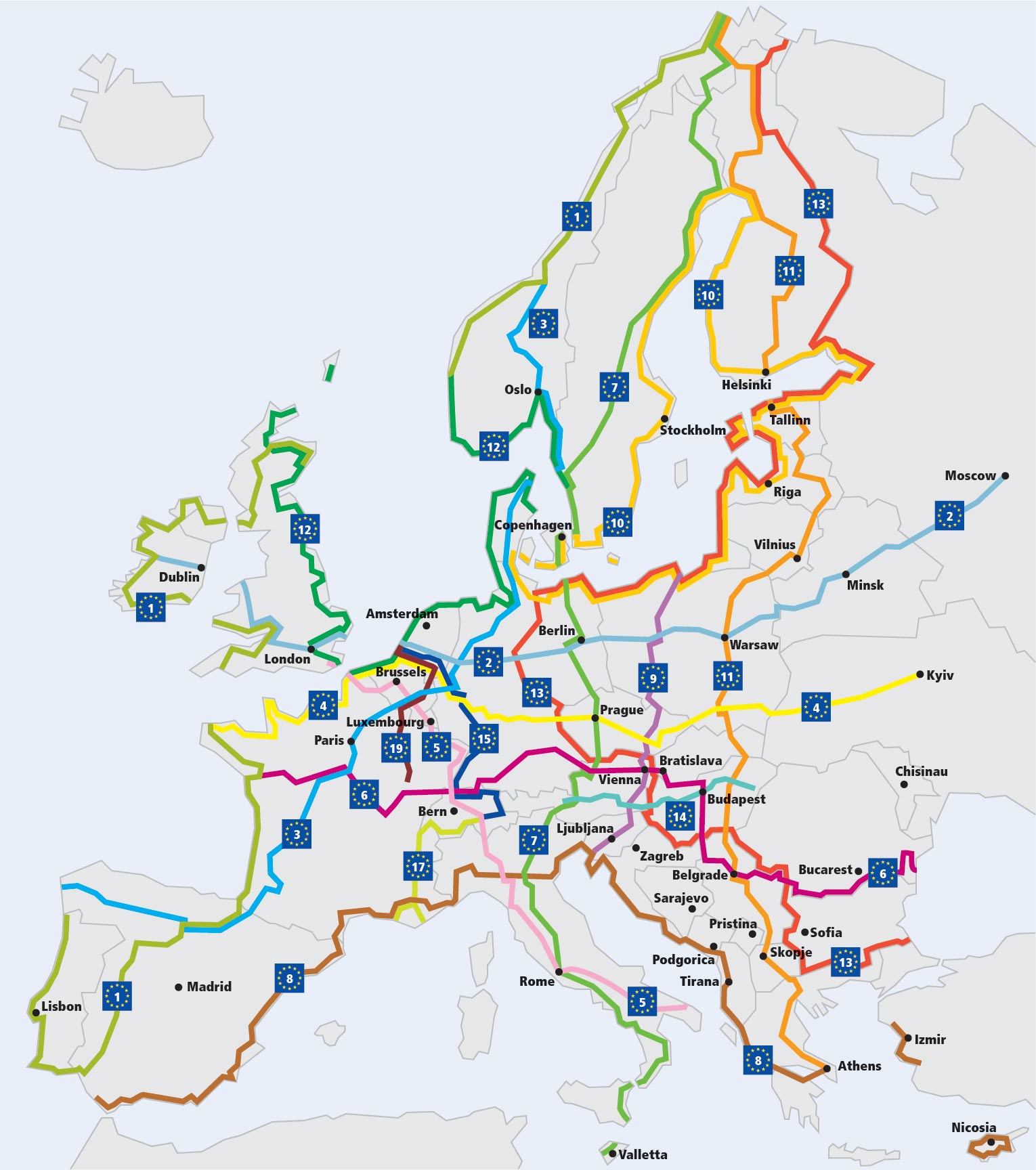


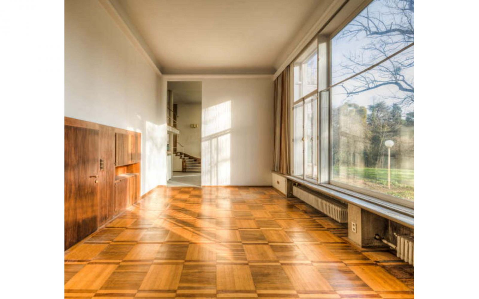

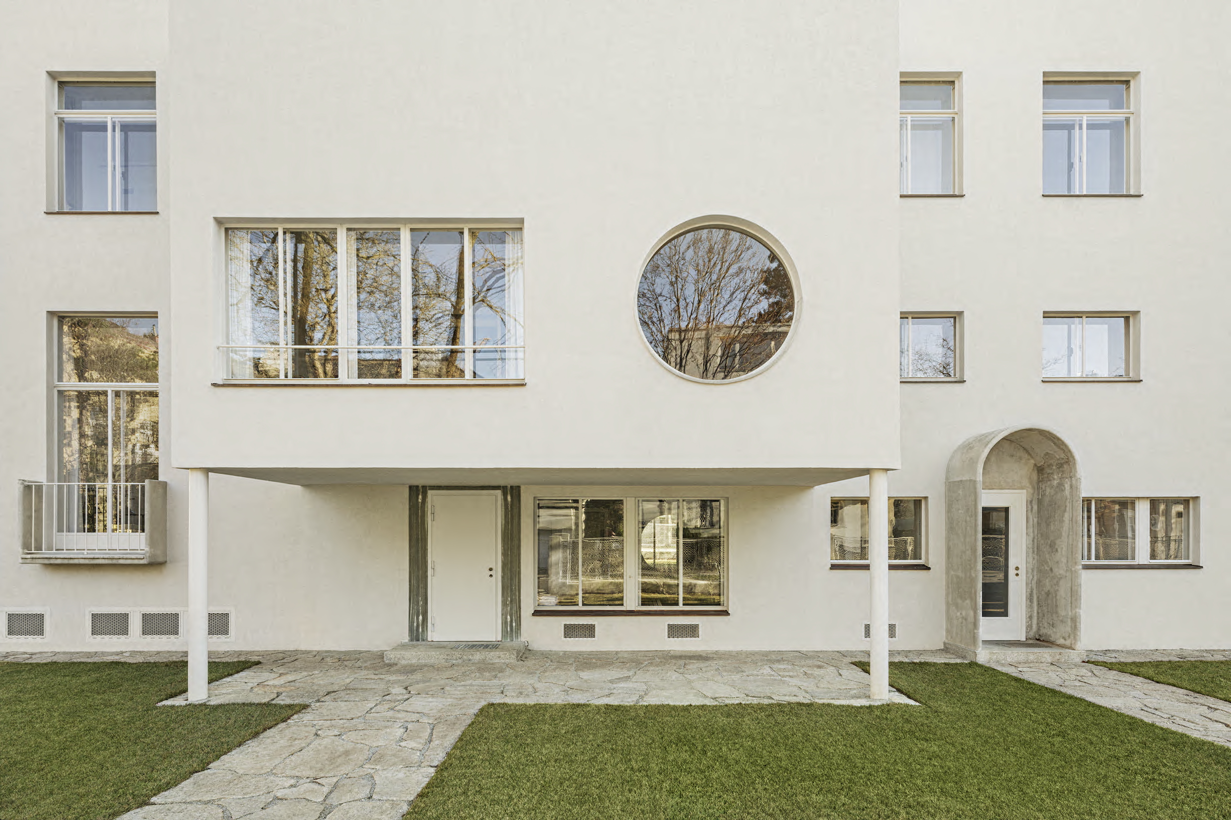
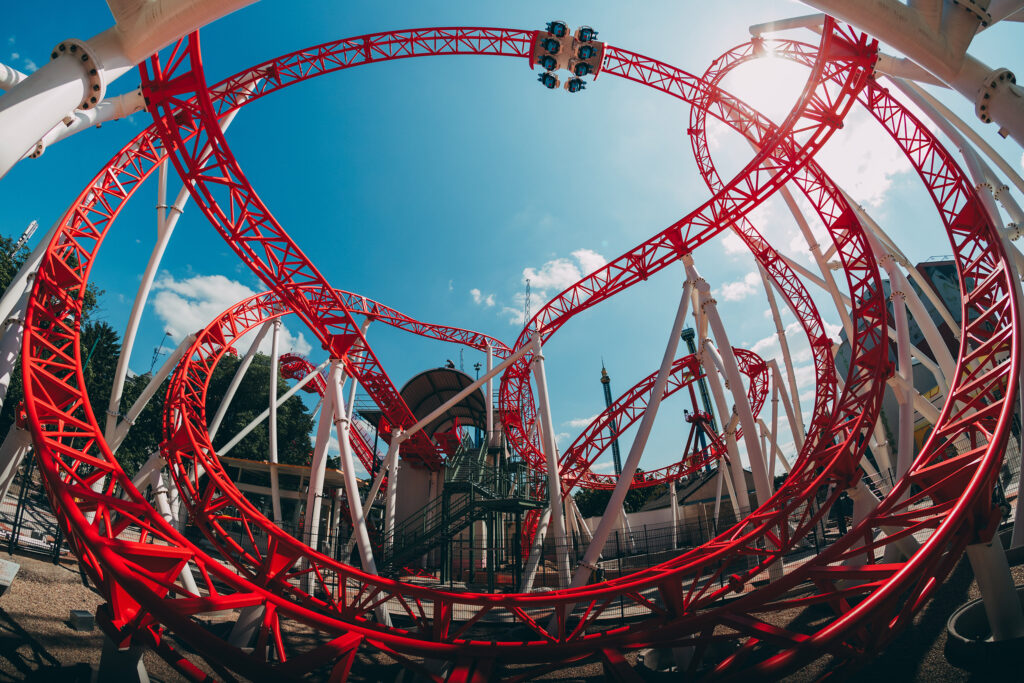
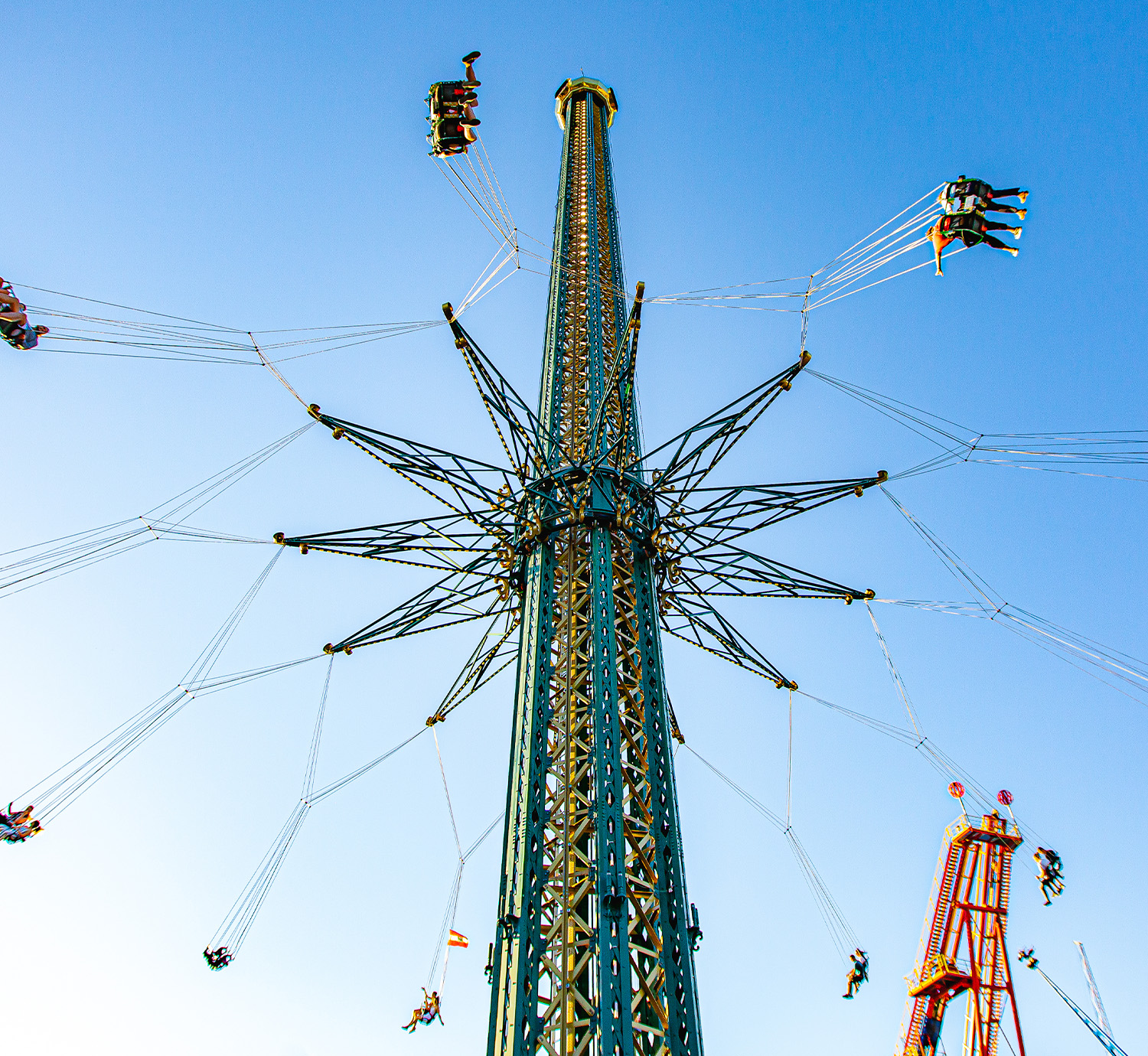

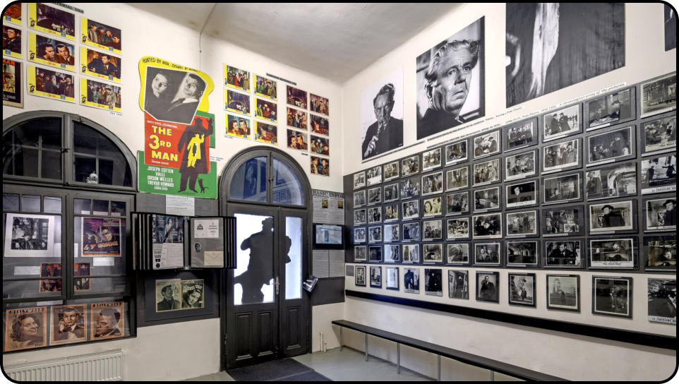
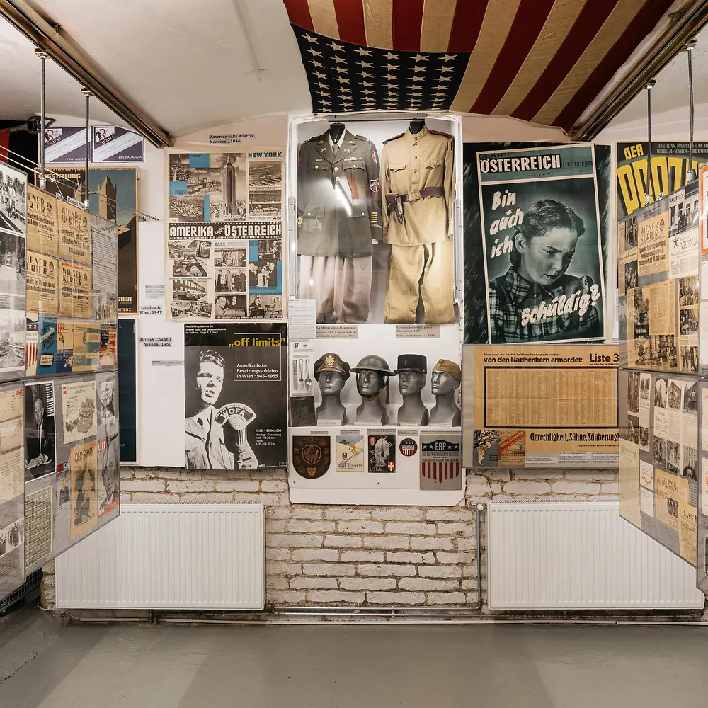
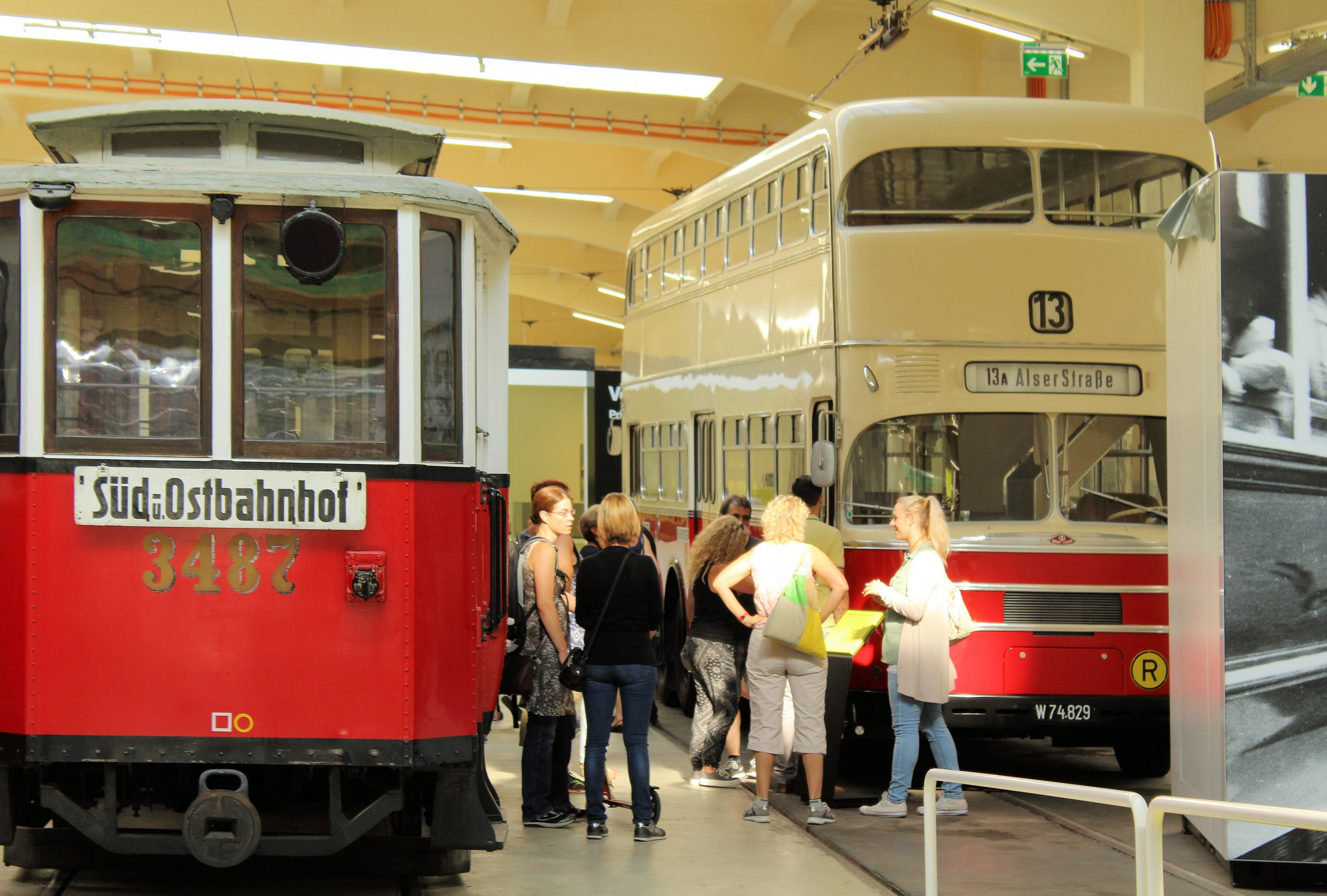
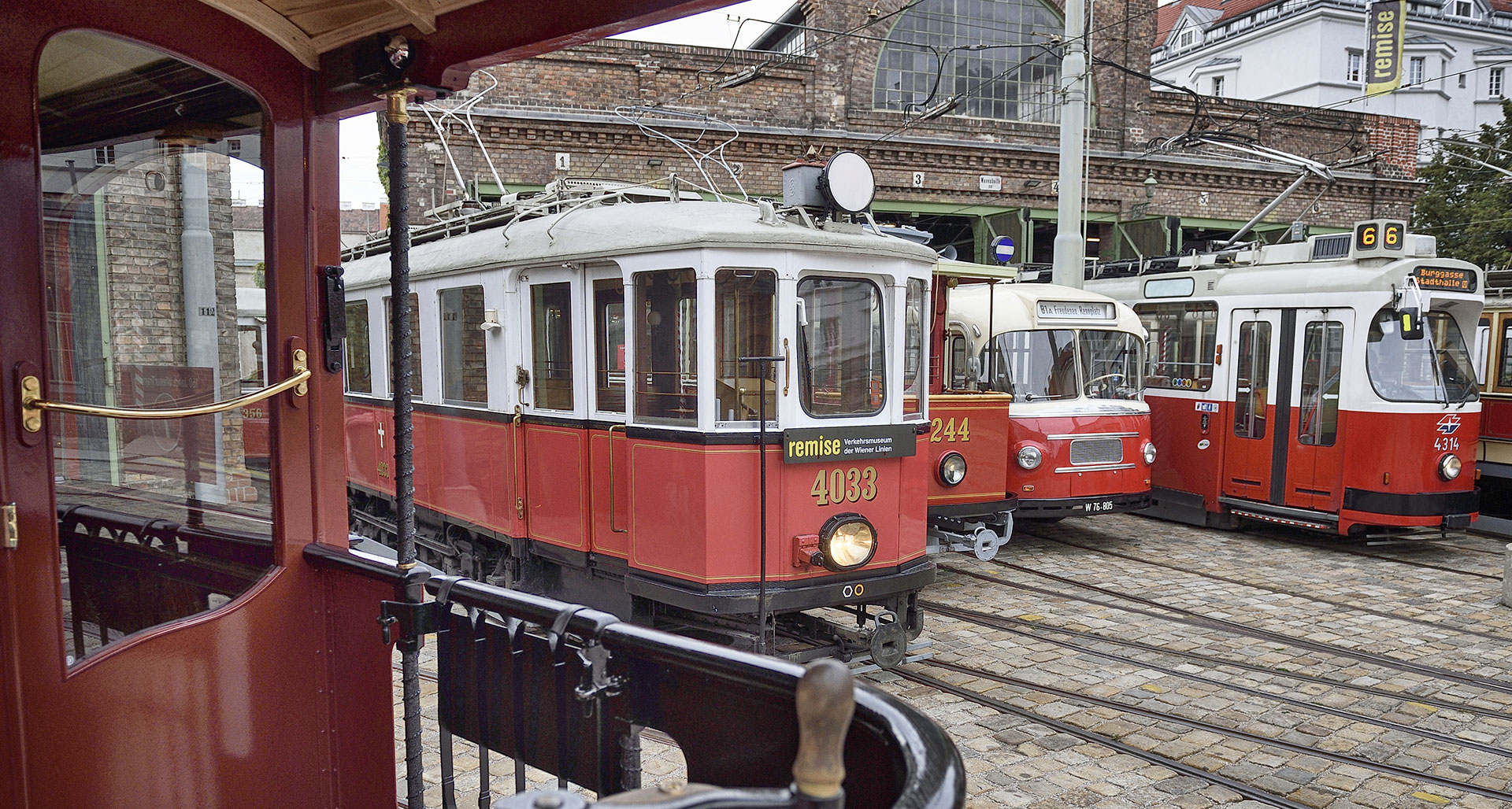
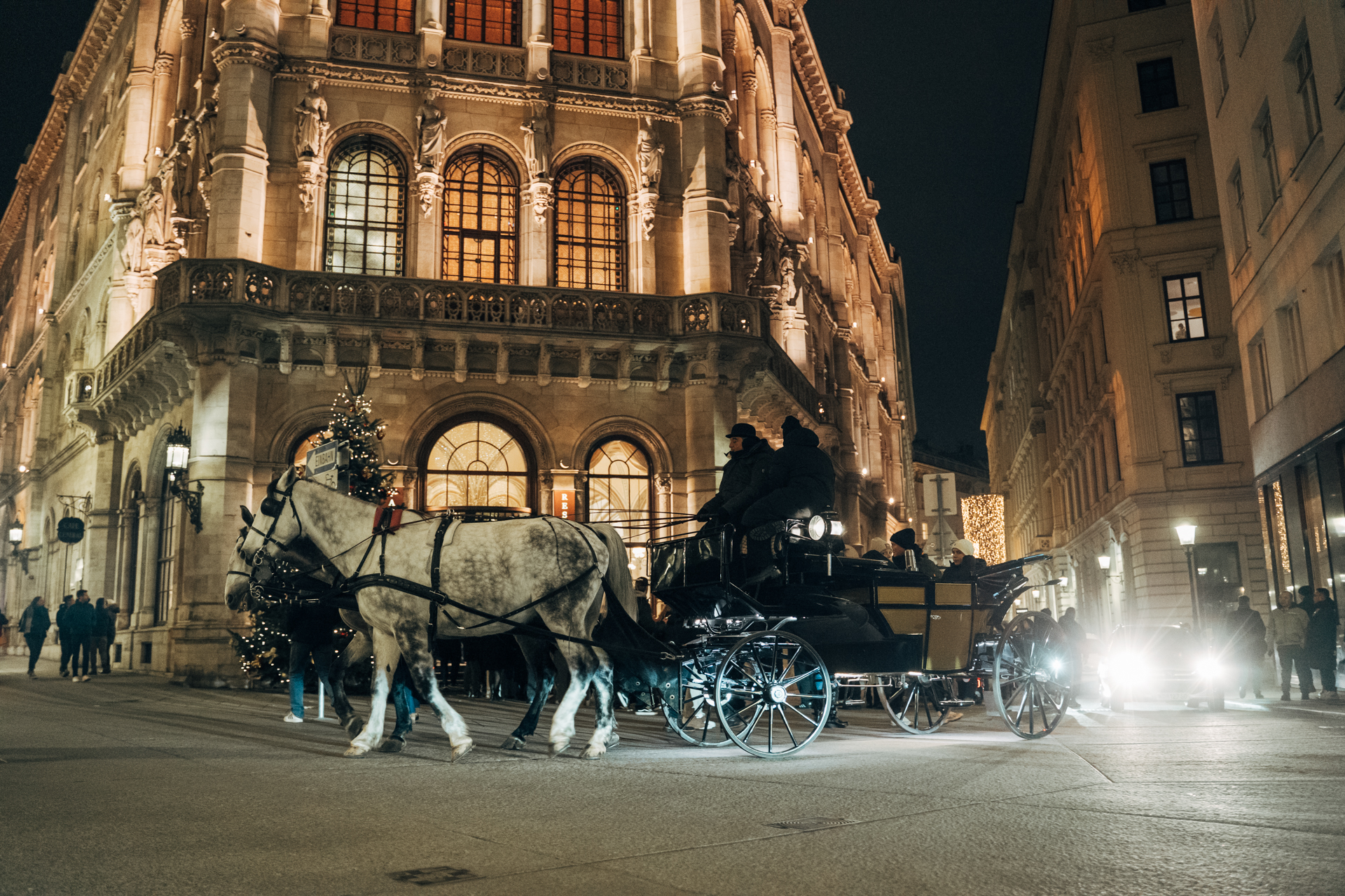

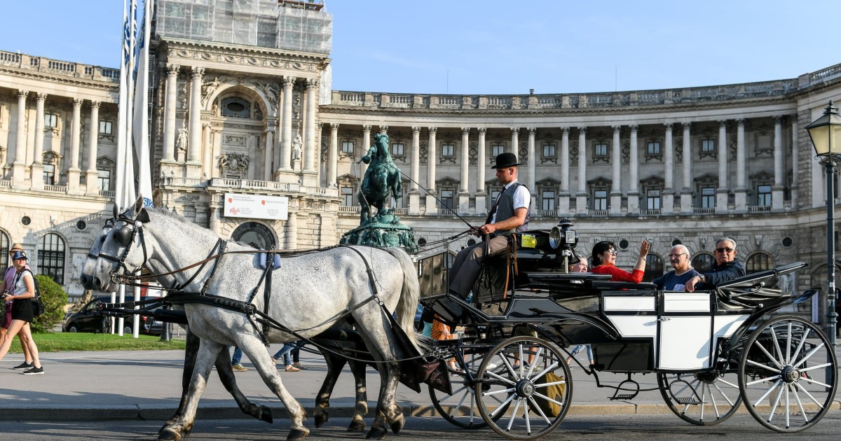

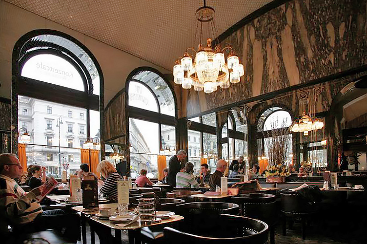
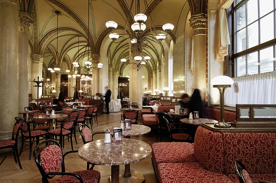

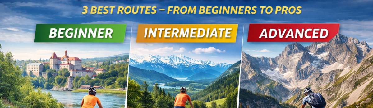


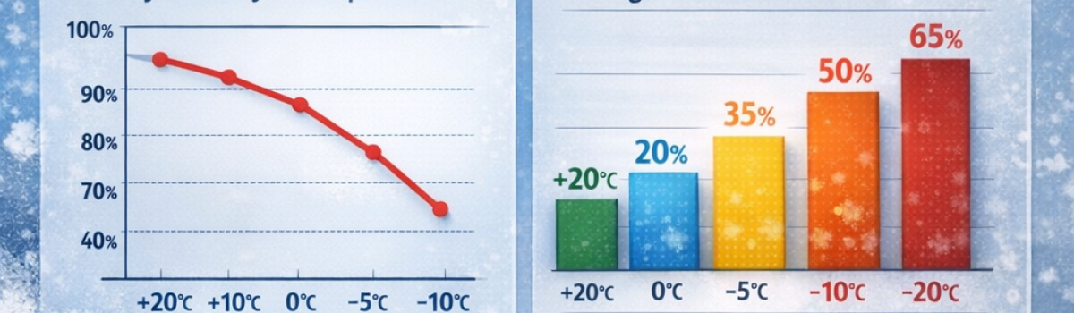
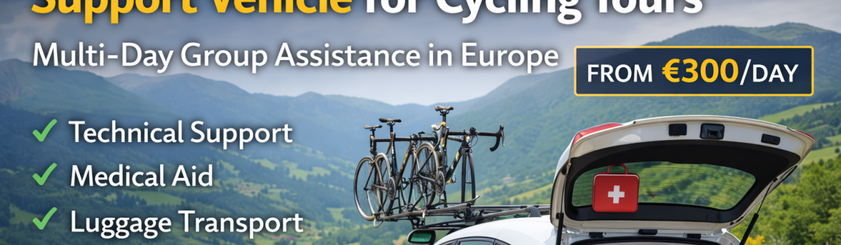
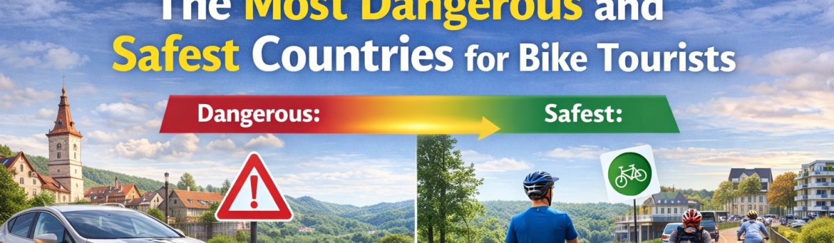
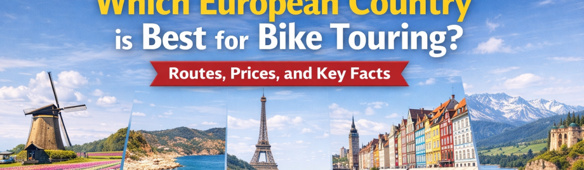

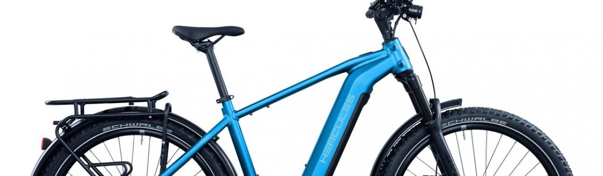


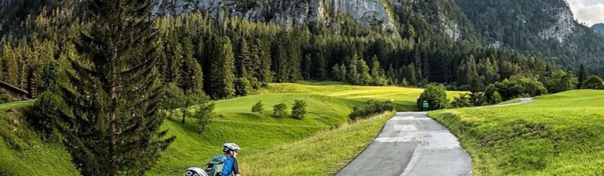
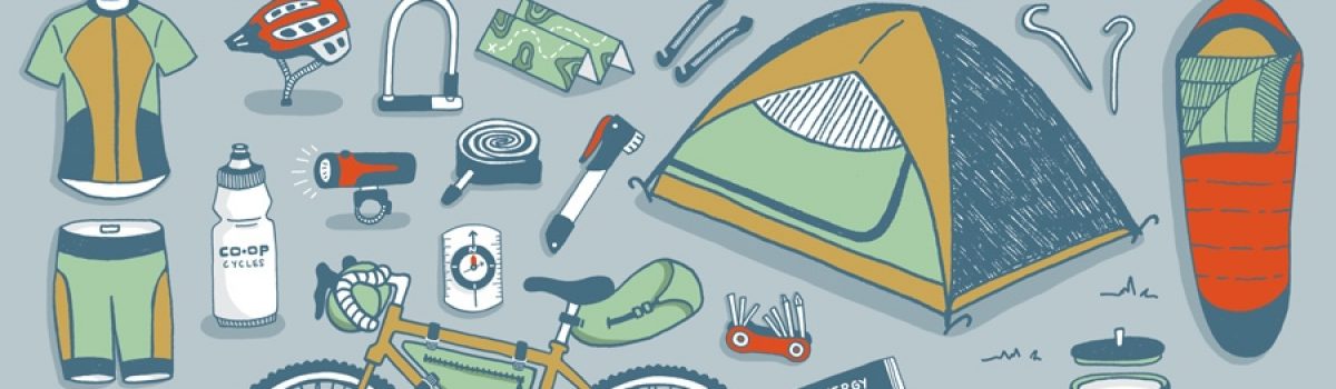
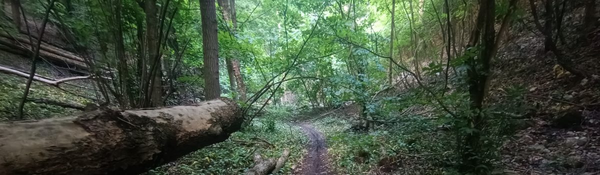
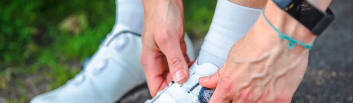
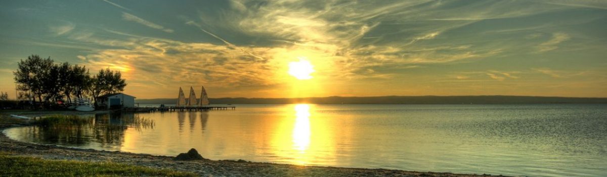
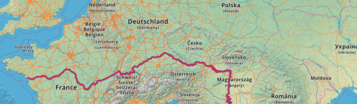


Follow Us