
Jauerling–Wachau: Where the Danube Meets the Mountains — and Cycling Tourism Finds New Routes
A nature park that nearly disappeared. A UNESCO-listed landscape shaped by people for thousands of years. And a cycling region where leisurely riders, road cyclists and mountain bikers now discover three quite different sides of Lower Austria.
An exploration of nature, history and cycling in Lower Austria — researched in November 2026.
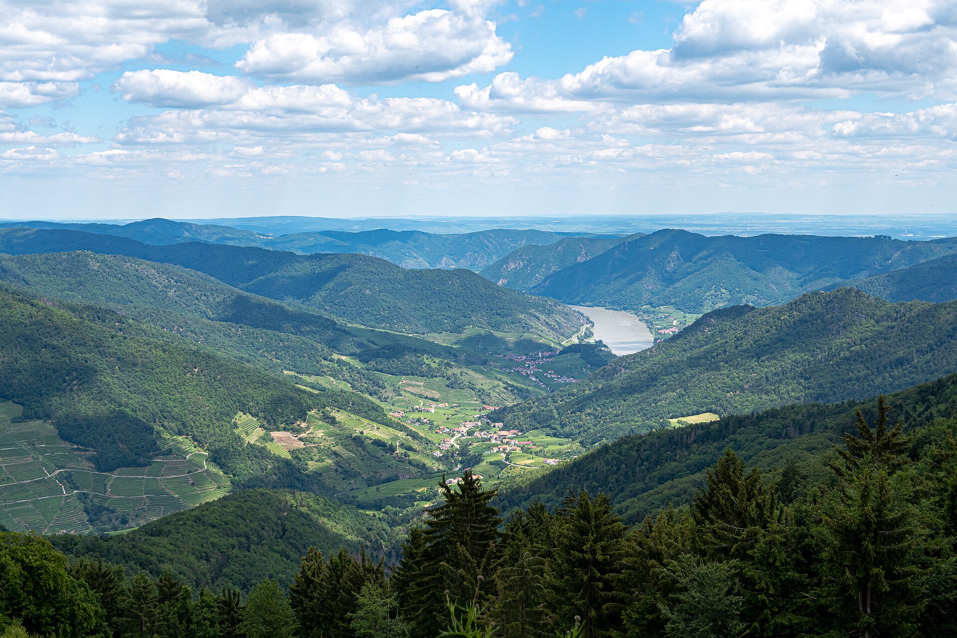

Look north from Spitz an der Donau and you won’t see a dramatic Alpine wall. Instead, wooded ridges rise beyond the vineyards, broken by small roads, scattered houses and patches of farmland. The highest point is easy to overlook. It’s only when you tackle it on a bicycle that the scale of the landscape becomes clear: more than 700 metres of climbing separate the Danube from Jauerling. At 960 metres, the mountain is the highest along the entire course of the Danube, from the Black Forest to the Black Sea. 1
Down by the river, touring cyclists with panniers are heading towards Vienna. A few kilometres inland, road cyclists are working their way up a series of bends. Elsewhere, mountain bikers turn off onto signed forest roads in the MTB-Area Wachau-Jauerling. They are travelling through the same region, but their days on the bike could hardly be more different.
That contrast is what makes Jauerling so interesting. The country between the Wachau and the southern Waldviertel is neither a conventional bike park nor a postcard landscape frozen in time. People have farmed, worked and changed it for centuries, and they still do. Tourism can help small communities remain economically viable. But it can also put pressure on paths, wildlife and village life. The history of this nature park is, in part, a story about trying to make those competing interests work together.
960 mJauerling summit elevation
1973Nature park established
7Member municipalities
588 kmMTB network at launch in 2024
One Mountain, Two Worlds: What Is Naturpark Jauerling-Wachau?
Covering roughly 11,500 hectares, Naturpark Jauerling-Wachau occupies the transition between the terraced vineyards of the Danube Valley and the cooler, more heavily wooded hills of the southern Waldviertel. Seven municipalities belong to the nature park association: Aggsbach, Emmersdorf, Maria Laach am Jauerling, Mühldorf, Raxendorf, Spitz and Weiten. 1
Apricots and grapes thrive near the Danube. Just a few kilometres uphill, the scenery changes to orchards, fields, mixed woodland, meadows and small villages. This is not untouched wilderness. Some of the area’s richest grasslands exist precisely because generations of farmers cut the hay or grazed their animals lightly. Stop managing them and shrubs gradually take over. Intensify the farming too much and sensitive species disappear for another reason. 2
That is why the term nature park should not be confused with a fully closed nature reserve. In Austria, a Naturpark combines protection of a valued landscape with recreation, education and regional development. Much of this landscape is still used for farming and forestry. A walking path across a meadow does not automatically make it a public mountain-bike trail.
Three labels are often used interchangeably here: UNESCO World Heritage Site, nature park and Natura 2000 protected area. They do not mean the same thing. The Wachau Cultural Landscape, running along the Danube between Melk and Krems, was added to the UNESCO World Heritage List on 30 November 2000. Naturpark Jauerling-Wachau overlaps part of that landscape and reaches farther into the Waldviertel. The Wachau and Wachau-Jauerling European conservation areas have their own boundaries and legal provisions. 3 4
It sounds like an administrative detail. For cyclists it makes a real difference. A beautiful-looking forest road is not necessarily open to bicycles, and a protection rule in one area does not automatically apply to every neighbouring village.

1973, a Collapse, and a Second Beginning
The nature park’s history is far from straightforward. It was established in 1973 to preserve the landscape while bringing visitors to an area with a tradition of summer holidays in the countryside. Initially it was run by a private association under Hans Pichler. His name survives in the Hans-Pichler-Haus, the restaurant at the nature park. 5
The idea was understandable: attract walkers and day-trippers, and local inns, farms and villages gain new opportunities. But the association’s finances proved too fragile. It was dissolved in 1999. By the early 2000s, following the failure of the original organisational structure, the nature park itself faced an uncertain future.
In 2003, the seven municipalities took responsibility and re-established the association. What had almost disappeared gradually became a more coordinated regional project, with environmental education, partnerships with local businesses, visitor facilities and landscape management. The Austrian Commission for UNESCO later highlighted the recovery as an example of good practice in maintaining a World Heritage cultural landscape. 5 6
That episode has something to teach the cycling industry. Impressive scenery does not, by itself, create a sustainable tourism economy. Somebody has to maintain trails, negotiate access with landowners, pay for signs, keep route information current and ensure that the costs and benefits of tourism do not always fall on the same people.
The park’s 2025–2030 strategy is organised around four themes: nature conservation, education, recreation and regional development. It addresses meadow and orchard management, trail maintenance, the nature park visitor centre, local business partnerships and educational projects. Cyclists are part of this wider visitor economy, not the sole reason the park exists. 7
The Lookout Tower: Nearly Two Centuries of Tourism on a Mountaintop
The wish to stand above the Wachau and look out across the valley predates the nature park by well over a century. The first wooden viewing platform on Jauerling was built in 1842. In August of that year, three young Habsburg archdukes visited the lookout, including the future Emperor Franz Joseph. 8
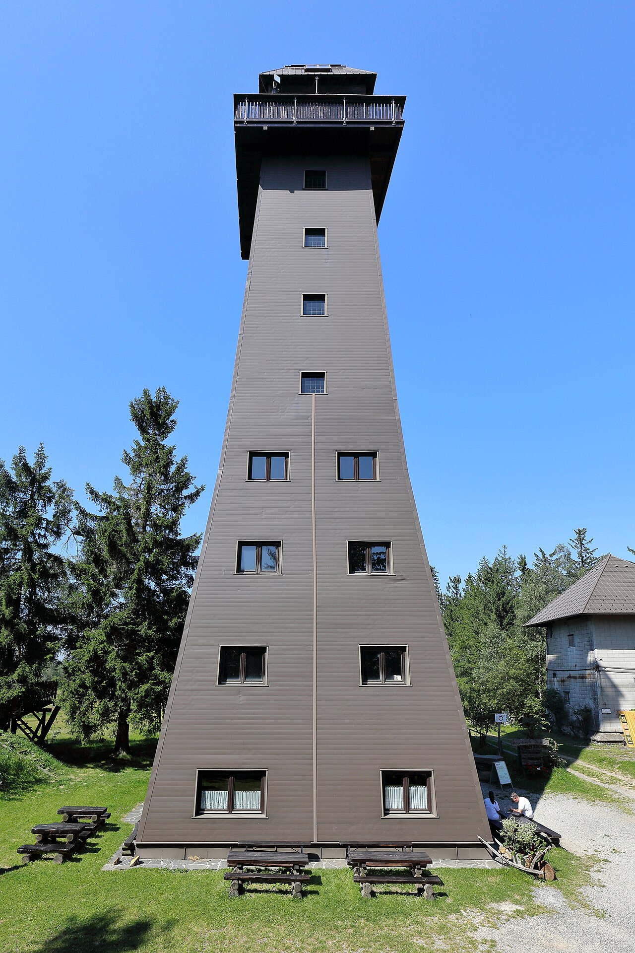
Another tower followed in 1898, named the Kaiser-Franz-Joseph-Jubiläumswarte in honour of the emperor. It collapsed in 1949. A replacement opened in 1951 but was later removed after storm damage in the 1970s. The present tower, approximately 38 metres high, was built in stages and has been open to visitors since 1991. 8
It’s a modest but telling piece of tourism history. Long before cycling computers counted vertical metres, people were making the trip uphill for the same reason: to see the landscape from above.
The terrace of the Naturparkhaus, at roughly 915 metres, is worth visiting even if the tower is closed. The view opens towards the Spitzer Graben, the Danube Valley and distant ranges on the horizon. Check opening dates before setting out, though. The restaurant and tower may have different seasonal hours, and bad weather can mean closures. 8 9

From the Stone Age to the Baroque: Places Worth Leaving the Saddle For
Counting kilometres is one way to travel through the Wachau. It is not necessarily the most interesting. Some of the region’s best discoveries require a detour — and occasionally a short walk without the bike.
Maria Laach: A Pilgrimage Village on the Plateau
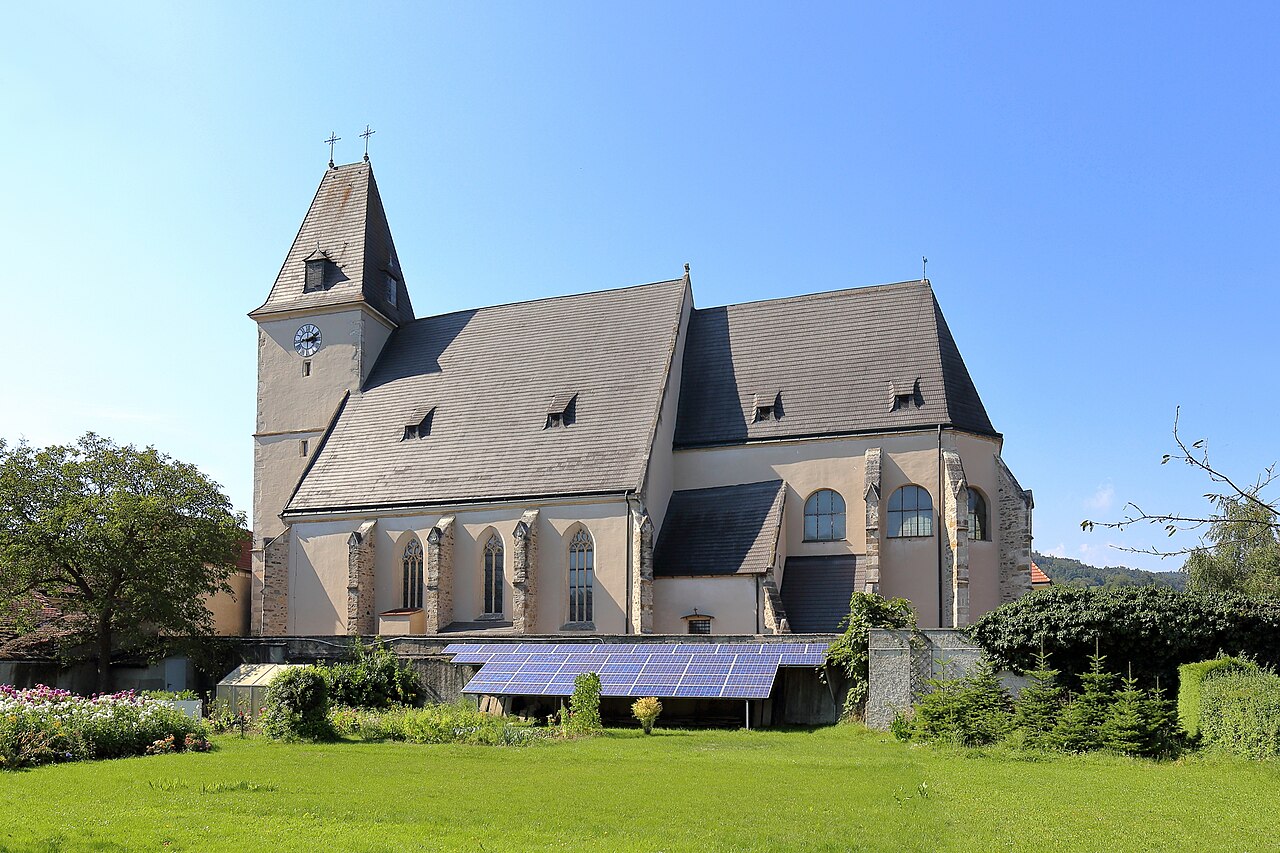
Maria Laach am Jauerling lies well away from the busy river corridor. Instead of streams of day-trippers, there is a village square, farmhouses and the late-Gothic pilgrimage church of the Visitation of Mary. Its history stretches back to the late Middle Ages, and its interior contains a notable Gothic winged altarpiece. The village is a useful starting point for cycling on the high plateau if you would rather avoid climbing all the way from the Danube.

Spitz, the Spitzer Graben and Hinterhaus Castle Ruins
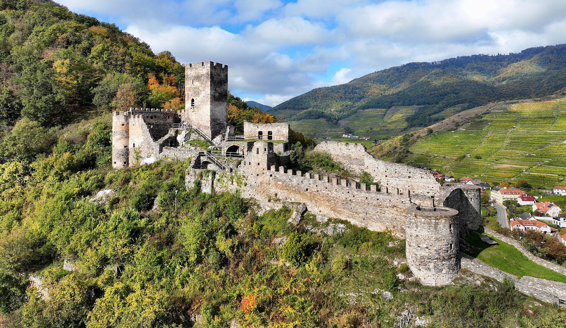
Spitz is where river cycling, wine tourism and mountain roads naturally come together. Behind its houses begins the Spitzer Graben, a valley of steep vineyard terraces and wooded slopes. Above the village stand the ruins of Hinterhaus Castle, whose origins go back to the 12th or 13th century. The best way to visit the ruins is on foot; the paths up to them should not be mistaken for designated MTB routes.

Willendorf: A Discovery That Changed Prehistory
In 1908, archaeologists working at Willendorf uncovered the famous Venus of Willendorf, a small Palaeolithic female figurine dating back approximately 29,500 years. The original is kept at the Natural History Museum in Vienna, while displays in and around Willendorf explain the discovery and the early history of the area. A ride through this part of the Wachau passes through a landscape inhabited by humans for an extraordinarily long time. 3 21
Melk, Dürnstein and Aggstein: Looking Beyond the Park Boundary
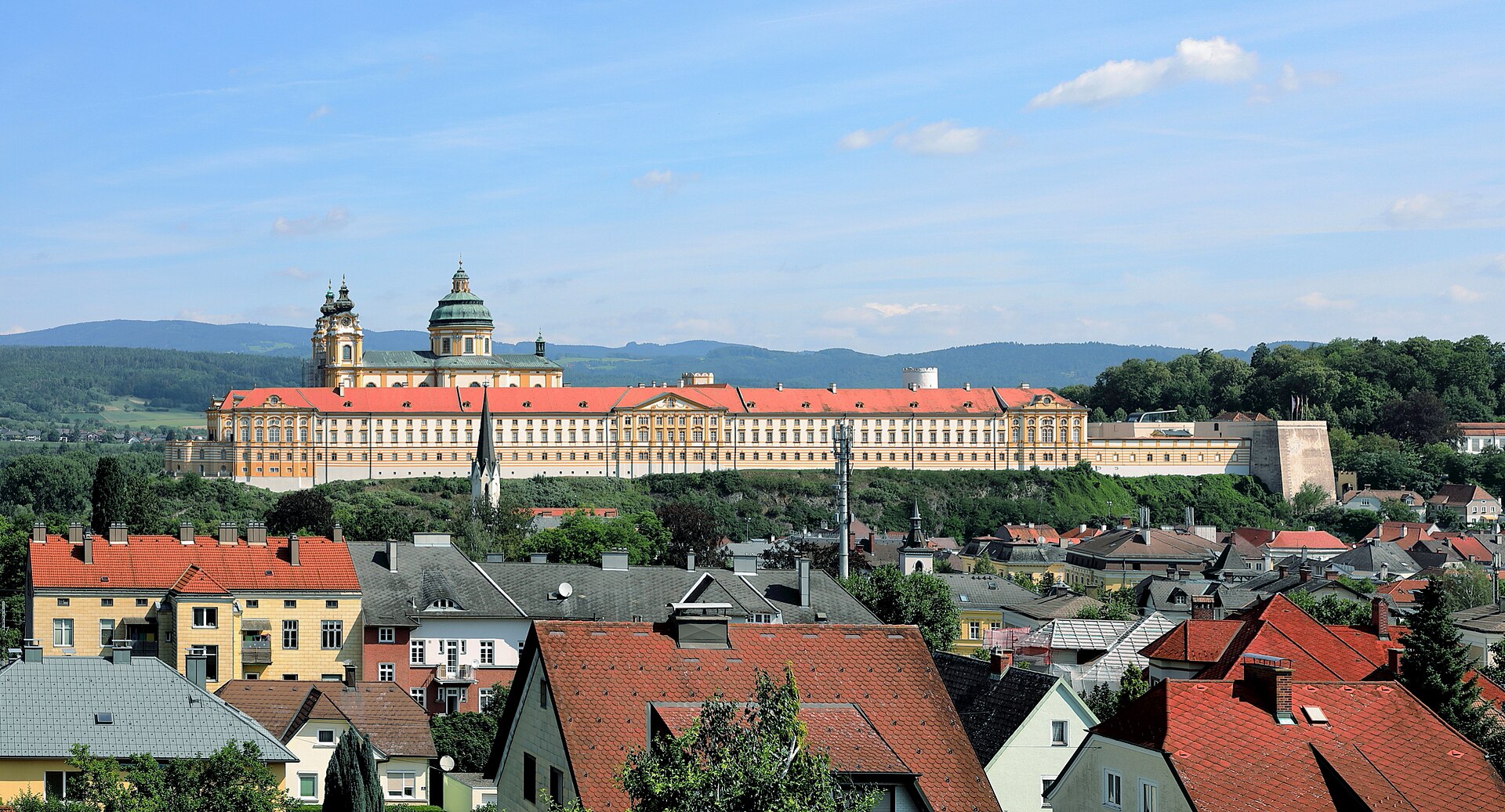
Not every famous Wachau landmark lies inside the nature park itself. On a longer cycling holiday, however, they belong to the same journey. Melk Abbey, at the western entrance to the Wachau, owes its striking present appearance largely to an 18th-century Baroque reconstruction. Dürnstein, with its blue church tower and ruined castle, recalls the imprisonment of Richard the Lionheart in the 12th century. Aggstein Castle commands a dramatic position above the southern bank of the Danube. Reaching some of these sites involves steep approaches, and visiting a castle is best treated as a proper stop rather than a quick ride-through. 3

The Danube Cycle Path: How a River Corridor Became a Tourism Business
The cycling boom in the Wachau began not on the mountain, but down by the water. The Donauradweg, or Danube Cycle Path, forms part of the EuroVelo 6 long-distance cycling network. It brought the Wachau within reach of travellers who were not interested in conquering steep climbs. A manageable elevation profile, connections between towns, relatively accessible sections of route and a long tradition of river commerce and hospitality created favourable conditions.
There are approximately 36 kilometres of Danube landscape between Melk and Krems. A day ride can cover roughly 35 kilometres, depending on which bank you use, ferry crossings and detours. For one visitor, that is a leisurely trip between railway stations. For another, it is a single stage of a longer journey from Passau through Vienna to Budapest. 3 10
The economic effect goes far beyond bicycle rentals. A traveller stopping in Spitz may need a room for the night. A puncture means a visit to a workshop. Others pay for a wine tasting, a ferry, luggage transport or a lift back to their starting point. Restaurants, bakeries, grocery shops and guided-tour operators benefit in different ways. The bicycle becomes a link between businesses that might otherwise have little in common.
How many cyclists use the route? A study reported approximately 926,000 cyclists on the wider Passau–Vienna Danube Cycle Path corridor in 2023. This figure covers the surveyed corridor as a whole; it is not a count of visitors to Naturpark Jauerling-Wachau. According to the survey, the recorded usage was divided into everyday cycling (33%), domestic day visitors (32%), touring cyclists (22%), holiday guests (11%) and cruise-ship visitors (2%). These were the survey’s categories, not a breakdown of unique people visiting the nature park. 11
In 2024, work also began on the “Donauradweg 3.0” development project: improved rest stops, clearer information, circular routes into the hinterland and better visibility for local businesses. The thinking is significant. The future challenge is not simply to move more riders along the water’s edge. It is to encourage worthwhile visits beyond the river, spread the benefits and give travellers reasons to stay longer. 12

Leisure Cycling, E-Bikes and Gravel: The River Is Only the Beginning
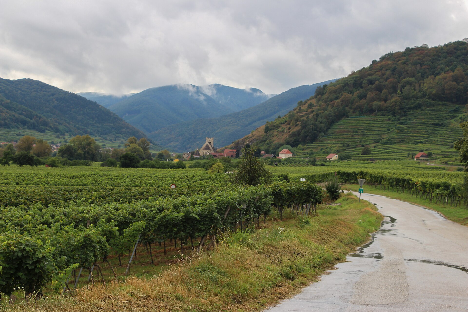
A classic Wachau cycling day often follows one of the two Danube banks. Which side you choose matters. Spitz, Weißenkirchen and Dürnstein are among the places on the north bank. On the southern side, sections pass through quieter settlements and farmland near Rossatz and the Arnsdörfer. Ferries connect the two banks at several points, but their service depends on season and weather.
For riders interested in a relaxed outing, the river is generally the best choice. A trekking bike, touring bike or e-touring bike will do the job. Turn inland towards Maria Laach, however, and the character of the ride changes quickly. Electric assistance does not remove the climb, but it makes the hills accessible to more people — and can turn a short river excursion into a full day exploring the countryside.
That shift changes what cycling businesses need to provide. An attractive line on a map is no longer enough. Battery range, charging arrangements, suitable frame sizes, reliable brakes for extended descents, access to repairs and safe places to leave a bike all become part of the travel experience.
Gravel bikes fill an interesting space between road touring and mountain biking. They are efficient on asphalt and more comfortable than narrow-tyred road bikes on firm gravel. The transition between the Danube Valley and the Waldviertel offers plenty of tempting connections. But a track does not become legally accessible just because a gravel bike can technically ride it. Austrian forestry law and local access permissions still apply.
Road Cycling on Jauerling: A Climb That Changes Your Perspective
For road cyclists, the Wachau’s greatest appeal may be the contrast between a relatively flat river route and serious climbing within just a few kilometres. From the Danube to Jauerling, it is possible to gain more than 700 metres of elevation. Roads through Spitz, the Laaben area and Maria Laach connect long gradients, tight bends, wooded sections and occasional views across the vineyards. 1
Jauerling is not an Alpine pass surrounded by cliffs. That can make the climb deceptively easy to underestimate. You may leave Spitz in warm sunshine and find cooler air, wind and different road conditions as you gain height. On the descent, blind corners, loose material on the road and oncoming vehicles deserve full attention.
The area also attracts riders who prefer long, demanding days. An officially published circuit from St. Pölten, “STP Route 5 – UNESCO World Heritage Wachau–Jauerling,” covers 118 kilometres with approximately 1,710 metres of climbing. It connects the Danube, Jauerling and the Dunkelsteinerwald. Those figures describe the entire circular route, not a single ascent of Jauerling. 13
There is a useful distinction here. You do not need low mountain-climbing gears for a gentle ride beside the river. For a day built around the Jauerling ascent, however, realistic planning matters: your fitness, gearing, brakes and the road back down. In a region with narrow roads and visitor traffic, a spectacular view is no substitute for careful riding.
Mountain Biking: Why 2024 Was a Turning Point
For years, the Wachau-Jauerling area had all the ingredients for mountain biking: hills, forests, villages and established local routes. What it lacked was a broadly coordinated network with consistent signs and clear access agreements. Developing one meant confronting a familiar Austrian question: how do you provide legal and enjoyable mountain-bike routes through a forest that is also a workplace, a hunting area, a wildlife habitat and somewhere people come to relax?
A preliminary project in 2021–2022 examined the cycling potential of the Wachau and the Dunkelsteinerwald and brought local stakeholders into the discussion. The MTB-Area Wachau-Jauerling officially opened on 1 June 2024. At launch, the Austrian Federal Forests (Österreichische Bundesforste) reported 588 kilometres of routes, 18 circular tours and more than 17,800 metres of cumulative climbing across the network. There were five easy, seven intermediate and six difficult tours. 14 15
That 17,800-metre figure is the sum across the published tours, not the elevation gain of a single ride. Similarly, the 588 kilometres should not necessarily be understood as 588 kilometres of completely separate tracks: circular routes can share sections.
The nature park’s current website lists 20 MTB tours. That differs from the 18 announced at the 2024 opening because the figures come from different stages of the network’s development. If you are planning an actual ride, the latest official route descriptions and GPX files matter more than an older press release. 16
Three Routes That Show What the Area Offers
| Route | Published figures | What to expect |
|---|---|---|
| Grand Tour Spitz (Route 6) | 52.60 km · 1,726 m ascent · Difficult | A substantial loop through woodland, villages, the Spitzer Graben and high Jauerling. |
| Maria Laacher Runde (Route 12) | 47.44 km · 1,745 m ascent · Difficult | A physically demanding circuit taking in Willendorf, Schwallenbach and high Jauerling. |
| Aggsbacher Runde | About 13.2 km at the 2024 launch | A shorter introduction to the regional route network. |
The distances and elevation gains come from published official route profiles or launch information. The two longer rides show why distance alone tells you little about difficulty. Close to 1,750 metres of climbing in fewer than 50 kilometres is a serious day out, even for fit riders. 14 17 18
Nor should the Jauerling network be confused with a lift-served bike park. This is predominantly touring mountain biking: forest roads, connecting tracks, changing surfaces, climbs powered by your legs or an e-MTB motor, and lengthy descents. Riders looking for jump lines and repeated chairlift runs should consider a different type of destination. Riders who want to spend several hours travelling through woodland and a lived-in rural landscape have much to explore here.
According to the Federal Forests, planning specifically took account of the European wildcat’s habitat. Local municipalities, landowners, forestry operations and other interest groups were involved in securing the route network. These largely invisible agreements are what turn a line on a digital map into a legal, dependable mountain-bike trail. 14
A Forest Is Not an Open-Air Playground
A region welcoming mountain bikers does not mean that every path is available to ride. The authorised routes come with permitted hours, temporary closures, behavioural rules and seasonal restrictions. One published set of route rules, for example, gives March and October: 9 a.m.–5 p.m.; April and September: 8 a.m.–6 p.m.; May to August: 7 a.m.–7 p.m. Another general page on the nature park website describes a closure from November through March. Those statements are not perfectly consistent. In practice, always check the current status of your specific route and the signs on the ground, particularly in March and at the start or end of the season. 16 17
Outside authorised trails and times, you cannot simply use a forest road as a shortcut. Logging machinery, timber stacks, hunting activity and fallen trees can also affect access. Riding within sight distance and respecting other users are practical necessities, not a decorative code of conduct.
Tour operators and guides have an additional responsibility. A route needs to be more than scenic: it must be legal, appropriate for the group and adaptable to changing conditions. A GPX track downloaded from the internet cannot guarantee any of those things on its own.
What Exactly Is Cycling Tourism Helping to Protect?
Ride past Jauerling’s meadows in spring or summer and the wildflowers may appear entirely natural, as though they have always been there. In reality, keeping those grasslands open takes work. The nature park describes hay meadows, nutrient-poor grasslands, wet meadows and dry grasslands rich in orchids, all supporting specialised plants, insects and birds. Traditional orchards with old fruit trees are another important habitat. 2
The threats can seem contradictory. Intensive land use can impoverish species-rich meadows. Stop mowing altogether, though, and bushes spread, followed eventually by woodland. Other economically attractive uses, such as Christmas-tree plantations, also change the landscape. The real question is not simply ‘people or nature?’ It is what kind of land management allows biodiversity to survive.
Through ReNature³, the park works with other Austrian nature parks to maintain and reconnect important habitats, including wet meadows, traditional orchards and vineyard landscapes. A local project called Jauerlinger Saftladen uses apples from traditional orchards, combining environmental education, farming and a product that can be sold. 19 20
The Saftladen marked its 15th anniversary in October 2026. According to the nature park, around 40,000 litres of apple juice have been pressed since the project began in 2011, involving more than 3,000 schoolchildren. Children collect apples from local orchards and each year’s juice label features an animal or another aspect of the local natural world. In 2026, the label featured the Natterer’s bat. Small projects like this provide a tangible example of what ‘regional value’ can mean beyond statistics on overnight stays. 20
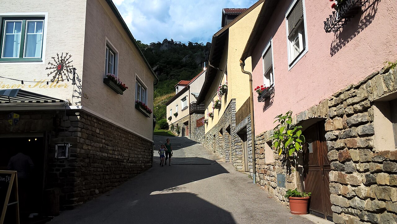

For cycling tourism, these are not merely environmental footnotes. Visitors come precisely because the area is a patchwork of vineyards, meadows, villages, forests and orchards. Lose the orchards, dry grasslands and quiet woodland edges, and the region loses some of what makes it different from other cycling destinations.
Who Actually Benefits When More People Arrive by Bike?
The Danube Cycle Path has an established local chain of businesses serving visitors. Mountain-bike tourism is still building one. A demanding circular route might encourage an extra overnight stay because riders are unlikely to leave immediately after a single outing. E-bikes open the climbs to more visitors. But all this also creates costs: trail maintenance, signs, negotiation, risk management, insurance arrangements and careful handling of visitor numbers.
The opportunities reach beyond bicycle-specific businesses. Inns on the high plateau, accommodation in the Spitzer Graben, wineries, farm shops, workshops, bike rentals, guides and passenger or luggage transport may all see benefits. But a busy viewpoint does not prove that every local company is making money. There is no robust, publicly consolidated set of figures separating the revenue of all bike rentals, workshops and guided cycling tours specifically within Naturpark Jauerling-Wachau. Inventing such a number would be misleading.
What can be documented are the development projects themselves. The MTB area was established through cooperation between municipalities. Donauradweg 3.0 is intended to draw visitors towards neighbouring towns and villages. The nature park works with partner businesses and promotes regional products. These initiatives share a basic principle: visitors should do more than enjoy the view; their presence should also help sustain the place they came to see. 7 12 14
Four Ways to Explore Jauerling by Bicycle
Very different cycling days are possible within the same landscape. The following are ideas for trips, not newly surveyed GPX routes. For any ride beyond the Danube Cycle Path, check the planned route and access permissions before setting out.
1. The Classic Wachau: An Easy Ride from Melk Towards Krems
A good choice for leisure cyclists, couples and visitors who want to get to know the valley. Allow roughly 35–40 kilometres along the Danube corridor, depending on your choice of bank and any ferry crossings. Leave time for Spitz, Weißenkirchen, Dürnstein and at least one proper break. A touring bike or e-touring bike will generally make more sense than a full-suspension mountain bike.
2. Jauerling as a Road-Cycling Climb
For fit road riders looking for a long ascent beyond the river. You might start in Spitz, take an appropriate public road towards Jauerling and Maria Laach, then descend with care. Total distance varies considerably with the route chosen. Those wanting a published, demanding long-distance circuit can use STP Route 5 as a reference: 118 kilometres and 1,710 metres of climbing.
3. An Official MTB Circuit in the Jauerling Network
For riders looking for a physical challenge on the mountain bike. Choose a signed tour from the park’s current collection, check the grade and cumulative ascent, and use the official GPX track. The 52.6 km Grand Tour Spitz and 47.44 km Maria Laacher Runde are both explicitly graded difficult. Shorter, easier published routes are more sensible for newcomers.
4. E-MTB or Gravel: Taking Time in the Hinterland
For travellers curious about the villages and the transition between the Danube and the Waldviertel. An e-MTB can make long climbs more manageable; a gravel bike works well on legal, firm mixed surfaces and public minor roads. The right route depends on trail conditions, permissions and experience. The aim is not to search for as many improvised forest shortcuts as possible, but to enjoy a quieter, more varied journey.
When Is the Best Time to Ride?
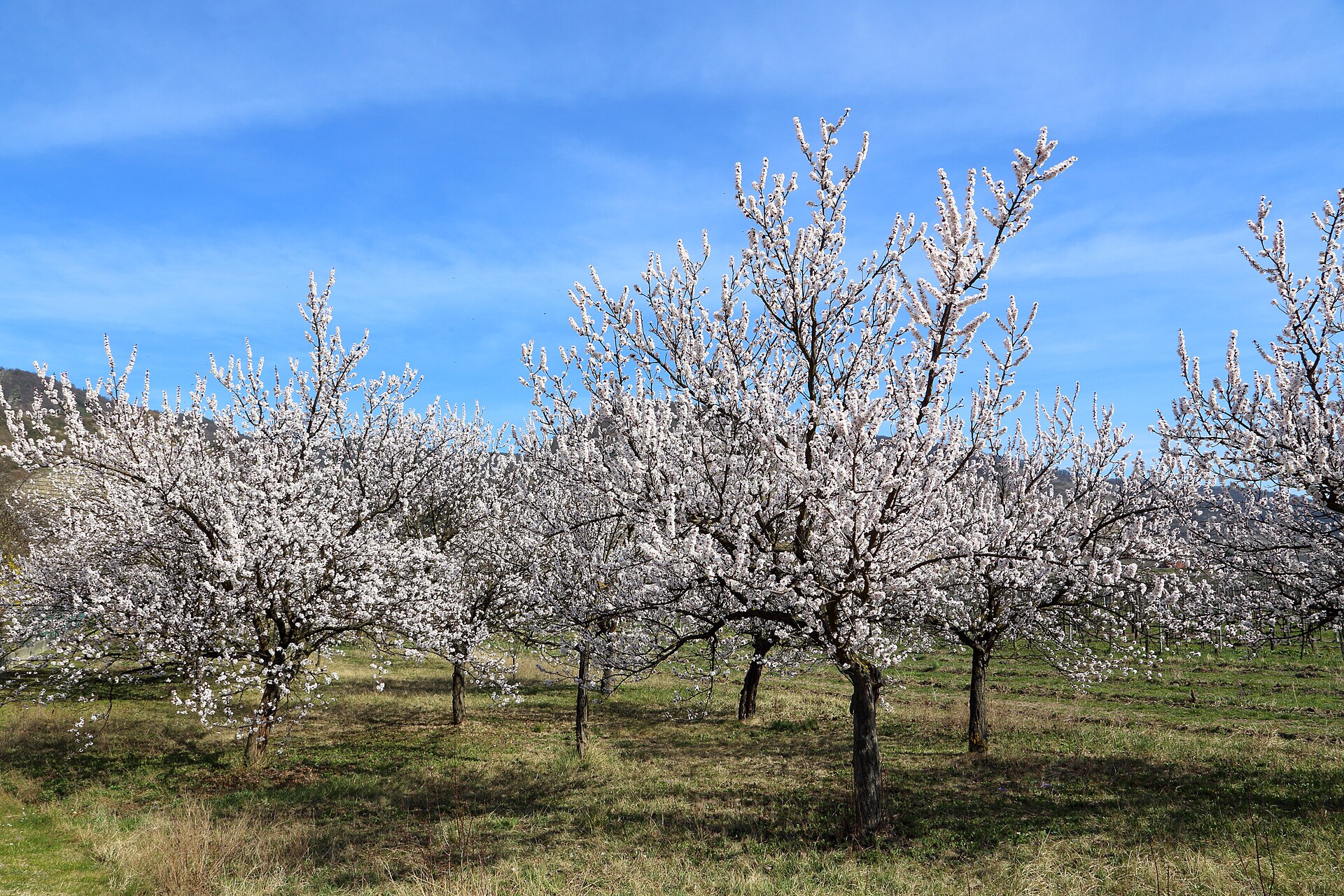
Spring: The Wachau’s apricot trees can bloom as early as March, although the exact date varies with the weather. Higher tracks stay damp and cold longer than the riverside. MTB access is subject to separate seasonal rules. April is often a particularly varied time for scenery.
Summer: Long daylight hours and plenty of places to stop make full-day rides easier to plan. The Danube Valley can get hot, while shaded climbs into the woods may feel considerably more comfortable. Carry enough water, use sun protection and allow realistic time for the distance.
Autumn: The grape harvest, colourful leaves and often clear views make this an attractive season. Wet leaves can be slippery on gravel and forest roads, however, and authorised riding hours become shorter towards the end of the season.
Winter: On suitable days, a ride beside the Danube can still be enjoyable. The high ground is another story. Official MTB routes have winter closures, while snow, ice and short daylight hours make improvised forest rides a poor choice.
Practical Questions Before You Go
Where should I start? For classic Danube cycling, Melk, Spitz and Krems are all useful starting points. Spitz works particularly well for rides involving a climb towards Jauerling; Maria Laach is practical if you prefer to begin on the plateau. It depends on whether you want to earn all the elevation gain yourself or start higher up.
Can I arrive by public transport? Melk and Krems are connected to the railway network. The Wachaubahn and regional buses offer additional options along the valley depending on the season. Check bicycle carriage rules, timetables, capacity and reservations for the exact service you intend to use. A train or bus cannot necessarily accommodate every group of cyclists and their bikes.
Do I need an e-MTB? Not necessarily. A touring bike is often perfectly adequate for the Danube Cycle Path. A gravel bike can suit a sporty mix of public roads and firm gravel. On official MTB routes, tyre choice, brakes, gearing and riding technique matter more than whether the bike has a motor. Electric assistance can, however, make a considerable difference on long climbs.
Can I ride on every forest road? No. Mountain bikes and gravel bikes must follow the applicable access permissions and local regulations. Walking paths are not automatically cycle routes.
How many days should I allow? It is possible to travel through the Wachau in one day if you mainly follow the river. Combining the Danube Cycle Path, Jauerling, an MTB circuit, castles and wine villages calls for two or three days — or several separate excursions.
The Question Ahead: More Cyclists, or Better Experiences?
Jauerling faces a promising but complicated challenge. The Wachau is already a well-established destination. The mountain behind the river still has room for more thoughtful, slower exploration. The MTB network has created new ways to bring cyclists inland, beyond the most famous riverside villages. At the same time, this is not a leisure park that can expand indefinitely.
What matters over the next few years will be how the different kinds of cycling fit together. A well-maintained Danube Cycle Path brings families and long-distance travellers through the villages. A legally agreed MTB network allows sportier riders to explore the hinterland. Road cyclists need attractive, safe roads. Guided tours can connect the scenery to local history. Businesses can earn an income from all of this, provided the paths, wildlife and everyday lives of residents are respected.
Perhaps the region’s greatest strength is that there is no single correct way to discover it. You can roll along the Danube with full panniers, work hard for every metre of the Jauerling ascent on a road bike, or cross the hills on a mountain bike, moving between meadows, forest and the next small village.
Sooner or later, you come back to that familiar view from the heights: a valley shaped over centuries. Cycling did not create this landscape. But it may be one of the most rewarding ways to understand it — and why it is worth looking after.
About This Article and AustriaTrails
AustriaTrails is a locally based cycling business in Lower Austria offering bicycle rental, guided tours, workshop services, and bike delivery and transport. Especially for routes that begin and finish in different places, having the right bicycle and well-planned logistics can make a significant difference. Information about rental bikes and tours is available at austriatrails.com.
Editorial note: The routes, historical details and published figures in this article were researched using official tourism, nature park, public authority and route-provider sources. This is not a route guide based on first-hand measurements. MTB route figures are taken from published descriptions; opening times and local access rules can change. The article does not claim that its author personally rode every route described.
Sources and Further Reading
- Naturpark Jauerling-Wachau: About the nature park — Elevation, area, municipalities and geography.
- Naturpark Jauerling-Wachau: Species and habitats — Meadows, woodland, traditional orchards and conservation threats.
- Austrian Commission for UNESCO: Wachau Cultural Landscape — World Heritage designation, history and geography.
- Naturland Niederösterreich: Wachau and Wachau-Jauerling European protected areas — Natura 2000 sites and protected landscapes.
- Naturpark Jauerling-Wachau: History and significance — The beginnings in 1973, dissolution in 1999 and revival in 2003.
- Austrian Commission for UNESCO: Jauerling-Wachau as a good-practice example — The park’s recovery and regional development.
- Naturpark Jauerling-Wachau: Nature Park Strategy 2025–2030 — Objectives and management priorities.
- Jauerling Observation Tower Association: Chronicle — The successive lookout towers since 1842.
- Wachaubahn: Naturpark Jauerling-Wachau — Naturparkhaus and visitor information.
- Donau Niederösterreich: Train, Bus and Bike — Danube Cycle Path connections and transport.
- ORF Lower Austria: Counting cyclists on the Danube Cycle Path, 25 May 2025 — 2023 corridor counts and survey user categories.
- Wachau World Heritage Management: Donauradweg 3.0 — Tourism development strategy.
- St. Pölten Tourism: STP Route 5 — Wachau–Jauerling — Published road-cycling route profile.
- Austrian Federal Forests: MTB-Area opening on 1 June 2024 — 588 kilometres, grades and stakeholder cooperation.
- Wachau World Heritage Management: Mountain biking in the Wachau — Regional potential study.
- Naturpark Jauerling-Wachau: Mountain-bike tours — Current tour directory and access notes.
- Naturpark Jauerling-Wachau: Grand Tour Spitz — 52.60 km, 1,726 m ascent and riding rules.
- Naturpark Jauerling-Wachau: Maria Laacher Runde — 47.44 km and 1,745 m ascent.
- Naturpark Jauerling-Wachau: ReNature³ — Biodiversity and habitat connectivity.
- Naturpark Jauerling-Wachau: 15 Years of Jauerlinger Saftladen (22 October 2026) — Approximately 40,000 litres of apple juice and more than 3,000 children.
- Natural History Museum Vienna: Venus Research — The Willendorf find, its age and context.
0 Comments